Stanford Dingley
Stanford Dingley is a village and civil parish in West Berkshire, England, between Newbury and Theale.
| Stanford Dingley | |
|---|---|
 15th-century building and The Old Boot Inn | |
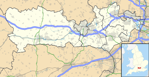 Stanford Dingley Location within Berkshire | |
| Area | 4.82 km2 (1.86 sq mi) |
| Population | 179 (2011 census)[1] |
| • Density | 37/km2 (96/sq mi) |
| OS grid reference | SU575715 |
| • London | 45.4 miles (73.1 km) |
| Civil parish |
|
| Unitary authority | |
| Ceremonial county | |
| Region | |
| Country | England |
| Sovereign state | United Kingdom |
| Post town | READING |
| Postcode district | RG7 |
| Dialling code | 0118 |
| Police | Thames Valley |
| Fire | Royal Berkshire |
| Ambulance | South Central |
| UK Parliament | |
Geography
Stanford Dingley fills part of both sides of the valley of the upper part of the River Pang, on the minor roads between the A4 Bath Road and the M4 motorway. The parish mostly consists of farmland, with some woodland in the upland regions. The southern parish boundary runs along the edge of the woodland on the northern slopes of Clay Hill. The official and actual northern boundary is the motorway which is buffered by the area's only area of woodlands, covering about a fifth of the total area. Bucklebury lies to the west and Bradfield to the east. The village spreads north-south along Cock Lane, that runs between Bradfield Southend and Yattendon. Slightly detached to the south is the hamlet of Jennetts Hill and to the north is 'The Buildings'. The pond complex around the 'Blue Pool', containing artesian aquifers, though generally thought of as part of Stanford Dingley is actually just across the parish boundary in Bradfield.
Demography
| Output area | Homes owned outright | Owned with a loan | Socially rented | Privately rented | Other | km² roads | km² water | km² domestic gardens | Usual residents | km² |
|---|---|---|---|---|---|---|---|---|---|---|
| Civil parish | 33 | 25 | 9 | 11 | 3 | 0.040 | 0.016 | 0.151 | 179 | 4.82 |
History

Stanford is from the Old English for "Stoney-Ford", perhaps indicating a Roman river-crossing of the Pang heading towards Dorchester-on-Thames.
Dingley was the name of the lords of the manor. One of their wives has a brass memorial in the 12th century Church of England parish church of Saint Denys. The church has remnants of the original Saxon church within its inner walls. The main door and nave wall paintings date from the 13th century and the white wooden bell tower was built in the 15th century. The churchyard is notable for a number of sweet chestnut trees.
Notable residents
- Thomas Tesdale, the founding benefactor of Pembroke College, Oxford, was born in Stanford Dingley in 1547.
- Robert Gathorne-Hardy (31 July 1902 – 11 February 1973) was an English garden writer.
Amenities
Public houses
There are two pubs, the 15th century Bull and the 18th century Old Boot Inn.
The latter has a regular Burns Night celebration at which Pippa Middleton, from nearby Chapel Row, has carried the haggis in accompanied by bagpipes.[2]
Parish
Stanford Dingley is an ecclesiastical parish in the Church of England, recorded as such since in the Domesday Book following the Norman Conquest. It shares in events and clergy with the benefice of Bucklebury, Bradfield and Stanford Dingley.[3][4]
Nearest places
Nearest Places (by Civil Parish) | ||||||||||
|---|---|---|---|---|---|---|---|---|---|---|
| ||||||||||
See also
- List of places in Berkshire
- List of civil parishes in Berkshire
Notes
- Key Statistics: Dwellings; Quick Statistics: Population Density; Physical Environment: Land Use Survey 2005
- Catherine Ostler, She's better connected, more outgoing and has the body of a Bond girl dated 18 February 2011 at dailymail.co.uk, accessed 19 February 2011
- benefice of Bucklebury, Bradfield and Stanford Dingley] The Church of England. Retrieved 2014-12-12.
- Information about the parish and the wider benefice served The Church of England. Retrieved 2014-12-12.
External links
| Wikimedia Commons has media related to Stanford Dingley. |