Wat Phleng District
Wat Phleng (Thai: วัดเพลง, pronounced [wát pʰlēːŋ]) is a district (amphoe) of Ratchaburi Province, western Thailand.
Wat Phleng วัดเพลง | |
|---|---|
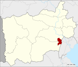 District location in Ratchaburi Province | |
| Coordinates: 13°27′14″N 99°53′13″E | |
| Country | Thailand |
| Province | Ratchaburi |
| Seat | Wat Phleng |
| Tambon | 3 |
| Muban | 28 |
| Area | |
| • Total | 37.892 km2 (14.630 sq mi) |
| Population (2017) | |
| • Total | 12,178 |
| • Density | 321.38/km2 (832.4/sq mi) |
| Time zone | UTC+7 (ICT) |
| Postal code | 70170 |
| Geocode | 7009 |
History
In the past, the district was called Wat Pradu District because the office was in front of Wat Pradu, Wat Pradu canal. When the district office was moved to the present area, the district name was changed to be Maenam Om District. Later in 1914 the government moved the district office of Maenam Om to Tambon Pak Tho, which was more accessible as it was near the railway station. The old central area was made the Wat Phleng minor district (king amphoe).[1] It was upgraded to a full district again on 17 July 1963.[2]
Geography
Neighboring districts are (from the southwest clockwise) Pak Tho and Mueang Ratchaburi of Ratchaburi Province and Bang Khonthi and Amphawa of Samut Songkhram Province.
The important water resource is the Khwae Om River, a branch of the Mae Klong River.
Administration
Central administration
Wat Phleng is divided into three subdistricts (tambons), which are further subdivided into 28 administrative villages (mubans).
| No. | Name | Thai | Villages | Pop.[3] |
|---|---|---|---|---|
| 1. | Ko San Phra | เกาะศาลพระ | 10 | 3,698 |
| 2. | Chom Prathat | จอมประทัด | 8 | 3,537 |
| 3. | Wat Phleng | วัดเพลง | 10 | 4,943 |
Local administration
There is one subdistrict municipality (thesaban tambon) in the district:
- Wat Phleng (Thai: เทศบาลตำบลวัดเพลง) consisting of parts of subdistricts Ko San Phra and Wat Phleng.
There are three subdistrict administrative organizations (SAO) in the district:
- Ko San Phra (Thai: องค์การบริหารส่วนตำบลเกาะศาลพระ) consisting of parts of subdistrict Ko San Phra.
- Chom Prathat (Thai: องค์การบริหารส่วนตำบลจอมประทัด) consisting of subdistrict Chom Prathat.
- Wat Phleng (Thai: องค์การบริหารส่วนตำบลวัดเพลง) consisting of parts of subdistrict Wat Phleng.
References
- แจ้งความกระทรวงมหาดไทย เรื่อง ย้ายที่ว่าการอำเภอและตั้งกิ่งอำเภอ: ย้ายที่ว่าการอำเภอแม่น้ำอ้อมไปตั้งที่ว่าการอำเภอปากท่อ เรียกว่า อำเภอปากท่อ และให้ตั้งกิ่งอำเภอวัดเพลง ขึ้นอยู่ในความปกครองของอำเภอปากท่อ จังหวัดราชบุรี (PDF). Royal Gazette (in Thai). 31 (0 ง): 2220. December 27, 1914.
- พระราชกฤษฎีกาตั้งอำเภอบ่อพลอย อำเภอไทรโยค อำเภอหนองปรือ อำเภอหนองสองห้อง อำเภอประทาย อำเภอห้วยแถลง อำเภอละหานทราย อำเภอกุยบุรี อำเภอตาพระยา อำเภอหนองไผ่ อำเภอนาเชือก อำเภอวัดเพลง อำเภอพนัสนิคม อำเภอภูกระดึง อำเภอปรางค์กู่ อำเภอท่าช้าง อำเภอบ้านด่านลานหอย อำเภอบ้านดง อำเภอสว่างอารมณ์ และอำเภอกุดชุม พ.ศ. ๒๕๐๖ (PDF). Royal Gazette (in Thai). 80 (72 ก): 362–366. July 16, 1963.
- "Population statistics 2016" (in Thai). Department of Provincial Administration. Retrieved 2017-10-12.