Washington Township, Stark County, Ohio
Washington Township is one of the seventeen townships of Stark County, Ohio, United States. The 2000 census found 4,791 people in the township.[3]
Washington Township, Stark County, Ohio | |
|---|---|
 Maudru House at Maximo | |
 Location of Washington Township in Stark County | |
| Coordinates: 40°52′25″N 81°8′26″W | |
| Country | United States |
| State | Ohio |
| County | Stark |
| Organized | 3 December 1821 |
| Area | |
| • Total | 30.8 sq mi (79.7 km2) |
| • Land | 30.8 sq mi (79.7 km2) |
| • Water | 0.0 sq mi (0.0 km2) |
| Elevation | 1,230 ft (375 m) |
| Population (2000) | |
| • Total | 4,791 |
| • Density | 155.8/sq mi (60.2/km2) |
| Time zone | UTC-5 (Eastern (EST)) |
| • Summer (DST) | UTC-4 (EDT) |
| FIPS code | 39-81634[2] |
| GNIS feature ID | 1086992[1] |
Geography
Located in the eastern part of the county, it borders the following townships and city:
- Lexington Township - north
- Alliance - northeast
- Knox Township, Columbiana County - east
- West Township, Columbiana County - southeast corner
- Paris Township - south
- Nimishillen Township - west
- Marlboro Township - northwest
Part of the city of Alliance is located in northern Washington Township, with the unincorporated communities of Maximo in the eastern part of the township and Freeburg near OH-153 in the southern part of the township.
Name and history
It is one of forty-three Washington Townships statewide.[4]
In 1833, Washington Township contained one gristmill, three saw mills, and one tannery.[5]
Government
The township is governed by a three-member board of trustees, who are elected in November of odd-numbered years to a four-year term beginning on the following January 1. Two are elected in the year after the presidential election and one is elected in the year before it. There is also an elected township fiscal officer,[6] who serves a four-year term beginning on April 1 of the year after the election, which is held in November of the year before the presidential election. Vacancies in the fiscal officership or on the board of trustees are filled by the remaining trustees.
References
- "US Board on Geographic Names". United States Geological Survey. 2007-10-25. Retrieved 2008-01-31.
- "U.S. Census website". United States Census Bureau. Retrieved 2008-01-31.
- Stark County, Ohio — Population by Places Estimates Ohio State University, 2007. Accessed 15 May 2007.
- "Detailed map of Ohio" (PDF). United States Census Bureau. 2000. Retrieved 2007-02-16.
- Kilbourn, John (1833). The Ohio Gazetteer, or, a Topographical Dictionary. Scott and Wright. pp. 478. Retrieved 12 December 2013.
- §503.24, §505.01, and §507.01 of the Ohio Revised Code. Accessed 4/30/2009.
External links
Municipalities and communities of Stark County, Ohio, United States | ||
|---|---|---|
| Cities | 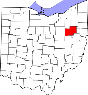 Map of Ohio highlighting Stark County | |
| Villages | ||
| Townships | ||
| CDPs | ||
| Unincorporated communities | ||
| Footnotes | ‡This populated place also has portions in an adjacent county or counties | |