Wanette, Oklahoma
Wanette is a town in Pottawatomie County, Oklahoma, United States. The population was 350 at the 2010 census, a decline of 13 percent from 402 at the 2000 census.[5] Wanette is part of the Purcell-Lexington retail trade area and is within the Greater Oklahoma City Metropolitan Area.
Wanette, Oklahoma | |
|---|---|
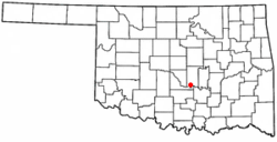 Location of Wanette, Oklahoma | |
| Coordinates: 34°57′46″N 97°1′52″W | |
| Country | United States |
| State | Oklahoma |
| County | Pottawatomie |
| Area | |
| • Total | 0.43 sq mi (1.10 km2) |
| • Land | 0.43 sq mi (1.10 km2) |
| • Water | 0.00 sq mi (0.00 km2) |
| Elevation | 1,027 ft (313 m) |
| Population (2010) | |
| • Total | 350 |
| • Estimate (2018)[2] | 363 |
| • Density | 852.11/sq mi (328.74/km2) |
| Time zone | UTC-6 (Central (CST)) |
| • Summer (DST) | UTC-5 (CDT) |
| ZIP code | 74878 |
| Area code(s) | 405 |
| FIPS code | 40-78200[3] |
| GNIS feature ID | 1099348[4] |
History
The Encyclopedia of Oklahoma History and Culture indicates that the first settlement at this location occurred in 1868, when two settlers from Kansas built a two-story cabin. Their cabin still existed as recently as 2003. Other settlers followed. The community had several different names before a post office named Wanette opened on March 19, 1894. In 1903, the town moved one mile north to be on the Atchison, Topeka and Santa Fe Railway line between Newkirk and Pauls Valley[6]
By 1907, Wanette had a population of 739. The population peaked at 783 in 1920. The local economy was based on agriculture. Discovery of the Wanette-Asher oil field aided the economy during the 1930s, but did not prevent a population decline. The town still has an agricultural base, but by the beginning of the 21st Century had become a bedroom community for people working in Moore, Norman and Oklahoma City.[6]
Wanette High School
Wanette High School has an average graduating class of 16. The percentage of children on Individualized Education Programs is well over 30%. Wanette High School is also the largest business in the town. The current superintendent is Crystal Shaw. The school board consists of Robbie Sanders, Bryan Richards, Linda Fullingim, Lori Lambert, & Kelly Teague. Wanette High School is home of the Tigers.
Geography
Wanette is located at 34°57′46″N 97°1′52″W (34.962707, -97.031170).[7] According to the United States Census Bureau, the town has a total area of 0.4 square miles (1.0 km2), all of it land.
Demographics
| Historical population | |||
|---|---|---|---|
| Census | Pop. | %± | |
| 1910 | 677 | — | |
| 1920 | 783 | 15.7% | |
| 1930 | 758 | −3.2% | |
| 1940 | 665 | −12.3% | |
| 1950 | 594 | −10.7% | |
| 1960 | 381 | −35.9% | |
| 1970 | 303 | −20.5% | |
| 1980 | 473 | 56.1% | |
| 1990 | 346 | −26.8% | |
| 2000 | 402 | 16.2% | |
| 2010 | 350 | −12.9% | |
| Est. 2018 | 363 | [2] | 3.7% |
| U.S. Decennial Census[8] | |||
At the 2000 census there were 402 people, 147 households, and 108 families in the town. The population density was 978.8 people per square mile (378.6/km²). There were 168 housing units at an average density of 409.0 per square mile (158.2/km²). The racial makeup of the town was 88.31% White, 8.71% Native American, and 2.99% from two or more races. Hispanic or Latino of any race were 0.50%.[3]
Of the 147 households 39.5% had children under the age of 18 living with them, 51.0% were married couples living together, 17.7% had a female householder with no husband present, and 25.9% were non-families. 24.5% of households were one person and 15.0% were one person aged 65 or older. The average household size was 2.73 and the average family size was 3.18.
The age distribution was 30.3% under the age of 18, 13.7% from 18 to 24, 23.1% from 25 to 44, 19.7% from 45 to 64, and 13.2% 65 or older. The median age was 29 years. For every 100 females, there were 100.0 males. For every 100 females age 18 and over, there were 89.2 males.
The median household income was $21,818 and the median family income was $23,000. Males had a median income of $21,731 versus $14,583 for females. The per capita income for the town was $10,740. About 20.2% of families and 21.0% of the population were below the poverty line, including 14.4% of those under age 18 and 30.6% of those age 65 or over.
Economy
The Wanette area economy has long been supported by agriculture. The main crops are cotton, pecans, oats, corn, alfalfa, and hay. Discovery of oil in the nearby Wanette-Asher field caused a brief boom during the early 1930s, but this effect wore off before 1940.[6]
References
- "2018 U.S. Gazetteer Files". United States Census Bureau. Retrieved Feb 12, 2020.
- "Population and Housing Unit Estimates". Retrieved June 4, 2019.
- "U.S. Census website". United States Census Bureau. Retrieved 2008-01-31.
- "US Board on Geographic Names". United States Geological Survey. 2007-10-25. Retrieved 2008-01-31.
- CensusViewer:Population of the City of Wanette, Oklahoma
- Beverly Mosman, "Wanette," Encyclopedia of Oklahoma History and Culture. Accessed May 21, 2012.
- "US Gazetteer files: 2010, 2000, and 1990". United States Census Bureau. 2011-02-12. Retrieved 2011-04-23.
- "Census of Population and Housing". Census.gov. Retrieved June 4, 2015.
Municipalities and communities of Pottawatomie County, Oklahoma, United States | ||
|---|---|---|
| Cities | 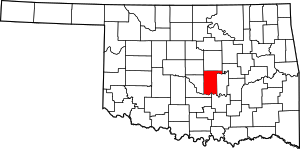 Pottawatomie County map | |
| Towns | ||
| CDP | ||
| Other unincorporated communities | ||
| Ghost towns | ||
| Footnotes | ‡This populated place also has portions in an adjacent county or counties | |