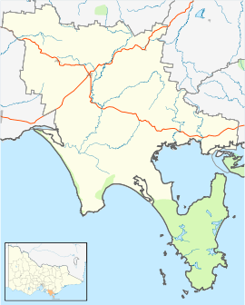
Walkerville, Victoria
Walkerville Victoria, Australia, is a tiny village on Waratah Bay in southwest Gippsland, about 190 km southeast of Melbourne. The small town, originally known as Waratah, is separated into Walkerville North and Walkerville South. The Walkerville Promontory View Estate is situated inland 2.3 km north of Walkerville North. At the 2006 census, Walkerville had a population of 262.[1]
| Walkerville Victoria | |
|---|---|
 Walkerville | |
| Coordinates | 38°51′S 145°59′E |
| Population | 262 (2006 census)[1] |
| Postcode(s) | 3956 |
| LGA(s) | South Gippsland Shire |
| State electorate(s) | Gippsland South |
| Federal Division(s) | Nicholls |
History
The Post Office opened on 10 August 1885 and was known as Waratah Bay until 1892. It closed in 1972.[2]
Its heyday was the early quarter of the 20th century, where commercial quantities of lime were bagged and exported to the booming capital city. Lime obtained from the site is said to have been used in the building of Melbourne's iconic Flinders Street station. Raw material was mined from the surrounding limestone cliffs, loaded into horse-drawn trams and hauled along above the high-tide line to be burned in one of six kilns[3]. Much of the surrounding countryside was depleted from a combination of mining and timber-harvesting to fuel the kilns. Burned lime was bagged, then stacked in sheds. Lime was transported to Melbourne aboard a series of ships that stopped at the 300-metre jetty nearby. Operations continued until 1926, when shipping expenses made the product unprofitable.
At its peak, the township was home to only eighty people, mostly workers at the six lime kilns.
The Walkerville Promontory View Estate was created in 1969.
In 2005, all that remained of the limeburning operations was the stonework from ruined buildings, ruins of several limeburning kilns and one wooden pile from the once imposing jetty at Walkerville South as well as Digger Island.
The Town today
Extremely secluded, Walkerville South is only accessible by a gravel road and the lack of people ensures that facilities are at a bare minimum. Walkerville North is accessed by a sealed winding road from the Walkerville Promontory View Estate through beautiful forest down to the shore. Once the road clears the forest at the shore a gravel road on the immediate left leads to a camping ground while the sealed road hugs the shore closely for about 500 metres before ending at a boat ramp, providing access to the shores of Waratah Bay. Along this road there are a few houses, along with a picnic area and public toilets. Walkerville North provides beautiful views across Waratah Bay to nearby Wilsons Promontory, and at low tide provides access to spectacular rock pools. Approximately 100 metres beyond the end of the boat ramp marks the beginning of a walking trail up the cliff that separates the two Walkerville settlements. This trail leads through spectacular forests and little creeks stained brown by the tea tree (melaleuca) plants. Along the trail are vantage points with information plaques about the brief mining and logging history of the settlement, and geographical information about the area. A short side-trail takes you to a hidden cemetery, with beautiful headstones of the settlers and workers that battled the rough terrain that is visibly different from that of today. The gravel road that leads to Walkerville South ends with a beach access ramp[4] similar to that of its northern sister settlement, and a sheltered bay frequented in the summer by families swimming, fishing and paddling in the quiet pristine waters.
The town was the focus of the Weddings Parties Anything song Walkerville from their 1996 album River'esque.
The small town is now best known for its camping ground 'Walkerville Foreshore Camping Reserve'[5], which consists of a one kilometre stretch of dirt road along the rocky beach with camping sites on either side. The camping ground is at its busiest during the Easter and New Year holidays, attracting many campers. Within the foreshore camping reserve is Walky kiosk[6], the only shop in Walkerville.
References
- Australian Bureau of Statistics (25 October 2007). "Walkerville (State Suburb)". 2006 Census QuickStats. Retrieved 24 October 2010.
- Premier Postal History, Post Office List, retrieved 11 April 2008
- "Walkerville Lime Kilns". Heritage Council Victoria. Retrieved 7 June 2020.
- "Beach Access".
- "Walkerville Foreshore Camping Reserve".
- "Walky Kiosk".