Waldbronn
Waldbronn is a municipality in the district of Karlsruhe, in Baden-Württemberg, Germany. It is situated in the northern Black Forest, 11 kilometres (7 miles) southeast of Karlsruhe.
Waldbronn | |
|---|---|
 Coat of arms | |
Location of Waldbronn 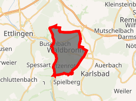
| |
 Waldbronn 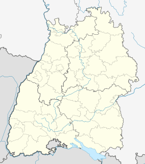 Waldbronn | |
| Coordinates: 48°55′28″N 8°28′33″E | |
| Country | Germany |
| State | Baden-Württemberg |
| Admin. region | Karlsruhe |
| District | Karlsruhe |
| Subdivisions | 3 |
| Government | |
| • Mayor | Franz Masino |
| Area | |
| • Total | 11.35 km2 (4.38 sq mi) |
| Highest elevation | 300 m (1,000 ft) |
| Lowest elevation | 230 m (750 ft) |
| Population (2018-12-31)[1] | |
| • Total | 13,151 |
| • Density | 1,200/km2 (3,000/sq mi) |
| Time zone | CET/CEST (UTC+1/+2) |
| Postal codes | 76333–76337 |
| Dialling codes | 07243 |
| Vehicle registration | KA |
| Website | www.waldbronn.de |
Geography
Waldbronn is located at the border of the Alb-Pfinz-Plateau in the valley of the river Alb.
History
Waldbronn was founded in 1972 as a result of a municipal restructuring, when the communities Busenbach and Reichenbach merged. A year earlier the community of Etzenrot had been merged with Reichenbach already.
The three communities are first mentioned in historic documents in 1292.
In January 1994 Waldbronn was awarded the official status of "Ort mit Heilquellen-Kurbetrieb", indicating the medicinal benefits of its hot wells.
Transport
Reichenbach is connected to the city of Karlsruhe by S 11 services operating over the Busenbach–Ittersbach railway, an electric railway that forms part of the Karlsruhe Stadtbahn.[2]
Sons and daughters
- Edmund Becker (born 1948), German football player
- Max Giesinger (born 1988), German singer
References
- "Bevölkerung nach Nationalität und Geschlecht am 31. Dezember 2018". Statistisches Landesamt Baden-Württemberg (in German). July 2019.
- Eisenbahnatlas Deutschland. Verlag Schweers + Wall GmbH. 2009. p. 93. ISBN 978-3-89494-139-0.
| Authority control |
|
|---|