Linkenheim-Hochstetten
Linkenheim-Hochstetten is a municipality in the district of Karlsruhe, in Baden-Württemberg, Germany. It is situated on the right bank of the Rhine, 17 km north of Karlsruhe.
Linkenheim-Hochstetten | |
|---|---|
 Coat of arms | |
Location of Linkenheim-Hochstetten 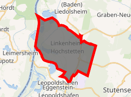
| |
 Linkenheim-Hochstetten 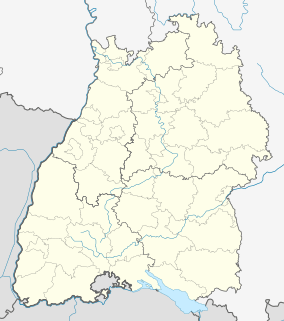 Linkenheim-Hochstetten | |
| Coordinates: 49°07′34″N 08°24′36″E | |
| Country | Germany |
| State | Baden-Württemberg |
| Admin. region | Karlsruhe |
| District | Karlsruhe |
| Government | |
| • Mayor | Michael Möslang |
| Area | |
| • Total | 23.60 km2 (9.11 sq mi) |
| Elevation | 110 m (360 ft) |
| Population (2018-12-31)[1] | |
| • Total | 11,796 |
| • Density | 500/km2 (1,300/sq mi) |
| Time zone | CET/CEST (UTC+1/+2) |
| Postal codes | 76351 |
| Dialling codes | 07247 |
| Vehicle registration | KA |
| Website | www.linkenheim-hochstetten.de |
The towns of Linkenheim and Hochstetten merged their municipal governments 1975, newly elected burgermeister (21.01.2007): Günther Johs.
The town is served by routes S1 and S11 of the Karlsruhe Stadtbahn, which is operated by the Albtal-Verkehrs-Gesellschaft over the Hardtbahn. Seven stops are served, at Linkenheim Süd, Linkenheim Friedrichstrasse, Linkenheim Rathaus, Linkenheim Schulzentrum, Hochstetten Grenzstrasse, Hochstetten Altenheim and Hochstetten.[2]
References
- "Bevölkerung nach Nationalität und Geschlecht am 31. Dezember 2018". Statistisches Landesamt Baden-Württemberg (in German). July 2019.
- Eisenbahnatlas Deutschland. Verlag Schweers + Wall GmbH. 2009. pp. 93, 160–161. ISBN 978-3-89494-139-0.
| Authority control |
|
|---|
This article is issued from Wikipedia. The text is licensed under Creative Commons - Attribution - Sharealike. Additional terms may apply for the media files.