Wakefield Parish, New Brunswick
Wakefield is a Canadian parish in Carleton County, New Brunswick.[2]
Wakefield | |
|---|---|
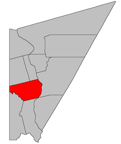 Location within Carleton County, New Brunswick | |
| Coordinates: 46.225°N 67.52°W | |
| Country | |
| Province | |
| County | Carleton |
| Established | 1803 |
| Area | |
| • Land | 196.43 km2 (75.84 sq mi) |
| Population (2016)[1] | |
| • Total | 2,767 |
| • Density | 14.1/km2 (37/sq mi) |
| • Pop 2011-2016 | |
| • Dwellings | 1,181 |
| Time zone | UTC-4 (AST) |
| • Summer (DST) | UTC-3 (ADT) |
Its population in the 2016 Census was 2,767.[1]
History
Wakefield Parish was established in 1803 as part of York County and named for the city of Wakefield in Yorkshire County, England: Wakefield Parish included Simonds Parish until 1842, and Brighton Parish, York County, until 1830.
Delineation
Wakefield Parish is defined in the Territorial Division Act[3] as being bounded:
- North by the lower line of lot numbered thirty-eight, granted to David Good, and the westerly prolongation thereof; westerly by the County line; south by Woodstock and Richmond Parishes, and east by the Saint John River, including all the islands in front.
Communities
|
|
|
Demographics
Population
|
LanguageMother tongue (2016)[1]
|
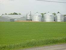
Farm in Jacksonville
See also
References
- "Census Profile, 2016 Census Wakefield, Parish [Census subdivision], New Brunswick". Statistics Canada. Retrieved September 6, 2019.
- New Brunswick Provincial Archives - Wakefield Parish
- "Territorial Division Act (R.S.N.B. 1973, c. T-3)". Government of New Brunswick website. Retrieved 30 August 2016.
- Statistics Canada: 1996, 2001, 2006 census
- 2011 Statistics Canada Census Profile: Wakefield Parish, New Brunswick
Places adjacent to Wakefield Parish, New Brunswick | |
|---|---|
| Subdivisions |
|
|---|---|
| Cities | |
| Counties | |
| |
This article is issued from Wikipedia. The text is licensed under Creative Commons - Attribution - Sharealike. Additional terms may apply for the media files.