Wajay
Wajay is a ward (consejo popular, "people's council") of the city of Havana, the capital of Cuba, belonging to the municipal borough of Boyeros. In 2011, it had a population of 47,954.[1]
Wajay | |
|---|---|
Ward of Havana | |
 | |
.png) Location of Wajay (red) within Boyeros (orange) and Havana | |
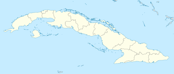 Wajay Location of Wajay in Cuba | |
| Coordinates: 23°00′16.2″N 82°25′28.2″W | |
| Country | |
| Province | |
| Municipal borough | Boyeros |
| Established[1] | 1720 |
| Elevation | 60 m (200 ft) |
| Population (2011)[1] | |
| • Total | 47,954 |
| Time zone | UTC-5 (EST) |
| Area code(s) | +53-7 |
History
The village was founded in 1720 and the first church, a subsidiary of the parish of Santiago de Las Vegas, was built in 1764. In 1943 it had a population of 4,535, that grew in the last decades of the 20th century.[1]
Geography
Located in the south-western suburb of Havana, Wayaj borders with the municipal boroughs of Marianao and La Lisa, and with the municipality of Bauta, in Artemisa Province.[2]
The ward is divided into the quarters (repartos) of Wajay (centre), Abel Santamaría, Fontanar, El Chico, El Morado, INVAF and Santa Cecilia.[3]
Transport
Located north to José Martí International Airport, Wajay is crossed by a branch of the A2 motorway linking it (the airport) to the city centre. It is served by 5 stations (Fontanar, Mazorra, Abel Santamaría, Wajay and Murgas) of the Havana Suburban Railway.[2]
Personalities
- Jorge Perugorría (b. 1965), actor
See also
References
- (in Spanish) Wajay on EcuRed
- 2549774993 Wajay on OpenStreetMap
- (in Spanish) Geography of Wajay on EcuRed
External links
| Wikimedia Commons has media related to Wajay. |
- Wajay on maplandia.com
- (in Spanish) Wajay on localidades.org
Municipalities and wards of Havana | ||
|---|---|---|
| Arroyo Naranjo |
| |
| Boyeros |
| |
| Centro Habana |
| |
| Cerro |
| |
| Cotorro |
| |
| Diez de Octubre |
| |
| Guanabacoa |
| |
| La Habana del Este |
| |
| La Habana Vieja |
| |
| La Lisa |
| |
| Marianao |
| |
| Playa |
| |
| Plaza de la Revolución |
| |
| Regla |
| |
| San Miguel del Padrón |
| |