Waimalu, Hawaii
Waimalu is a census-designated place (CDP) in Honolulu County, Hawaiʻi, United States. The population was 13,730 at the 2010 census.[1]
Waimalu | |
|---|---|
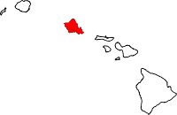
 Location in Honolulu County and the state of Hawaii | |
| Coordinates: 21°23′57″N 157°56′54″W | |
| Country | United States |
| State | Hawaii |
| Area | |
| • Total | 1.9 sq mi (5.0 km2) |
| • Land | 1.8 sq mi (4.7 km2) |
| • Water | 0.08 sq mi (0.2 km2) |
| Elevation | 377 ft (115 m) |
| Population (2010) | |
| • Total | 13,730 |
| • Density | 7,100/sq mi (2,700/km2) |
| Time zone | UTC-10 (Hawaii-Aleutian) |
| Area code(s) | 808 |
| FIPS code | 15-77750 |
| GNIS feature ID | 1867264 |
Geography
Waimalu is located at 21°23′57″N 157°56′54″W (21.399150, -157.948432).[2]
According to the United States Census Bureau, the CDP has a total area of 1.9 square miles (5.0 km2), of which 1.8 square miles (4.7 km2) is land and 0.077 square miles (0.2 km2), or 4.62%, is water.[3]
Demographics
At the 2000 census there were 29,371 people in 10,524 households, including 7,514 families, in the CDP. The population density was 4,972.1 people per square mile (1,918.8/km²). There were 10,999 housing units at an average density of 1,862.0 per square mile (718.6/km²). The racial makeup of the CDP was 17.08% White, 2.33% African American, 0.26% Native American, 55.32% Asian, 5.63% Pacific Islander, 1.10% from other races, and 18.27% from two or more races. Hispanic or Latino of any race were 5.97%.[4]
Of the 10,524 households 29.2% had children under the age of 18 living with them, 55.9% were married couples living together, 11.1% had a female householder with no husband present, and 28.6% were non-families. 21.0% of households were one person and 3.4% were one person aged 65 or older. The average household size was 2.78 and the average family size was 3.26.
The age distribution was 21.4% under the age of 18, 9.5% from 18 to 24, 31.5% from 25 to 44, 27.5% from 45 to 64, and 10.1% 65 or older. The median age was 38 years. For every 100 females, there were 102.6 males. For every 100 females age 18 and over, there were 102.7 males.
The median household income was $61,210 and the median family income was $70,740. Males had a median income of $40,949 versus $32,090 for females. The per capita income for the CDP was $25,913. About 4.1% of families and 5.9% of the population were below the poverty line, including 7.9% of those under age 18 and 3.0% of those age 65 or over.
Education
Waimalu is within the Hawaii Department of Education.
Public elementary schools in the CDP include Momilani elementary, Pearl Ridge elementary, Waiau elementary, and Waimalu elementary. Pearl City High School is located in the Waimalu CDP.[5]
Legends
There are several geographic legends of Waimalu in the Ewa Area between the East Loch of Pearl Harbor and the terraces in the Waimalu Stream, Waipi Stream which is east of Waiua Pond. Accounts of Heiau, the Waimalu Burial Cave, Paul Marin, and Paunana- loa Huewai-pi, are also included.[6]
References
- "Profile of General Population and Housing Characteristics: 2010 Demographic Profile Data (DP-1): Waimalu CDP, Hawaii". United States Census Bureau. Retrieved May 29, 2012.
- "US Gazetteer files: 2010, 2000, and 1990". United States Census Bureau. 2011-02-12. Retrieved 2011-04-23.
- "Geographic Identifiers: 2010 Demographic Profile Data (G001): Waimalu CDP, Hawaii". United States Census Bureau. Retrieved May 29, 2012.
- "U.S. Census website". United States Census Bureau. Retrieved 2008-01-31.
- "Waimalu CDP, Hawaii Archived 2009-08-05 at the Wayback Machine." U.S. Census Bureau. Retrieved on May 21, 2009.
- "Sites of Oahu." Compiled by Elspeth P. Sterling and Catherine C. Summers. Published by the Pauahi Bishop Museum in Honolulu in 1993.
Islands, municipalities, and communities of Honolulu County, Hawaii, United States | ||
|---|---|---|
| CDPs |
|  Map of Hawaii highlighting Honolulu County |
| Other communities | ||