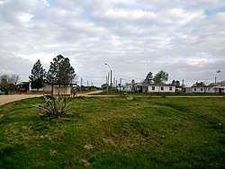
Vergara, Uruguay
Vergara is a small city in the Treinta y Tres Department of eastern Uruguay.
Vergara | |
|---|---|
City | |
 | |
 Flag  Coat of arms | |
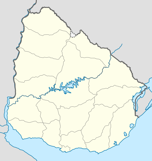 Vergara Location in Uruguay | |
| Coordinates: 32°57′0″S 53°56′0″W | |
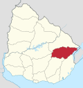
| Country | |
| Department | |
| Population (2011 Census) | |
| • Total | 3,810 |
| Time zone | UTC -3 |
| Postal code | 33002 |
| Dial plan | +598 4458 (+4 digits) |
Location and geography
It is located between Route 18, which passes to the northwest, and on Route 91, which passes to the southeast, and about 54 kilometres (34 mi) northeast of Treinta y Tres, the capital city of the department. The stream Arroyo Parao flows along the northeast limits of the town.
History
On 10 March 1903, the group of houses here was declared a "Pueblo" (village) by the Act of Ley Nº 2.788.[1] On 13 December 1994, its status was elevated to "Cuidad" (city) by the Act of Ley Nº 16.668[2]
Population
In 2011, Vergara had a population of 3,810.[3]
| Year | Population |
|---|---|
| 1963 | 2,837 |
| 1975 | 2,826 |
| 1985 | 3,379 |
| 1996 | 3,983 |
| 2004 | 3,985 |
| 2011 | 3,810 |
Source: Instituto Nacional de Estadística de Uruguay[1]
Places of worship
- Most Holy Sacrament Parish Church (Roman Catholic)
References
- "Statistics of urban localities (1963–2004)" (PDF). INE. 2012. Archived from the original (PDF) on 5 November 2012. Retrieved 6 September 2012.
- "Ley Nº 16.668". República Oriental del Uruguay, Poder Legislativo. 1964. Archived from the original on 29 December 2012. Retrieved 6 September 2012.
- "Censos 2011 Cuadros Trenta y Tres". INE. 2012. Archived from the original on 10 October 2012. Retrieved 25 August 2012.
External links
Capital: Treinta y Tres | ||
| Towns and villages |
|  |
| Sights |
| |
This article is issued from Wikipedia. The text is licensed under Creative Commons - Attribution - Sharealike. Additional terms may apply for the media files.