Ventura Village, Minneapolis
Ventura Village is a neighborhood within the Phillips community in Minneapolis. Its boundaries are Interstate 35W to the west, Interstate 94 (including the I-94/I-35W bottleneck) to the north, and Hiawatha Avenue to the east. The southern boundary runs (from west to east) along East 22nd Street from I-35W to Chicago Avenue, along East 24th Street from Chicago Avenue to 17th Avenue South, and then back up to 22nd Street from 17th Avenue to Hiawatha Avenue (this portion is only about a block long). Franklin Avenue, which runs east-west, acts as the main commercial artery in the neighborhood.
Ventura Village | |
|---|---|
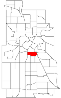 Location of Ventura Village within the U.S. city of Minneapolis | |
| Country | United States |
| State | Minnesota |
| County | Hennepin |
| City | Minneapolis |
| Community | Phillips |
| Population (2010)[1] | |
| • Total | 6,537 |
| Time zone | UTC-6 (CST) |
| • Summer (DST) | UTC-5 (CDT) |
| ZIP code | 55404 |
| Area code(s) | 612 |
| Historical population | |||
|---|---|---|---|
| Census | Pop. | %± | |
| 2000 | 6,769 | — | |
| 2010 | 6,537 | −3.4% | |
References
- "Minneapolis Neighborhood Profile: Ventura Village" (PDF). Minnesota Compass. October 2011. Retrieved 2013-11-13.
- Ventura Village, Minneapolis, MN. Google Earth. Retrieved 2011-03-09.
External links
- Minneapolis Neighborhood Profile - Ventura Village
- pdf map of the Neighborhood.
- Ventura Village Neighborhood Association
- Phillips Neighbors Forum - Neighborhood e-mail list and forum including Ventura Village
Places adjacent to Ventura Village, Minneapolis | ||||||||||
|---|---|---|---|---|---|---|---|---|---|---|
| ||||||||||
This article is issued from Wikipedia. The text is licensed under Creative Commons - Attribution - Sharealike. Additional terms may apply for the media files.