Utica Township, Clark County, Indiana
Utica Township is one of twelve townships in Clark County, Indiana. As of the 2010 census, its population was 6,016 and it contained 2,422 housing units.[3]
Utica Township | |
|---|---|
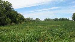 Countryside in the township | |
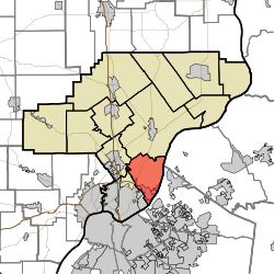 Location of Utica Township in Clark County | |
| Coordinates: 38°21′30″N 85°40′29″W | |
| Country | United States |
| State | Indiana |
| County | Clark |
| Government | |
| • Type | Indiana township |
| Area | |
| • Total | 22.01 sq mi (57.0 km2) |
| • Land | 21.64 sq mi (56.0 km2) |
| • Water | 0.36 sq mi (0.9 km2) |
| Elevation | 548 ft (167 m) |
| Population (2010) | |
| • Total | 6,016 |
| • Density | 278/sq mi (107/km2) |
| FIPS code | 18-78128[2] |
| GNIS feature ID | 453941 |
History
Utica Township was organized in 1831.[4] It was named after the town of Utica, Indiana.[5]
Geography
According to the 2010 census, the township has a total area of 22.01 square miles (57.0 km2), of which 21.64 square miles (56.0 km2) (or 98.32%) is land and 0.36 square miles (0.93 km2) (or 1.64%) is water.[3]
Cities and towns
- Jeffersonville (northeast quarter)
- Utica
Unincorporated towns
- Longview Beach
- Prather
- River Ridge
- Watson
(This list is based on USGS data and may include former settlements.)
Adjacent townships
- Charlestown Township (north)
- Jeffersonville Township (southwest)
- Silver Creek Township (west)
Major highways
Cemeteries
The township contains many cemeteries: Adams Family, Barnett (aka Adams Cemetery), Briar Hill, Burtt, Friend (aka Dailey), Hillcrest, Koonz Cemetery, Lentz Family, Lentz Heirs, New Chapel, Queen of Heaven, Smith, Stacy, Union, Utica, and Washington.[6]
References
- "US Board on Geographic Names". United States Geological Survey. 2007-10-25. Retrieved 2008-01-31.
- "U.S. Census website". United States Census Bureau. Retrieved 2008-01-31.
- "Population, Housing Units, Area, and Density: 2010 - County -- County Subdivision and Place -- 2010 Census Summary File 1". United States Census. Archived from the original on 2020-02-12. Retrieved 2013-05-10.
- Biographical and Historical Souvenir for the Counties of Clark, Crawford, Harrison, Floyd, Jefferson, Jennings, Scott, and Washington, Indiana. Chicago Printing Company. 1889. pp. 8.
- History of the Ohio Falls Cities and Their Counties: Precincts of Jefferson County, Ky. General histories of Clark and Floyd counties, Ind. New Albany and Floyd County. Clark County and Jeffersonville. L. A. Williams & Company. 1882. p. 394.
- Mauk, Lois. "Clark County, Indiana Cemeteries". usgennet.org. USGenNet. Retrieved 7 September 2014.
External links
Municipalities and communities of Clark County, Indiana, United States | ||
|---|---|---|
| Cities | Map of Indiana highlighting Clark County | |
| Towns | ||
| Townships | ||
| CDPs | ||
| Unincorporated communities |
| |
| Footnotes | ‡This populated place also has portions in an adjacent county or counties | |