Monroe Township, Clark County, Indiana
Monroe Township is one of twelve townships in Clark County, Indiana. As of the 2010 census, its population was 5,402 and it contained 2,125 housing units.[3]
Monroe Township | |
|---|---|
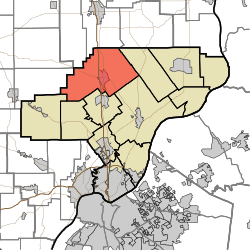 Location of Monroe Township in Clark County | |
| Coordinates: 38°32′41″N 85°46′25″W | |
| Country | United States |
| State | Indiana |
| County | Clark |
| Government | |
| • Type | Indiana township |
| Area | |
| • Total | 56.06 sq mi (145.2 km2) |
| • Land | 55.78 sq mi (144.5 km2) |
| • Water | 0.28 sq mi (0.7 km2) |
| Elevation | 525 ft (160 m) |
| Population (2010) | |
| • Total | 5,402 |
| • Density | 96.9/sq mi (37.4/km2) |
| FIPS code | 18-50274[2] |
| GNIS feature ID | 453636 |
History
Monroe Township was organized prior to 1827 but the exact date is unclear because records have been lost. It was likely named for President James Monroe.[4]
Geography
According to the 2010 census, the township has a total area of 56.06 square miles (145.2 km2), of which 55.78 square miles (144.5 km2) (or 99.50%) is land and 0.28 square miles (0.73 km2) (or 0.50%) is water.[3]
Unincorporated towns
Adjacent townships
- Vienna Township, Scott County (north)
- Oregon Township (east)
- Charlestown Township (southeast)
- Union Township (south)
- Carr Township (southwest)
- Wood Township (southwest)
- Polk Township, Washington County (west)
- Finley Township, Scott County (northwest)
Major highways


Cemeteries
The township contains several cemeteries: Blue Lick Cemetery (a.k.a. Mountain Grove), Bowerman Cemetery, Cass, Clegg (a.k.a. Mt. Moriah), Collings, Dieterlen Grave, Dietz, Forest Grove (a.k.a. Willey's Chapel), Guernsey, Henryville, Hylton-Condrey, Hosea Family, Kaylor-Wilcox, Little Union (a.k.a. Gross), McBride-Allen-Biggs (a.k.a. Allen), Mt. Lebanon, Mt. Moriah, Mt. Zion, Otisco II, St. Clair, St. Francis Catholic (a.k.a. Henryville Catholic), Tuttle, and Wootan.[5]
References
- "US Board on Geographic Names". United States Geological Survey. 2007-10-25. Retrieved 2008-01-31.
- "U.S. Census website". United States Census Bureau. Retrieved 2008-01-31.
- "Population, Housing Units, Area, and Density: 2010 - County -- County Subdivision and Place -- 2010 Census Summary File 1". United States Census. Archived from the original on 2020-02-12. Retrieved 2013-05-10.
- History of the Ohio Falls Cities and Their Counties: Precincts of Jefferson County, Ky. General histories of Clark and Floyd counties, Ind. New Albany and Floyd County. Clark County and Jeffersonville. L. A. Williams & Company. 1882. p. 357.
- Mauk, Lois. "Clark County, Indiana Cemeteries". usgennet.org. USGenNet. Retrieved 7 September 2014.
External links
Municipalities and communities of Clark County, Indiana, United States | ||
|---|---|---|
| Cities | Map of Indiana highlighting Clark County | |
| Towns | ||
| Townships | ||
| CDPs | ||
| Unincorporated communities |
| |
| Footnotes | ‡This populated place also has portions in an adjacent county or counties | |