Utah State Route 172
State Route 172 (SR-172) is a state highway in the U.S. state of Utah connecting 6200 South and West Valley City to SR-201 and I-80 via 5600 West in a span of 9.22 miles (14.84 km). The highway was formed in 1985.
| ||||
|---|---|---|---|---|
| 5600 West | ||||
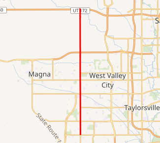
SR-172 highlighted in red | ||||
| Route information | ||||
| Defined by Utah Code §72-4-123 | ||||
| Maintained by UDOT | ||||
| Length | 9.218 mi[1] (14.835 km) | |||
| Existed | 1985–present | |||
| Major junctions | ||||
| South end | 6200 South in Kearns | |||
| North end | ||||
| Highway system | ||||
| ||||

Route description
The route begins at the junction of 6200 South and 5600 West and heads due north on the latter as a two-lane undivided highway, with wide shoulders on each side. Past the intersection of SR-173, the road widens to four lanes. Past the diamond interchange at SR-201, the route loses two lanes in each direction. The highway continues in this manner until it terminates at the diamond interchange at I-80.[2]
All of SR-172 has been included in the National Highway System.[3]
History
State Route 172 was formed in 1985 by the Utah Transportation Commission. Since the route's formation, it has not been changed.[4]
Major intersections
The entire route is in Salt Lake County. [5]
| Location[5] | mi[1] | km | Destinations | Notes | |
|---|---|---|---|---|---|
| Kearns | 0.000 | 0.000 | 6200 South | Southern terminus | |
| West Valley City | 0.993 | 1.598 | |||
| 3.993 | 6.426 | ||||
| Salt Lake City | 5.933– 6.086 | 9.548– 9.794 | |||
| 9.005– 9.218 | 14.492– 14.835 | Northern terminus | |||
| 1.000 mi = 1.609 km; 1.000 km = 0.621 mi | |||||
References
| Wikimedia Commons has media related to Utah State Route 172. |
- "State Route 172 Highway reference". Utah Department of Transportation.
- "Google Maps". Google.
- "Utah National Highway System". UDOT Data Portal. Retrieved January 22, 2019.
- Utah Department of Transportation, Highway Resolutions: "SR-172". (838 KB), updated November 2007, accessed July 2008
- "State Highway Map". Utah Department of Transportation. Retrieved 27 July 2008.