Union Township, Putnam County, Ohio
Union Township is one of the fifteen townships of Putnam County, Ohio, United States. The 2000 census found 2,557 people in the township, 1,526 of whom lived in the unincorporated portions of the township.[3]
Union Township, Putnam County, Ohio | |
|---|---|
 Flood-damaged fields north of Kalida | |
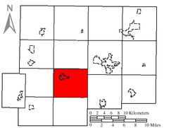 Location of Union Township in Putnam County | |
| Coordinates: 40°58′28″N 84°10′31″W | |
| Country | United States |
| State | Ohio |
| County | Putnam |
| Area | |
| • Total | 30.4 sq mi (78.7 km2) |
| • Land | 30.4 sq mi (78.7 km2) |
| • Water | 0.0 sq mi (0.0 km2) |
| Elevation | 728 ft (222 m) |
| Population (2000) | |
| • Total | 2,557 |
| • Density | 84.2/sq mi (32.5/km2) |
| Time zone | UTC-5 (Eastern (EST)) |
| • Summer (DST) | UTC-4 (EDT) |
| FIPS code | 39-78526[2] |
| GNIS feature ID | 1086870[1] |
Geography
Located in the central part of the county, it borders the following townships:
- Greensburg Township - north
- Ottawa Township - northeast
- Pleasant Township - east
- Sugar Creek Township - south
- Jennings Township - southwest corner
- Jackson Township - west
- Perry Township - northwest corner
The village of Kalida is located in northwestern Union Township.
Name and history
Union Township was erected in 1832.[4] It is one of twenty-seven Union Townships statewide.[5]
Government
The township is governed by a three-member board of trustees, who are elected in November of odd-numbered years to a four-year term beginning on the following January 1. Two are elected in the year after the presidential election and one is elected in the year before it. There is also an elected township fiscal officer,[6] who serves a four-year term beginning on April 1 of the year after the election, which is held in November of the year before the presidential election. Vacancies in the fiscal officership or on the board of trustees are filled by the remaining trustees.
References
- "US Board on Geographic Names". United States Geological Survey. 2007-10-25. Retrieved 2008-01-31.
- "U.S. Census website". United States Census Bureau. Retrieved 2008-01-31.
- Putnam County, Ohio — Population by Places Estimates Archived 2016-08-18 at the Wayback Machine Ohio State University, 2007. Accessed 15 May 2007.
- Warren, Robert (May 31, 1953). "Blanchard River Brought Pioneers To Putnam". Toledo Blade. p. 3. Retrieved 30 April 2015.
- "Detailed map of Ohio" (PDF). United States Census Bureau. 2000. Retrieved 2007-02-16.
- §503.24, §505.01, and §507.01 of the Ohio Revised Code. Accessed 4/30/2009.
External links
Municipalities and communities of Putnam County, Ohio, United States | ||
|---|---|---|
| Villages | 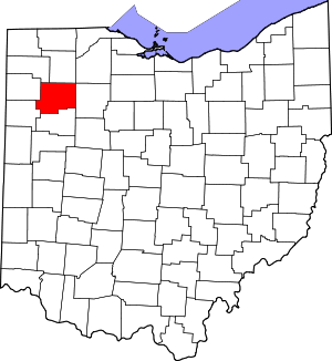 Map of Ohio highlighting Putnam County | |
| Townships | ||
| CDP | ||
| Unincorporated communities | ||
| Ghost towns | ||