Umm al-Qutuf
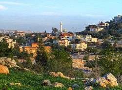
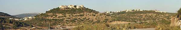
Umm al-Qutuf (Arabic: أمّ القـُطـُف; Hebrew: אֻם אל-קֻטוּף) is an Arab village in northern Israel. Located in the triangle, it falls under the jurisdiction of Menashe Regional Council. In 2018 it had a population of 1,093.[1]
Umm al-Qutuf אֻם אל-קֻטוּף, אום אל-קוטוף أمّ القـُطـُف | |
|---|---|
 | |
 Umm al-Qutuf 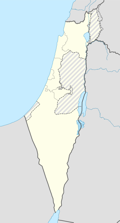 Umm al-Qutuf | |
| Coordinates: 32°28′N 35°04′E | |
| Grid position | 155/208 PAL |
| Country | |
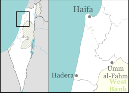
| District | Haifa |
| Council | Menashe |
| Population (2018)[1] | 1,093 |
| Name meaning | "The ruin with the St. John's-worts"[2] |
History
Pottery remains from the Hellenistic,[3] Roman,[3][4] and Byzantine eras have been found here,[3][4][5] as have pottery remains from the early Muslim and the Middle Ages.[3]
Ottoman era
In 1882, the PEF's Survey of Western Palestine (SWP) found at Kh. Umm el Kutuf only "ruined walls."[6]
British Mandate era
In the 1922 census of Palestine, conducted by the British Mandate authorities, Kherbet Umm al-Qatuf had a population of 11 Muslims.[7]
See also
References
- "Population in the Localities 2018" (XLS). Israel Central Bureau of Statistics. 25 August 2019. Retrieved 26 August 2019.
- Palmer, 1881, p. 150
- Zertal, 2016, p. 163
- Haddad, 2012, Umm el-Qutuf
- Dauphin, 19918, p. 750
- Conder and Kitchener, 1882, SWP II, p. 64
- Barron, 1923, Table IX, Sub-district of Jenin, p. 30
Bibliography
- Barron, J.B., ed. (1923). Palestine: Report and General Abstracts of the Census of 1922. Government of Palestine.
- Conder, C.R.; Kitchener, H.H. (1882). The Survey of Western Palestine: Memoirs of the Topography, Orography, Hydrography, and Archaeology. 2. London: Committee of the Palestine Exploration Fund.
- Dauphin, Claudine (1998). La Palestine byzantine, Peuplement et Populations. BAR International Series 726 (in French). III : Catalogue. Oxford: Archeopress. ISBN 0-860549-05-4.
- Haddad, Elie (2012-03-22). "Umm el-Qutuf" (124). Hadashot Arkheologiyot – Excavations and Surveys in Israel. Cite journal requires
|journal=(help) - Palmer, E.H. (1881). The Survey of Western Palestine: Arabic and English Name Lists Collected During the Survey by Lieutenants Conder and Kitchener, R. E. Transliterated and Explained by E.H. Palmer. Committee of the Palestine Exploration Fund.
- Zertal, A. (2016). The Manasseh Hill Country Survey. 3. Boston: BRILL. ISBN 9004312307.
External links
- Welcome To Umm al-Qutaf
- Survey of Western Palestine, Map 8: IAA, Wikimedia commons
This article is issued from Wikipedia. The text is licensed under Creative Commons - Attribution - Sharealike. Additional terms may apply for the media files.