Umka
Umka (Serbian: Умка) is a suburban settlement of Belgrade, the capital of Serbia. It is located in the municipality of Čukarica.
Umka Умка | |
|---|---|
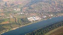 Aerial view on Umka | |
 Umka Location within Serbia | |
| Coordinates: 44.678092°N 20.306418°E | |
| Country | |
| Region | Belgrade |
| Municipality | Čukarica |
| Area | |
| • Total | 10.38 km2 (4.01 sq mi) |
| Population (2011)[2] | |
| • Total | 5,272 |
| • Density | 510/km2 (1,300/sq mi) |
| Time zone | UTC+1 (CET) |
| • Summer (DST) | UTC+2 (CEST) |
| Postal code | 11260 |
| Area code | +381(0)11 |
| Car plates | BG |
Location
Umka is located 22 km (14 mi) south-west of Belgrade, on the right bank of the Sava river, close to river's 22 km (14 mi). It is a crossroads on the IB-26 highway, with roads connecting it with another important highway to the east, the Ibarska magistrala.[3]
Administration
Umka was a separate municipality, comprising surrounding villages of Rucka and Pećani which had a population 3,044 by the 1953 census.[4] It was later enlarged with several surrounding villages, but the municipality was ultimately dissolved in 1960 and divided between Čukarica (Umka, Rucka and Pećani) and Barajevo (Meljak and Vranić).
Geography
One of the characteristics of the Belgrade city terrain is mass wasting. On the territory covered by the General Urban Plan there are 1,155 recorded mass wasting points, out of which 602 are active and 248 are labeled as the "high risk". They cover almost 30% of the city territory. Downhill creeps are located on the slopes above the rivers, mostly on the clay or loam soils, inclined between 7 and 20 degrees and Umka, especially its neighborhood of Duboko, is one of the largest and most active.[5][6] The creep stretches into the municipality of Obrenovac.[7]
The settlement Duboko, on the creep, developed in the 1960s.[6] It is unevenly constructed, with over 500 houses and other objects. Historically, the largest movements of the land occurred in 1914, 1941, 1978, 1982 and 2005. The creep itself is triangularly shaped, on the 900 m (3,000 ft) long slope, 1,450 m (4,760 ft) wide at the base, with the average inclination of 9 degrees. It covers an area of 100 ha (250 acres) and is 14 m (46 ft) deep on average.[8] The mass wasting causes the damages on the houses and the freeway which sink and get ruptured constantly. Damages are being repaired and patched but the massive project of stopping down the terrain is found to be too expensive.
It caused the problem for the route of the future A2 motorway, as the Belgrade City government planned to conduct the road on the left bank of the Sava, in the flat Syrmia region, bypassing the mass wasting area, while the government of Serbia pushed the right bank route. Ensuing debate became highly political and resulted in open clash between the Belgrade's mayor Nenad Bogdanović and Serbian minister for capital investments Velimir Ilić in 2006. In the end, in March 2017 the construction of the motorway through Syrmia began.[9][10] The projected cost of repairing Duboko is over 30 million euros. The most likely process would be a massive filling up of the area with stone, which would shift the river current from the right side, where it erodes the creep, to the left, Syrmian side.[5][6]
Population
| Historical population | ||
|---|---|---|
| Year | Pop. | ±% |
| 1921 | 772 | — |
| 1948 | 2,058 | +166.6% |
| 1953 | 2,368 | +15.1% |
| 1961 | 3,731 | +57.6% |
| 1971 | 5,393 | +44.5% |
| 1981 | 5,618 | +4.2% |
| 1991 | 4,847 | −13.7% |
| 2002 | 5,292 | +9.2% |
| 2011 | 5,272 | −0.4% |
| Source: [11] | ||
Umka is classified as an urban settlement (town), but many published sources refer to it as varošica (small town) even though statistically there is no such classification. The settlement experienced high growth of population after World War II, but has stagnated in the last four decades. New tourist settlement (vikend naselje) is built on the bank of the Sava. According to the 2011 census, the population of Umka was 5,272. Umka makes a continuous built-up urban area with the neighboring urban settlements of Pećani (pop. 562 in 2011) and Rucka (pop. 316).
Economy
Umka was well known in former Yugoslavia for its two major factories: Zelengora, the knitted goods manufacturer and general representative for the Speedo swimsuits, and Umka cardboard factory. Both factories followed the destiny of other companies during the economic collapse in the 1990s. Umka also has an advanced agricultural farm.
In 1928, a railway tunnel was dug at Umka. It was part of the Belgrade-Dubrovnik narrow gauge railway. The 1,620 m (5,310 ft) long tunnel was later abandoned when the narrow gauge railways were discontinued and the gas pipeline was conducted through a part of it. As of 2018, the entrance into the tunnel is accessible.[12]
Notable people
- Milan Gutović, actor
References
- "Насеља општине Чукарица" (pdf). stat.gov.rs (in Serbian). Statistical Office of Serbia. Retrieved 22 October 2019.
- "2011 Census of Population, Households and Dwellings in the Republic of Serbia: Comparative Overview of the Number of Population in 1948, 1953, 1961, 1971, 1981, 1991, 2002 and 2011, Data by settlements" (PDF). Statistical Office of Republic Of Serbia, Belgrade. 2014. p. 32. ISBN 978-86-6161-109-4. Retrieved 2014-06-27.
- Turističko područje Beograda. Geokarta. 2007. ISBN 86-459-0099-8.
- Popis stanovništva 1953, Stanovništvo po narodnosti (pdf). Savezni zavod za statistiku, Beograd.
- Nikola Belić (8 November 2011), "Klizišta nisu samo hir prirode", Politika (in Serbian)
- Nikola Belić (22 February 2012), "Otapanje pokreće i klizišta", Politika (in Serbian)
- Tanjug (16 February 2012), "Sanacija klizišta na Umci izuzetno skupa", Večernje Novosti (in Serbian)
- Petar Mitrović, Branko Jelisavac (2006), Sanacija klizišta "Duboka" (in Serbian and English)
- Časlav Lazić (14 November 2016). "Zatvara se prsten: Deonica Surčin-Obrenovac gotova za tri godine, gradi se 11 mostova" (in Serbian). Blic.
- Beta, FoNet (1 March 2017). "Počela izgradnja deonice autoputa Surčin-Obrenovac" (in Serbian). N1.
- Comparative overview of the number of population in 1948, 1953, 1961, 1971, 1981, 1991, 2002 and 2011 – Data by settlements, page 29. Statistical Office of the Republic of Serbia, Belgrade. 2014. ISBN 978-86-6161-109-4.
- Aleksandra Kurteš (17 September 2018). "Тајне подземља Чукарице" [Secrets of Čukarica's underground]. Politika (in Serbian).
External links
| Wikimedia Commons has media related to Umka. |