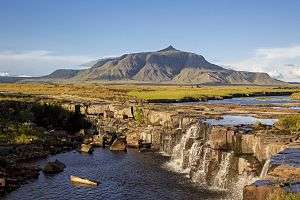
Uei-tepui
Uei-tepui, also known as Wei-tepui, Cerro El Sol or Serra do Sol[2] is a tepui on the border between Brazil and Venezuela. It may be considered the southernmost member of the Eastern Tepuis chain.[1]
| Uei-tepui | |
|---|---|
 Uei-tepui in 2013 | |
| Highest point | |
| Elevation | 2,150 m (7,050 ft) [1] |
| Coordinates | 05°01′01″N 60°36′55″W |
| Geography | |
.jpg) Uei-tepui Location in Venezuela | |
| Location | Roraima, Brazil / Bolívar, Venezuela |
Uei-tepui has an elevation of around 2,150 metres (7,050 ft), a summit area of 2.5 km2 (0.97 sq mi), and an estimated slope area of 20 km2 (7.7 sq mi).[1] While the peak of Uei-tepui lies completely in Venezuelan territory, large part of the main ridge forms the boundary between Venezuela and Brazil.
See also
References
- Huber, O. (1995). Geographical and physical features. In: P.E. Berry, B.K. Holst & K. Yatskievych (eds.) Flora of the Venezuelan Guayana. Volume 1. Introduction. Missouri Botanical Garden Press, St. Louis. pp. 1–61.
- McPherson, S., A. Wistuba, A. Fleischmann & J. Nerz (2011). Sarraceniaceae of South America. Redfern Natural History Productions, Poole.
Further reading
- Kok, P.J.R., R.D. MacCulloch, D.B. Means, K. Roelants, I. Van Bocxlaer & F. Bossuyt (7 August 2012). "Low genetic diversity in tepui summit vertebrates" (PDF). Archived from the original (PDF) on 2013-06-05. Current Biology 22(15): R589–R590. doi:10.1016/j.cub.2012.06.034 ["supplementary information" (PDF).]
This article is issued from Wikipedia. The text is licensed under Creative Commons - Attribution - Sharealike. Additional terms may apply for the media files.