Tonteg
Tonteg is a village around three and a half miles (6 km) from Pontypridd, south Wales. It is 9 miles (14.5 km) north west of Cardiff and four miles (6.5 km) north east of Llantrisant. The village is within the community of Llantwit Fardre. Tonteg is to the north west of the Garth Mountain, on the west side of the River Taff valley, at the top of a hill known locally as Powerstation Hill. The hill gets its name from the Upper Boat power station which was situated at the bottom of the hill until it was demolished in 1972. Tonteg is next to Church Village and the boundaries between the two villages are blurred. A significant part of the Treforest Industrial Estate falls within the Willowford area of Tonteg.
| Tonteg | |
|---|---|
 | |
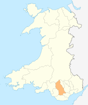
 Tonteg Location within Rhondda Cynon Taf | |
| Population | 4,098 (2011 ward)[1] |
| Community | |
| Principal area | |
| Ceremonial county |
|
| Country | Wales |
| Sovereign state | United Kingdom |
| Post town | Pontypridd |
| Postcode district | CF38 1 |
| Police | South Wales |
| Fire | South Wales |
| Ambulance | Welsh |
| UK Parliament | |
Toponymy
The name of the village occurs in a number of forms: Tonteg, Ton teg, Ton-teg and on some older maps as Ton-têg or Twyn-teg. Tonteg is now seen on the village sign. The name means "Beautiful hill" when translated from Welsh, deriving not from the Welsh for "wave" as might be thought, but rather from the earlier form of the name from the word "twyn".[2] Indeed, a farm on the Black Road above the nearby Church Village is named Dan-y-twyn ("Beneath the hill"). It could also be related to the toponym ton as seen in Tonna.
Castle
The village has a fairly well preserved 12th-century motte castle with an intact moat called Tomen-Y-Clawdd.[3] To locals this fort situated in Ffordd Gerdinan is known as the Monkey Tump
Hospital
Tonteg Hospital exists in the north of the village, now surrounded by housing estates. It was originally an isolation hospital treating contagious diseases. Nowadays it provides mental health care and other services.[4] No emergency services are provided.
Schools
Gwauncelyn Primary School[5] serves the local community.
Shopping
Two main areas of local businesses exist along Main Road through the village and in the center of one of the housing estates (Cardigan Close area). Tonteg still has a post office.
Transport
There are bus services to Beddau, Cardiff, Pontypridd, Talbot Green and Royal Glamorgan Hospital.[6]
Tonteg used to have at differing times two stations - both called Tonteg Halt railway station - on two former railway lines that ran nearby; Barry Railway and the Llantrisant and Taff Vale Junction Railway. After 1930 the original Tonteg Halt was moved to Tonteg Junction after track rationalisation; the name Tonteg Halt was used for this station.
The existence of the railways in the area around Power Station Hill has been obliterated by the Church Village bypass (described below), though some remnants exist between Tonteg and Treforest and to the south of the village towards Church Village.
There existed plans for a new station to be built on the remaining Pontypridd-Cardiff line between Treforest and Treforest Estate to serve the village, although its location would have been at the bottom of Power Station Hill and access to the village difficult.
Bypass
Rhondda Cynon Taf, the local authority, has constructed a bypass to reduce traffic congestion on the A473, Pontypridd to Bridgend (Welsh: Penybont ar Ogwr) road, at Tonteg, Church Village (Welsh: Pentre'r Eglwys) and Llantwit Fardre (Welsh: Llanilltud Faerdref). The Church Village bypass, as it is known, is built as a single carriageway, with crawler and overtaking lanes around roundabouts and was completed in Autumn 2010.[7][8]
Governance
Tonteg is represented on Rhondda Cynon Taf County Borough Council by two county councillors from the electoral ward of Ton-teg.[9] The ward comprises the eastern strip of the Llantwit Fardre community, including the Tonteg village, Treforest Industrial Estate in the north and Gedrys Farm in the south.[10] A 2018 review of electoral arrangements, if accepted, would see a decrease in the number of councillors to one, effective from the 2022 council elections.[11]
Tonteg is also the name of a community ward for Llantwit Fardre Community Council, electing one of the twelve community councillors.[12]
References
- "Ward population 2011". Retrieved 17 November 2015.
- Papurau Newydd Arlein. National Library of Wales http://newspapers.library.wales/view/3826470/3826477/73/. Retrieved 5/1/15. Check date values in:
|accessdate=(help); Missing or empty|title=(help) - The Welsh Academy Encyclopaedia of Wales. John Davies, Nigel Jenkins, Menna Baines and Peredur Lynch (2008) pg 507 ISBN 978-0-7083-1953-6
- "Archived copy". Archived from the original on 28 September 2011. Retrieved 27 January 2011.CS1 maint: archived copy as title (link)
- http://www.gwauncelynprimary.com/
- http://www.carlberry.co.uk/rfnshowl.asp?L1=TON004
- "Church Village Bypass - Web Online". Church Village Bypass website. Rhondda Cynon Taf CBC, Costain and the Welsh Assembly Government. 2009. Archived from the original on 2009-06-22. Retrieved 2009-04-175. Check date values in:
|accessdate=(help) - "WalesOnline - News - South Wales Valleys - Pontypridd & Llantrisant - Safety worries discounted as bypass work begins". Wayne Nowaczyk, Pontypridd Observer. Media Wales Ltd. 11 December 2008. Retrieved 17 April 2009.
- "The County Borough of Rhondda Cynon Taff (Electoral Arrangements) Order 1998". Legislation.gov.uk. 23 November 1998. Retrieved 17 February 2019.
- "Election maps". Ordnance Survey. Retrieved 17 February 2019.
- Anthony Lewis (30 August 2018). "The number of electoral council wards in Rhondda Cynon Taf could be cut for 2022 election". Wales Online. Retrieved 17 February 2019.
- "Council Members". Llantwit Fardre Community Council. Retrieved 17 February 2019.
External links
- www.geograph.co.uk : photos of Tonteg and surrounding area
- WWW.TRACKBED.COM : photos of Tonteg Junction railway station