Tongi
Tongi (Bengali: টঙ্গী) is a major township in Gazipur, Bangladesh, with a population of 350,000. It hosts the Biswa Ijtema and features a BSCIC industrial area, which produces BDT 1500 crore of industrial products annually,[3][4] and marks the northern border of Dhaka since 1786.[5] Tongi Shahid Memorial School compound is mass burial site of the genocide in Liberation War of Bangladesh.[3]
Tongi টঙ্গী | |
|---|---|
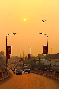 Tongi Flyover | |
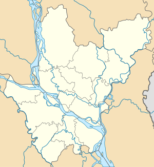 Tongi Location in Dhaka Division  Tongi Location in Bangladesh | |
| Coordinates: 23.90°N 90.41°E | |
| Country | |
| Division | Dhaka Division |
| District | Gazipur District |
| Government | |
| • Type | Mayor–Council |
| • Body | Tongi Municipality |
| Area | |
| • Total | 32.07 km2 (12.38 sq mi) |
| Population (2011) | |
| • Total | 350,000 [1] |
| • Rank | 36th[2] |
| Time zone | UTC+6 (Bangladesh Time) |
| National Dialing Code | +880 |
History
Mir Jumla II (1660–1663) built a fort to protect the northern entry of Dhaka during his reign as a Mughal subadar (1660–1663).[5][6] The subadar also built a bridge over the river Turag.[5] Mir Jumla constructed a road, now a part of the Dhaka-Mymensingh highway, that connected Tongi with Bag-e-Badshahi. It served as an axis of urban growth in the 19th and 20th centuries as sites for establishment of new urban settlements - Gulshan (formed in 1961), Banani (in 1964), Baridhara (in 1972) and Uttara (in 1965) - were picked off the highlands along that axis road.[5]
In 1786, Tongi-Jamalpur was designated as the northern boundary of Dhaka by the East India Company, reaffirmed by John Taylor, the first English Commercial Resident of Dhaka in 1800.[5] the newly added
Geography and administration
.jpg)
Tongi, a thana (police station) within the Gazipur Sadar Upazila along with Joydebpur since 1983,[3] is located immediately north of Dhaka. It lies within the jurisdiction Gazipur District, which is a part of the Dhaka Division.
Geologically, the Tongi area comprises the southern extension of the Madhupur tract, a long narrow tract of tectonically elevated area of older sediments only a few metres above the surrounding rivers the Turag. Locally, the Tract is subdivided into the Bhawal Garh terrace which is a part of an inlier, an elevated area surrounded by lowlands by very young riverine sediments occupying the surrounding valleys. The older sediment sequence consists of sandstone of the Dupi Tila Formation overlain by Madhupur Clay, which in turn is overlain by alluvium. The elevation of the Tract varies from 2 to 14 m above mean sea level and it has shallow bedrock which forms a firm substrate for supporting large structures.[7]
Demography
Many of the people who live in Tongi commute to Dhaka each day, mainly by bus. Many people are also employed at factories in Export Processing Zones, areas given special tax and tariff exemptions by the government in order to stimulate industry.[8]
River
Tongi has a bordering river called the Turag River, it is very actively used by the local commuters and traders.[9]. The annual Bishwa Ijtema is also held in Tongi beside the banks of Turag River.[10].
Transport

The newly constructed Tongi Diversion Road forms another important artery of the road network leading to Dhaka.[5]
The Narayanganj-Dhaka-Mymensingh State railway was opened in 1885-86.[5] Tongi is a break of gauge junction station on the Bangladesh Railway where the new cross country line across the Jamuna Bridge from the western section joins the eastern section. Tongi is situated on the bank of the river Turag, transport boats and cargo boats are also available here.
Education
Educational institutions in this area include:
- Tongi Govt. College
- Mozida Government High School
- Safiuddin Sarker Academy and College
- Siraj Uddin Sarker Vidya-niketon & College
- Tongi Pilot School & Girls' College
- Shahajuddin Sarker Model School & College
- Tamirul Millat Kamil Madrasah (Tongi Branch)
- Ashraf Textiles High School
Medical colleges and hospitals
- Tongi Sadar Hospital - 250 bedded hospital
- Tairunnessa Memorial Medical College & Hospital - 375 bedded hospital
- International Medical College & Hospital - 500 bedded hospital
- Ahsanullah Master General Hospital
References
- "Population & Housing Census-2011: Urban Area Report" (PDF). Bangladesh Bureau of Statistics. Retrieved 2019-10-07.
- "Population & Housing Census-2011: Urban Area Report" (PDF). Bangladesh Bureau of Statistics. p. 11. Retrieved 2019-10-07.
- Ahmed, Md Farid Uddin (2012). "Gazipur District". In Islam, Sirajul; Jamal, Ahmed A. (eds.). Banglapedia: National Encyclopedia of Bangladesh (Second ed.). Asiatic Society of Bangladesh.
- "Tongi Bangladesh Small and Cottage Industries Corporation (BSCIC), produces Tk 1500 cr industrial goods annually". Daily News Monitoring Service. BSS. 2005-01-20. Retrieved 2007-04-24.
- Chowdhury, AM (2012). "Dhaka". In Islam, Sirajul; Jamal, Ahmed A. (eds.). Banglapedia: National Encyclopedia of Bangladesh (Second ed.). Asiatic Society of Bangladesh.
- Alam, Helemul (2006-03-21). "DCC demolishes Dhaka gate at Banani". New Age. Archived from the original on 2007-09-30. Retrieved 2007-04-23.
- Alam, MK; Aurangzeb, MM (1975). "Geological environment for Greater Dhaka City". Proceedings of 3rd Annual Conference. Dhaka: Bangladesh Geological Society. pp. 34–37.
- "Bangladesh". Global Connectivity and Exchange Project. Department of State, USA. Retrieved 2007-04-22.
- http://en.banglapedia.org/index.php?title=Turag_River
- https://www.dhakatribune.com/bangladesh/2018/01/21/ijtema-ends-prayer-peace-2
External links
- Gazipur District Commissioner's Official Website
- UNESCAP Publication on the Geographical Engineering possibilities of the Dhaka-Tongi area
- report on enhancing economic zones including the Tongi BSCIC zone by International Finance Corporation
- Population and Housing Census 2011 - Volume 3: Urban Area Report (PDF), Bangladesh Bureau of Statistics, Aug 2014