Tiffin, Ohio
Tiffin is a city in and the county seat of Seneca County, Ohio, United States.[7] Developed along the Sandusky River, which flows to Lake Erie, Tiffin is about 55 miles southeast of Toledo. The population was 17,963 at the 2010 census.[8] The National Arbor Day Foundation has designated Tiffin as a Tree City USA.
Tiffin, Ohio | |
|---|---|
 A view from the Kiwanis Manor in Tiffin, showing bridges across the Sandusky River | |
| Nickname(s): Fort Ball | |
| Motto(s): Crossroads of America | |
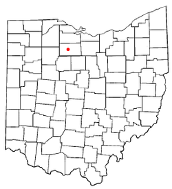 Location in Ohio | |
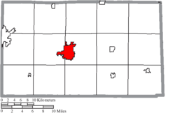 Location of Tiffin in Seneca County | |
| Coordinates: 41°7′1″N 83°10′44″W | |
| Country | United States |
| State | Ohio |
| County | Seneca |
| Fort Ball | 1812 |
| Government | |
| • Mayor | Aaron Montz (R) |
| • City council | Members[1]
|
| Area | |
| • Total | 6.90 sq mi (17.87 km2) |
| • Land | 6.76 sq mi (17.51 km2) |
| • Water | 0.14 sq mi (0.36 km2) |
| Elevation | 745 ft (227 m) |
| Population | |
| • Total | 17,963 |
| • Estimate (2019[5]) | 17,582 |
| • Density | 2,657.2/sq mi (1,026.0/km2) |
| Time zone | UTC-5 (Eastern (EST)) |
| • Summer (DST) | UTC-4 (EDT) |
| ZIP code | 44883 |
| Area code(s) | 419, 567 |
| FIPS code | 39-76778[6] |
| GNIS feature ID | 1058075[3] |
| Website | http://tiffinohio.gov/ |

It is the home of Heidelberg University and Tiffin University. At one time the city was noted as a glass and porcelain manufacturing center. Tiffin has several public elementary schools, Tiffin Middle School, Columbian High School. In addition, Calvert Catholic Schools form a parochial system.
History
The European-American settled history of Tiffin dates back to 1812. The familiar bronze statue of "The Indian Maiden" on Frost Parkway, near Miami Street, marks the site of Fort Ball, a military depot of the War of 1812. During a fighting engagement of that war, Erastus Bowe sighted the location where Tiffin later developed. In 1817, he returned to the site and built his Pan Yan Tavern, on the North Sandusky River. Its name was likely derived from Penn Yan, New York, the seat of Yates County in the Finger Lakes region and the origin for numerous migrants to Ohio.
Early homesteaders followed soon after Bowe, and the settlement of Oakley sprang up around the Pan Yan on the north side of the river. The chief road of the area followed the path of the stagecoaches through Oakley, which was called Fort Ball after 1824.
In 1821, Josiah Hedges purchased a piece of land on the south bank of the river opposite Oakley and founded another settlement. He named this village "Tiffin" in honor of Edward Tiffin, first governor of Ohio and later a member of the United States Senate. He had helped gain statehood for the Ohio Territory in 1803.[9] Tiffin was incorporated by an act of the Ohio Legislature on March 7, 1835. These two communities, split by the Sandusky River, were rivals. In 1850, seeing that their interests lay together, the villages merged to form Tiffin, with Fort Ball becoming a part of Tiffin in March of that year.
In 1824, with the establishment of Seneca County by the Ohio Legislature, Tiffin was designated as the county seat. The county was named after the Seneca Indians, the westernmost of the Iroquois League of Six Nations, who dominated this territory for centuries. They were based in New York, from the Hudson River west along the southern edge of the Great Lakes into Pennsylvania. They had conquered the Ohio Valley during the Beaver Wars and preserved it as hunting grounds.
The discovery of natural gas in the vicinity in 1888 gave new momentum to the city's industrial development. New enterprises located in Tiffin, making it a prosperous industrial city:
- The National Machinery Company moved from Cleveland to Tiffin in 1882.
- Webster Industries, Inc. moved from Chicago to Tiffin in 1906.
- Tiffin Glass Works operated here from 1889 to 1980.
- American Standard Company (formerly Great Western Pottery), maker of ceramic kitchen and bath products, operated here from 1899 to 2007. It was the largest employer in the city.
- Clifford O. Hanson founded The Hanson Clutch and Machinery Company in Tiffin. It was acquired by Pettibone in 1966. Pettibone LLC, which today is an affiliate of The Heico Companies, renamed the business unit Tiffin Parts in 1997. Operating at the same site since the 1920s, the building on Miami Street is on the National Register of Historic Places.[10]
In the spring of 1913, the Upper Mississippi and Ohio River valleys were ravaged by one of the most devastating floods in the region's history. Among those communities which suffered the consequences of that flood was Tiffin, located on the Sandusky River in northwest Ohio. During that three-day period, Tiffin sustained more than $1,000,000 in property loss, 46 houses and 2 factories swept away, 10 factories damaged, 69 places of business heavily damaged, 6 bridges within the corporate limits destroyed, and 19 lives were lost.
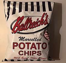
Ballreich's Bros., a potato chip company, has operated in Tiffin since 1920. While the company's retail market is Northern Ohio, its products have a reputation that extends beyond its local retail market; these are available for shipping anywhere via the company's website. The company was acquired by a group of local investors in 2019.[11]
Tiffin St. Paul's United Methodist Church was the first church in the world to be lit by Edison's light bulb, and the first public building in the United States to be wired for electricity.[12][13]
Tiffin is home to a large population of German-Americans, descendants of immigrants largely from the mid-19th century. In 1970 Tiffin's peak population was 21,896. Since the late 1970s and industrial restructuring, the city has lost industry, jobs and population. Many jobs have moved offshore.
Tiffin is the home of the historic Ritz Theatre, built in 1928 as a vaudeville house; it is in the Italian Renaissance style. The Ritz Theatre received extensive renovation and restoration in 1998.
In 2002, an F3 tornado hit southeast Tiffin, destroying several homes outside city limits.
A new Mercy Hospital of Tiffin was built and opened in July 2008.
Geography
Tiffin is located at 41°7′1″N 83°10′44″W (41.116834, -83.179003).[14]
According to the United States Census Bureau, the city has a total area of 6.90 square miles (17.87 km2), of which 6.76 square miles (17.51 km2) is land and 0.14 square miles (0.36 km2) is water.[2] The Sandusky River flows through the center of the city. It is located on U.S. Route 224.
Demographics
| Historical population | |||
|---|---|---|---|
| Census | Pop. | %± | |
| 1830 | 248 | — | |
| 1840 | 823 | 231.9% | |
| 1850 | 2,718 | 230.3% | |
| 1860 | 3,992 | 46.9% | |
| 1870 | 5,648 | 41.5% | |
| 1880 | 7,879 | 39.5% | |
| 1890 | 10,801 | 37.1% | |
| 1900 | 10,989 | 1.7% | |
| 1910 | 11,894 | 8.2% | |
| 1920 | 14,375 | 20.9% | |
| 1930 | 16,428 | 14.3% | |
| 1940 | 16,102 | −2.0% | |
| 1950 | 18,952 | 17.7% | |
| 1960 | 21,478 | 13.3% | |
| 1970 | 21,596 | 0.5% | |
| 1980 | 19,567 | −9.4% | |
| 1990 | 18,604 | −4.9% | |
| 2000 | 18,135 | −2.5% | |
| 2010 | 17,963 | −0.9% | |
| Est. 2019 | 17,582 | [5] | −2.1% |
| Sources:[6][15][16][17] | |||
2010 census
As of the census[4] of 2010, there were 17,963 people, 7,086 households, and 4,115 families residing in the city. The population density was 2,657.2 inhabitants per square mile (1,026.0/km2). There were 8,007 housing units at an average density of 1,184.5 per square mile (457.3/km2). The racial makeup of the city was 93.9% White, 2.6% African American, 0.2% Native American, 1.0% Asian, 0.7% from other races, and 1.6% from two or more races. Hispanic or Latino of any race were 3.1% of the population.
There were 7,086 households of which 27.4% had children under the age of 18 living with them, 41.0% were married couples living together, 12.2% had a female householder with no husband present, 4.9% had a male householder with no wife present, and 41.9% were non-families. 34.3% of all households were made up of individuals and 15.4% had someone living alone who was 65 years of age or older. The average household size was 2.29 and the average family size was 2.91.
The median age in the city was 35.2 years. 20.7% of residents were under the age of 18; 17.4% were between the ages of 18 and 24; 21.5% were from 25 to 44; 24.6% were from 45 to 64; and 15.8% were 65 years of age or older. The gender makeup of the city was 48.9% male and 51.1% female.
2000 census
As of the census[6] of 2000, there were 18,135 people, 11,330 households, and 9,471 families residing in the city. The population density was (10,792.4/mi²) people per square mile (11,078.9/km²). There were 17,862 housing units at an average density of 11,210.6 per square mile (467.7/km²). The racial makeup of the city was 96.3% White, 1.5% African American, 0.2% Native American, 0.5% Asian, 0.0% Pacific Islander, 0.6% from other races, and 1.00% from two or more races. Hispanic or Latino of any race were 2.1% of the population.[18]
There were 11,330 households out of which 32.4% had children under the age of 18 living with them, 46.2% were married couples living together, 11.1% had a female householder with no husband present, and 39.0% were non-families. 32.6% of all households were made up of individuals and 14.0% had someone living alone who was 65 years of age or older. The average household size was 2.31 and the average family size was 2.92.
In the city the population was spread out with 22.3% under the age of 18, 15.1% from 18 to 24, 25.9% from 25 to 44, 20.9% from 45 to 64, and 15.8% who were 65 years of age or older. The median age was 36 years. For every 100 females, there were 95.7 males. For every 100 females age 18 and over, there were 92.6 males.
The median income for a household in the city was $33,261, and the median income for a family was $41,329. Males had a median income of $31,207 versus $22,259 for females. The per capita income for the city was $16,580. About 5.7% of families and about 11.1% of the population were below the poverty line, including 9.4% of those under age 18 and 8.9% of those age 65 or over.
Education
Tiffin is served by Tiffin City Schools: Columbian High School, Tiffin Middle School, and C.A. Krout, Noble, and Washington elementary schools.
Tiffin is also served by the Calvert Catholic Schools: Calvert High School for grades 7-12, and one campus school, Calvert Elementary, for preschool through grade 6.
Other schools in Tiffin include the Sentinel Career Center, one of two charters schools, Bridges Community Academy, and North Central Academy.
Tiffin is the home of Tiffin University, Heidelberg University, the Tiffin Academy of Hair Design, and formerly of the American Institute of Massotherapy.
Tiffin also has two Catholic churches. St. Mary's Catholic Church, originally started with primarily Irish and Italian immigrants, has a cathedral appearance and stained glass windows; it once had a school and continues to host the annual St. Mary's Catholic Church Fair. St. Joseph's Catholic Church, the tallest and one of the oldest churches in Tiffin, was originally started with primarily German immigrants.
Tiffin has the county's only lending library, Tiffin-Seneca Public Library.[19]
Transportation
Tiffin has one airport, Seneca County Airport (K16G). Tiffin also has 3 reliable taxi services. Tiffin is currently on 5 state routes, as well as U.S. Route 224, which skirts the city's southern edge. Tiffin is located on the southern terminus of Northern Ohio and Western Railway. CSX operates a busy line that travels east and west through the city. The city is still a very busy railhub for CSX because of its closeness to CSX's Willard Yard and the "Iron Triangle" in Fostoria.
Culture
Media
Tiffin is served by The Advertiser-Tribune as its primary print newspaper, and TiffinOhio.net as its primary online news website/tabloid. The city has 5 radio stations, 1600 WTTF AM, 103.7 WCKY-FM, 103.3 WSJG-LP "St. John Paul The Great Radio," 93.3 COOL FM, and WTSC SenecaCountyRadio.com. It is also served by its local news/sport/entertainment channel, WTIF (Channel 21 on Cable, and currently not carried by DirecTV or Dish Network).
Sports
The Tiffin Saints were part of the Independent Baseball League that played an abbreviated single season at the Heidelberg University baseball field in 2014. The Saints were Tiffin's first "professional" baseball team since the Tiffin Mud Hens played in the Ohio State League from 1936–41. The Tiffin Mud Hens won the OSL championship in 1936. The Saints and IBL, which initially began with six teams, folded before the end of the inaugural season due to financial woes and controversy over whether or not the players were paid. The Adrian Pioneers beat the Ohio Travelers to win the shortened IBL season.
Tiffin is also home to the Tiffin Cross Country Carnival, a large-scale high school cross country meet.
Notable people
- Oliver Edwin Baker, president of the Association of American Geographers, author of Geography of the World's Agriculture, and editor of the Atlas of American Agriculture
- George H. Brickner, politician and businessman
- Oliver Cowdery, early leader in the Latter Day Saint movement. Practiced law and politics in Tiffin, 1842–1847
- George Babcock Cressey, Geography
- Charles W. Foster, 40th Secretary of the Treasury, 35th Governor of Ohio.
- William Harvey Gibson, Union General, Civil War, and noted 19th century orator
- Paul Gillmor, Republican U.S. representative representing the Ohio 5th District from 1988 to 2007.
- John R. Goodin, U.S. Representative from Kansas
- Bill Groman, professional football player in the American Football League (AFL)
- Jay Gruden, former head coach of the Washington Redskins of the NFL
- Katrina Hertzer, Chief Nurse, U. S. Navy Nurse Corps, during World War I
- Sue Wilkins Myrick, U.S. Representative from North Carolina and former mayor of Charlotte, North Carolina. Myrick is a Tiffin native and Heidelberg College alumna
- John Quinn, Tiffin native, lawyer, art patron, collector of historical manuscripts, and major supporter of William Butler Yeats.
- George E. Seney, U.S. Representative from Ohio
- Rodger Wilton Young, Medal of Honor recipient, World War II
References
- "City Council", City of Tiffin.Retrieved April 11, 2020.
- "US Gazetteer files 2010". United States Census Bureau. Archived from the original on 2012-07-02. Retrieved 2013-01-06.
- "US Board on Geographic Names". United States Geological Survey. 2007-10-25. Retrieved 2008-01-31.
- "U.S. Census website". United States Census Bureau. Retrieved 2013-01-06.
- "Population and Housing Unit Estimates". Retrieved May 21, 2020.
- "U.S. Census website". United States Census Bureau. Retrieved 2008-01-31.
- "Find a County". National Association of Counties. Retrieved 2011-06-07.
- U.S. Census website. U.S. Census Bureau. February 4, 2011. Retrieved April 5, 2011.
- Butterfield, Consul Willshire (1848). History of Seneca County: Containing a Detailed Narrative of the Principal Events that Have Occurred Since Its First Settlement Down to the Present Time. D. Campbell. pp. 84.
- "Our History", Tiffin Parts
- "Local investor group purchases Ballreich potato chip company". http://www.wtol.com. Retrieved 26 October 2019. External link in
|website=(help) - "East Ohio Conference United Methodist Archives Center". East Ohio Conference Historian's Page. Archived from the original on 2006-03-20. Retrieved 2006-03-26.
- "St. Paul's Methodist has gift from Edison". The Advertiser Tribune. Archived from the original on 2007-09-28. Retrieved 2006-03-26.
- "US Gazetteer files: 2010, 2000, and 1990". United States Census Bureau. 2011-02-12. Retrieved 2011-04-23.
- "Number of Inhabitants: Ohio" (PDF). 18th Census of the United States. U.S. Census Bureau. 1960. Retrieved 26 April 2020.
- "Ohio: Population and Housing Unit Counts" (PDF). U.S. Census Bureau. Retrieved 22 November 2013.
- "Incorporated Places and Minor Civil Divisions Datasets: Subcounty Population Estimates: April 1, 2010 to July 1, 2012". U.S. Census Bureau. Archived from the original on 11 June 2013. Retrieved 25 November 2013.
- American Fact Finder. "Profile of General Demographic Characteristics: 2000". Archived from the original on 12 February 2020. Retrieved 23 June 2014.
- "Homepage". Tiffin-Seneca Public Library. Retrieved 3 March 2018.
External links
Municipalities and communities of Seneca County, Ohio, United States | ||
|---|---|---|
| Cities | 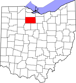 Map of Ohio highlighting Seneca County | |
| Villages | ||
| Townships | ||
| CDPs | ||
| Unincorporated communities | ||
| Ghost towns | ||
| Footnotes | ‡This populated place also has portions in an adjacent county or counties | |
| Authority control |
|
|---|