Scipio Township, Seneca County, Ohio
Scipio Township is one of the fifteen townships of Seneca County, Ohio, United States. The 2010 census found 1,729 people in the township, 1,180 of whom lived in the unincorporated portions of the township.[3]
Scipio Township, Seneca County, Ohio | |
|---|---|
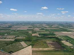 Countryside southwest of Republic | |
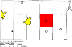 Location of Scipio Township in Seneca County | |
| Coordinates: 41°7′27″N 83°1′9″W | |
| Country | United States |
| State | Ohio |
| County | Seneca |
| Area | |
| • Total | 36.9 sq mi (95.5 km2) |
| • Land | 36.9 sq mi (95.5 km2) |
| • Water | 0.0 sq mi (0.0 km2) |
| Elevation | 850 ft (259 m) |
| Population (2010) | |
| • Total | 1,729 |
| • Density | 46.9/sq mi (18.1/km2) |
| Time zone | UTC-5 (Eastern (EST)) |
| • Summer (DST) | UTC-4 (EDT) |
| FIPS code | 39-71024[2] |
| GNIS feature ID | 1086953[1] |
Geography
Located in the east central part of the county, it borders the following townships:
- Adams Township - north
- Thompson Township - northeast corner
- Reed Township - east
- Venice Township - southeast corner
- Bloom Township - south
- Eden Township - southwest corner
- Clinton Township - west
- Pleasant Township - northwest corner
The village of Republic is located in central Scipio Township.
Name and history
Scipio Township was organized in 1824.[4] It was named after Scipio, New York, the former hometown of many of its early settlers.[5] Statewide, the only other Scipio Township is located in Meigs County.
Government
The township is governed by a three-member board of trustees, who are elected in November of odd-numbered years to a four-year term beginning on the following January 1. Two are elected in the year after the presidential election and one is elected in the year before it. There is also an elected township fiscal officer,[6] who serves a four-year term beginning on April 1 of the year after the election, which is held in November of the year before the presidential election. Vacancies in the fiscal officership or on the board of trustees are filled by the remaining trustees.
References
- "US Board on Geographic Names". United States Geological Survey. 2007-10-25. Retrieved 2008-01-31.
- "U.S. Census website". United States Census Bureau. Retrieved 2008-01-31.
- "U.S. Census website". United States Census Bureau. Retrieved 26 July 2018.
- Lang, William (1880). History of Seneca County, from the Close of the Revolutionary War to July, 1880. Transcript Printing Company. pp. 586.
- Kilbourn, John (1833). The Ohio Gazetteer, or, a Topographical Dictionary. Scott and Wright. pp. 415. Retrieved 12 December 2013.
- §503.24, §505.01, and §507.01 of the Ohio Revised Code. Accessed 4/30/2009.
External links
Municipalities and communities of Seneca County, Ohio, United States | ||
|---|---|---|
| Cities | 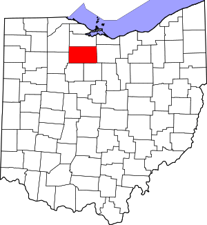 Map of Ohio highlighting Seneca County | |
| Villages | ||
| Townships | ||
| CDPs | ||
| Unincorporated communities | ||
| Ghost towns | ||
| Footnotes | ‡This populated place also has portions in an adjacent county or counties | |