Thimert-Gâtelles
Thimert-Gâtelles is a commune in the Eure-et-Loir department in northern France.
Thimert-Gâtelles | |
|---|---|
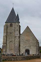 The church in Thimert-Gâtelles | |
Location of Thimert-Gâtelles 
| |
 Thimert-Gâtelles  Thimert-Gâtelles | |
| Coordinates: 48°34′12″N 1°15′08″E | |
| Country | France |
| Region | Centre-Val de Loire |
| Department | Eure-et-Loir |
| Arrondissement | Dreux |
| Canton | Saint-Lubin-des-Joncherets |
| Intercommunality | Thymerais |
| Government | |
| • Mayor (2008–2014) | Dominique Journet |
| Area 1 | 42.67 km2 (16.47 sq mi) |
| Population (2017-01-01)[1] | 1,256 |
| • Density | 29/km2 (76/sq mi) |
| Time zone | UTC+01:00 (CET) |
| • Summer (DST) | UTC+02:00 (CEST) |
| INSEE/Postal code | 28386 /28170 |
| Elevation | 174–254 m (571–833 ft) (avg. 200 m or 660 ft) |
| 1 French Land Register data, which excludes lakes, ponds, glaciers > 1 km2 (0.386 sq mi or 247 acres) and river estuaries. | |
It was the site of a royal castle until 1058, when it was taken by the Normans. Between 1058 and 1060, it was besieged by the king of France. After that the castle was razed and a new castle built nearby, giving rise to Châteauneuf-en-Thymerais.
Population
| Historical population | ||
|---|---|---|
| Year | Pop. | ±% |
| 1962 | 755 | — |
| 1968 | 786 | +4.1% |
| 1975 | 815 | +3.7% |
| 1982 | 826 | +1.3% |
| 1990 | 841 | +1.8% |
| 1999 | 929 | +10.5% |
| 2008 | 1,085 | +16.8% |
References
- "Populations légales 2017". INSEE. Retrieved 6 January 2020.
| Wikimedia Commons has media related to Thimert-Gâtelles. |
| Authority control |
|
|---|
This article is issued from Wikipedia. The text is licensed under Creative Commons - Attribution - Sharealike. Additional terms may apply for the media files.