Thai–Laotian Border War
The Thai–Laotian Border War (December 1987 – February 1988) was a short confrontation between Thai and Laotian forces. It involved a dispute over the map made by French surveyors in 1907 to mark the borders between Siam and French Indochina in the southern Luang Prabang Range. Ownership of the village of Ban Romklao on the border of Phitsanulok Province and three small border villages on the edge of Uttaradit Province was left unclear. This is the same map underlying the Cambodian–Thai border dispute. The agreed criterion for determining ownership was the natural watershed, but the French map makers at times ignored this.[2]
| Thai–Laotian Border War | |||||||||
|---|---|---|---|---|---|---|---|---|---|
| Part of the Third Indochina War and Cold War | |||||||||
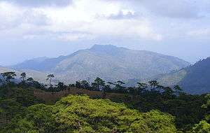 เนิน 1428 (Hill 1428), the battlefield of Thai–Laotian Border War of 1988, view from Phu Soidao National Park, Chat Trakan, Phitsanulok. | |||||||||
| |||||||||
| Belligerents | |||||||||
|
|
| ||||||||
| Casualties and losses | |||||||||
|
Laos: ~200 soldiers killed ~400 wounded[1] Vietnam: Unknown |
Thailand: ~100 soldiers killed ~200 wounded[1] | ||||||||
| ~1,000 total deaths | |||||||||
A series of minor shooting incidents had occurred between Thai and Laotian forces in 1984. In December 1987, however, Thai armed forces occupied the disputed village of Ban Romklao, raising the Thai flag over it. The government of the Lao People's Democratic Republic protested strongly, insisting the village was part of Botene District of Sainyabuli Province. Thailand replied that the village belonged to Chat Trakan District (amphoe) of Phitsanulok Province. Laotian Army forces staged a night attack on the small Thai garrison, driving the Thai soldiers from the village and replacing the Thai flag with that of Laos. Serious fighting followed, continuing for weeks until a cease-fire was declared on 19 February 1988.
The brief war claimed a total of about 1,000 deaths,[3] the Thais suffering more heavily since for much of the war they were attacking entrenched Laotian positions. Gen Chavalit Yongchaiyudh was the commander of the Royal Thai Army at the time of the war and was criticized for engaging in it against the wishes of the Thai Ministry of Foreign Affairs. Vietnam had assisted its socialist ally, sending troops from its 2nd Division to Baan Nakok air field in Sainyabuli to support the Laotian military operations, amidst the border clashes with Thailand along the Thai–Cambodian border.[4]
Aftermath
The Thai-Lao Joint Boundary Commission (JBC) was established in 1996 to clarify the 1,810-kilometre boundary and settle ownership of the disputed villages. As of 2007 border demarcation was on-going.[2]
References
- Clodfelter, M. (2017). Warfare and Armed Conflicts: A Statistical Encyclopedia of Casualty and Other Figures, 1492-2015 (4th ed.). Jefferson, North Carolina: McFarland. ISBN 978-0786474707. Page 627.
- Supalak Ganjanakhundee (March 8, 2007). "Lao border talks progressing". The Nation. Archived from the original on October 5, 2012. Retrieved February 8, 2011.
Officials from both sides will start to conduct aerial photography for mapping this month before beginning the demarcation process and plan to complete the task by 2010.
- Savada, Andrea Matles; Whitaker, Donald P (1995). Laos: a country study. Washington DC: Library of Congress. p. 285. Retrieved 4 December 2016.
- Banerjee, Sumantra (1988-01-16). "New Tension Point". Economic and Political Weekly. 23 (3): 62. JSTOR 4377962.