Ternoise
The river Ternoise (Dutch: Ternaas) is one of the small chalk streams that flow from the plateau of the southern Boulonnais and Picardy, via the Canche, into the English Channel. The basin of the Ternoise extends to 342 square kilometres (132 sq mi) and lies in the southern end of the département of Pas-de-Calais. It is one of the rivers of the Seven Valleys tourist area and gives its name to the Ternois area.
| Ternoise | |
|---|---|
 | |
| Location | |
| Country | France |
| Physical characteristics | |
| Source | |
| • location | Pas-de-Calais |
| Mouth | |
• location | Canche |
• coordinates | 50°22′53″N 2°0′41″E |
| Length | 41.4 km (25.7 mi) |
| Basin size | 342 km2 (132 sq mi) |
| Discharge | |
| • average | 4.45 m3/s (157 cu ft/s) |
| Basin features | |
| Progression | Canche→ English Channel |
Geography
The 41.4-kilometre (25.7 mi) long river[1] rises at Ligny-Saint-Flochel and passes through Saint-Pol-sur-Ternoise to join the river Canche at Huby-Saint-Leu, near to the town of Hesdin.
Towns and villages along the course
The Ternoise flows through the following places (all within the Pas-de-Calais department):
Tributaries
The Faux and the Eps are the only principal watercourses joining the Ternoise.
Hydrological Information
The Ternoise is a very uniform river. Seasonal flow fluctuations are not very marked, similar to the Canche or the Somme, its neighbours. The higher water flows occur at the end of winter and in the spring. Average flows vary between 3.44 m³ per second in September to 5.36 m³ per second in March.
Gallery
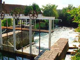
 The Ternoise at Hernicourt
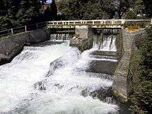 The Ternoise at Auchy-lès-Hesdin
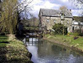
 The Ternoise at Anvin
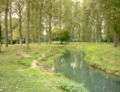 At Anvin, further upstream
See also
References
- Carte Géologique de la France à l'échelle du millionième 6th edn. BRGM (2003) ISBN 2-7159-2158-6
- http://www.geoportail.fr
External links
| Wikimedia Commons has media related to Ternoise. |