Tengréla
Tengréla (also spelled Tingréla) is a town in the far north of Ivory Coast near the border with Mali. It is a sub-prefecture and the seat of Tengréla Department in Bagoué Region, Savanes District. Tengréla is also a commune.
Tengréla Tingréla | |
|---|---|
Town, sub-prefecture, and commune | |
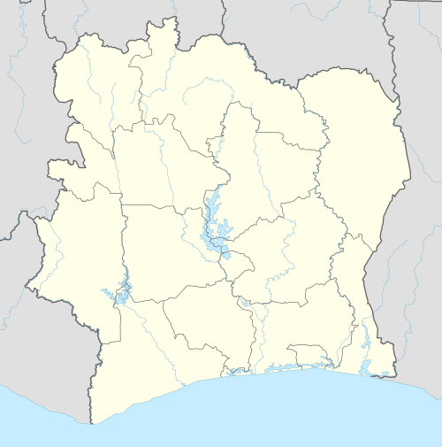 Tengréla Location in Ivory Coast | |
| Coordinates: 10°29′N 6°24′W | |
| Country | |
| District | Savanes |
| Region | Bagoué |
| Department | Tengréla |
| Population (2014)[1] | |
| • Total | 80,887 |
| Time zone | UTC+0 (GMT) |
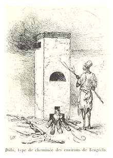
The French explorer René Caillié stopped at the settlement of Tengréla, which was then a large walled village, in January 1828 on his journey to Timbuktu. He was travelling with a caravan of 500 to 600 people and 80 donkeys transporting kola nuts. In his book Travels through Central Africa to Timbuctoo published in 1830, he spelled the name of the village as "Tangrera".[2][3]
In 2014, the population of the sub-prefecture of Tengréla was 80,887 [4].
Villages
The 28 villages of the sub-prefecture of Tengréla and their population in 2014 are[4]:
- Danzourou (852)
- Daraniani (440)
- Djoguinasso (195)
- Flabougou (774)
- Kotou (689)
- Maniasso (1 139)
- M'basso (561)
- Missasso (250)
- Naniasso (801)
- Nigouni (989)
- Sorokoumo (834)
- Tamania (937)
- Tengrela (40 323)
- Tialaka (680)
- Tienderime (630)
- Bolona (5 531)
- Bougoula (196)
- Diamankani (3 462)
- Dougba (1 653)
- Dougba2 (691)
- Feni (2 152)
- Fimbiasso (924)
- M'bele (2 718)
- Neguepie (3 947)
- San (5 320)
- Tiebi (1 128)
- Tiempa (684)
- Zelesso (2 387)
Notes
- "Côte d'Ivoire". geohive.com. Retrieved 7 December 2015.
- Caillié 1830, pp. 379-388.
- Viguier 2008, p. 27.
- "RGPH 2014, Répertoire des localités, Région Bagoué" (PDF). ins.ci. Retrieved 5 August 2019.
References
- Caillié, René (1830). Travels through Central Africa to Timbuctoo; and across the Great Desert, to Morocco, performed in the years 1824-1828 (Volume 1). London: Colburn & Bentley.CS1 maint: ref=harv (link)
- Viguier, Pierre (2008). Sur les Traces de René Caillié: Le Mali de 1828 Revisité. Versailles, France: Quae. ISBN 978-2-7592-0271-3.CS1 maint: ref=harv (link).
Regional seat: Boundiali | ||
| Boundiali Department |  | |
| Kouto Department | ||
| Tengréla Department | ||
* also a commune | ||