Te Atatū South
Te Atatū South (also written as "Te Atatu South") is a residential suburb in Auckland, New Zealand. Its location allows the suburb easy access to the city and Henderson town centre. Its elevation allows views back on to the city and Waitākere Ranges. Situated on the Te Atatū Peninsula, it has coasts backing on to water on its eastern and western sides with walkways and cycleways on both sides.
Te Atatū South | |
|---|---|
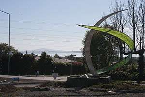 Wade Cornell Sculpture, Te Atatū South roundabout | |
 Te Atatū South | |
| Coordinates: 36°51′54″S 174°38′49″E | |
| Country | New Zealand |
| Local authority | Auckland Council |
| Electoral ward | Waitākere ward |
| Population (2013) | |
| • Total | 13,635 |
| Lincoln | Te Atatū Peninsula | Waitemata Harbour |
| Henderson |
|
(Whau River) |
| Henderson | Glendene | (Whau River) |
History
The area prior to suburban settlement was used largely for vineyards, poultry farms, fruit trees, apples, lemons orchards and flower farms. Vineyards were located along Te Atatu, McLeod and Edmonton Rd's. There were brickworks under what is now the Whau River bridge and a timber mill at the end of Roberts Rd.[1]
The name "Te Atatu South" was attributed to the area in 1961 when the area of Te Atatū was divided by the Northwestern Motorway (State Highway 16). With the new motorway, the area rapidly changed in 10 years from rural to suburban. While new homes in Te Atatū Peninsula were dominated by one builder, "Neil Homes", Te Atatū South had more diversity in new homes and a large quantity of larger quality family homes. These homes reflected Te Atatū South being one of the more affluent areas in West Auckland during the 1970s and 1980s.
Today the suburb is redeveloping its roads and town centre to accommodate more modern needs to build a more walkable and vibrant community.[2]
Schools
Primary schools in this area include Flanshaw Road School, Tirimoana Primary, Freyberg Community School and Edmonton Primary School. The area has one Intermediate school, Rangeview Intermediate. The local state secondary school that services the area is Rutherford College which is just north of the boundary between the suburb and Te Atatū Peninsula. It is also home to Arohanui Special School which caters to students 5 to 21 years of age.
Sport
Te Atatū South is home to Waitemata AFC, West City Baseball Club (NZ's longest running baseball club) and fields for Waitakere Rugby club. The Te Atatu Boating Club was founded in 1959.[3]
Main centres
Its main centre is the Te Atatū Town Centre where Edmonton Road and Te Atatu Road intersect. The Te Atatū South Community Centre is located here.
A small light industrial area is located on McLeod Road.
Two large parks in the area are Te Atatū South Park and McLeod Park.
Transport
Te Atatu Road: the main road that runs through the whole suburb. Bus services run along here and Edmonton Road.
Edmonton Road: links to Henderson with close proximity to the Henderson Railway Station.
McLeod Road: a main road linking the southern part of the suburb to Henderson.
State Highway 16 (SH 16) / Northwestern Cycleway: the northern tip of the suburb links to the city and to the north. The Te Atatū State Highway interchange will be one of the stations on the proposed Western Route of the Light rail in Auckland network.
Twin Stream Walkway/Cycleway: on the western side of the suburb and running along Henderson Creek from the NorthWestern cycleway to Henderson's Twin streams and on to Oratia or Henderson Valley.
Te Whau Pathway (in progress): a walkway/cycleway on the eastern side of the suburb running along the historic Whau River. When completed it will link Te Atatū to Green Bay creating a pathway between the Manukau and Waitemata Harbour's.[4][5]
Ferry Service (proposed). A ferry service has been proposed to link the suburb to the centre city.[6]
Notable buildings and landmarks
36 Te Atatu Rd – Two Storey 520 square metres (5,600 sq ft) home built in the 1930s for the wealthy Ryan family. It has been home to the Henderson Tennis Club and in 1955 it was bought by the Auckland Hospital Board and became a maternity hospital. It has been used recently for other commercial purposes.[7]
Coop's Store - 104 McLeod Road. Built in the 1920s this store was the only store that serviced the area at the time and since then has continuously been operating a retail function in the suburb. It is situated on the corner of McLeod Road and Te Atatu Road. It has been a number of uses and currently is a café and food establishment.[8]
111 McLeod Rd (Women's Centre). Built in 1924. Was the residence of aviator Bob Johnson. The front door is adorned with a stained glass plane. He is responsible for a number of photographs of the area in the 1930s.
Ayr House - 17 Ayrton Street. Two storey home built out of kauri by the Roberts Family in the 1910s. The surrounding area was where the family had a timber factory and planted a lemon tree farm.[9]
Swan Arch - Swan Arch Reserve, Central Park Drive. On the border of Te Atatū South and Henderson. Built by Henry Swan between 1901 and 1931. Henry Swan's story has been romanticised over the years. The Devonport solicitor told friends he was going to sail around the world in his yacht, Awatea but ended up living the life of a recluse on this part of the Henderson Creek for the next 30 years. In his time there he built the brick arch and kept an orchard.[10]
Te Atatū South Community Centre – 247 Edmonton Road. The original centre opened in 1968.
Notable past and present residents
- Brooke Family - Rugby family including All Black's Zinzan Brooke and Robin Brooke[11]
- Sir Graeme Douglas - Founder of Douglas Pharmaceuticals[12]
- Marina Erakovic – Tennis player[13]
- Shayne Elliott - ANZ Group Chief Executive[14]
- Michael Erceg - Founder of Independent Liquor[15]
- Jan Hellriegel - Singer/songwriter
- Sir Michael Jones - All Black
- Kees Meeuws - All Black
- Paula Morris - Writer
- John Rowles – OBE. Singer[16]
- Paul Urlovic – Ex All White
- Ivan Vicelich – Most capped All White
References
- Waitākere Central Library files. "Overhauling surburbia 1990". A report prepared by the Auckland Heritage Trust. Source Peter Buffett W.C.C Historian by A.G. Flude
- "Te Atatu corridor improvement". Auckland Transport. Retrieved 26 October 2016.
- http://www.teatatuboatclub.co.nz/
- Monica Tischler (7 August 2014). "Big plans for boardwalk". Western Leader. Stuff.co.nz. Retrieved 26 October 2016.
- Te Whau Pathway
- James Ireland (23 August 2012). "Te Atatu ferry could ease traffic". Stuff.co.nz. Retrieved 26 October 2016.
- Kelly Dennett (22 February 2013). "House has a story to tell". Western Leader. Stuff.co.nz. Retrieved 26 October 2016.
- Waitākere Central Library files. "Overhauling surburbia 1990". A report prepared by the Auckland Heritage Trust. Source Peter Buffett W.C.C Historian by A.G. Flude
- Waitākere Central Library files. "Overhauling surburbia 1990". A report prepared by the Auckland Heritage Trust. Source Peter Buffett W.C.C Historian by A.G. Flude
- http://homepages.ihug.co.nz/~tonyf/swan/swan.html
- http://www.stuff.co.nz/auckland/local-news/western-leader/2347732/Brooke-still-a-westie
- Nick Krause (18 May 2012). "Drugs empire started with cough". Stuff.co.nz. Retrieved 26 October 2016.
- http://tvnz.co.nz/neighbourhood/season-3-episode-7-te-atatu-south-5942118
- Liam Dann (26 March 2016). "Outrageous Fortune: The Westie boss of ANZ Bank". NZ Herald. Retrieved 26 October 2016.
- http://www.nzherald.co.nz/nz/news/article.cfm?c_id=1&objectid=10353810
- http://www.stuff.co.nz/auckland/local-news/north-shore-times/69590466/star-musician-comes-to-north-shore
External links
- Photographs of Te Atatu South held in Auckland Libraries' heritage collections.