Tarrant Keyneston
Tarrant Keyneston is a village and civil parish in the English county of Dorset, situated in the Tarrant Valley 5 miles (8.0 km) southeast of Blandford Forum in the North Dorset administrative district. In the 2011 census the parish had 152 dwellings,[1] 145 households and a population of 310.[2]
| Tarrant Keyneston | |
|---|---|
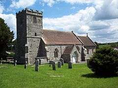 All Saints Church, Tarrant Keyneston | |
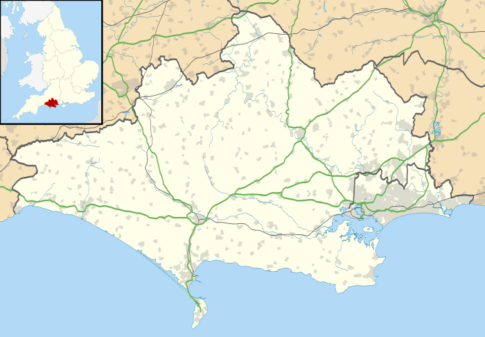 Tarrant Keyneston Location within Dorset | |
| Population | 310 |
| OS grid reference | ST923047 |
| District | |
| Shire county | |
| Region | |
| Country | England |
| Sovereign state | United Kingdom |
| Post town | BLANDFORD FORUM |
| Postcode district | DT11 |
| Police | Dorset |
| Fire | Dorset and Wiltshire |
| Ambulance | South Western |
| UK Parliament | |
On the hills northwest of the village are the earthworks of Buzbury Rings (or Busbury Rings), the remains of an Iron Age and Romano-British fortified encampment or settlement,[3][4][5] described by Sir Frederick Treves in 1905 as "a circle of entrenchments, composed of a stout vallum and a ditch".[5] The outer enclosure covers about 10 acres (4.0 ha) and within this is an inner enclosure, covering about 3 acres (1.2 ha), which is the location of most of the finds from the site, including Roman pottery, animal bones and daub imprinted by wattles. The site has been much damaged by ploughing and by the road between Wimborne Minster and Blandford Forum, which crosses the site.[4]
The village's parish church has a 15th-century tower, though the rest of the building was rebuilt in 1852 by Thomas Henry Wyatt.[4] The chancel of the earlier building contained an anchorite's cell.[3] Richard Poore is most likely to have been buried at Tarrant Keyneston in accordance with his wishes.[6]
Almost all of Tarrant Keyneston parish is within the Cranborne Chase and West Wiltshire Downs Area of Outstanding Natural Beauty (AONB).[7]
References
- "Area: Tarrant Keyneston (Parish). Dwellings, Household Spaces and Accommodation Type, 2011 (KS401EW)". Neighbourhood Statistics. Office for National Statistics. Retrieved 8 June 2015.
- "Area: Tarrant Keyneston (Parish). Key Figures for 2011 Census: Key Statistics". Neighbourhood Statistics. Office for National Statistics. Retrieved 8 June 2015.
- North Dorset District Council (c. 1982). North Dorset District Official Guide. Home Publishing Company Ltd. p. 51.
- "'Tarrant Keyneston', in An Inventory of the Historical Monuments in Dorset, Volume 4, North (London, 1972), pp. 101-105". British History Online. University of London. Retrieved 18 March 2015.
- Sir Frederick Treves (1905). Highways and Byways in Dorset. Macmillan. p. 78.
- Hoskin, Philippa "Poor, Richard (d. 1237)" Oxford Dictionary of National Biography Oxford University Press, 2004 Online Edition. Retrieved 26 November 2007.
- "Cranborne Chase & West Wiltshire Downs Area of Outstanding Natural Beauty" (PDF). ccwwdaonb.org.uk. Archived from the original (PDF) on 8 August 2013. Retrieved 19 March 2015.
External links
![]()
