Tarifa
Tarifa (Spanish pronunciation: [taˈɾifa]) is a Spanish municipality in the province of Cádiz, Andalusia. Located at the southernmost end of the Iberian Peninsula, it is primarily known as one of the world's most popular destinations for windsports. Tarifa lies on the Costa de la Luz ("coast of light") and across the Strait of Gibraltar facing Morocco.
Tarifa | |
|---|---|
_(cropped).jpg) | |
 Flag  Coat of arms | |
| |
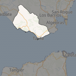
 Tarifa Location of Tarifa 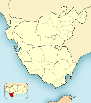 Tarifa Tarifa (Province of Cádiz) | |
| Coordinates: 36.014°N 5.606°W | |
| Country | Spain |
| Autonomous community | Andalusia |
| Province | Cádiz |
| Judicial district | Algeciras |
| Government | |
| • Mayor | Juan Andrés Gil García (2011) (People's Party[PP]) |
| Area | |
| • Total | 419.67 km2 (162.04 sq mi) |
| Elevation | 7 m (23 ft) |
| Population (2018)[1] | |
| • Total | 18,169 |
| • Density | 43/km2 (110/sq mi) |
| Demonym(s) | Tarifeños |
| Time zone | UTC+1 (CET) |
| • Summer (DST) | UTC+2 (CEST) |
| Postal code | 11380 |
| Dialing code | (+34) 956 |
| Official language(s) | Spanish |
| Website | Official website |
At exactly 36 degrees latitude, the Punta de Tarifa is the southernmost point of continental Europe. (The only parts of Europe farther south are islands - including the Greek island of Gavdos, which is the southernmost point of Europe.) Across the Strait of Gibraltar, the African capitals of Tangier, Tunis and Algiers are to the south of Tarifa.
There are several villages which depend economically on Tarifa in the municipality, including Tahivilla, Facinas, and Bolonia.
History
.jpg)

It was thought that Tarifa was once the site of the Roman settlement of Julia Transducta (also known as Julia Joza, or just Transducta). However, that settlement is now thought to have been where Algeciras now stands, while there is strong evidence that Casas de Porro, Valdevaqueros (Tarifa) was the site of the settlement of Mellaria.[2][3] Tarifa was given its present name after the attack of Tarif ibn Malik in 710, a Berber military commander of Musa bin Nusayr.[4] The village of Bolonia near Tarifa was also populated in Roman times (called Baelo Claudia). Roman ruins still exist near the village today.
After the Islamic conquest of southern Spain, the city was fortified starting from the 10th century. Later Tarifa was held by the taifa of Algeciras (1031) and by that of Seville (1057), and subsequently by the Almoravids. After the latter's fall, it lived a short period under another taifa of Algeciras (1231), until becoming part of the Kingdom of Granada. In 1292 it was conquered by Sancho IV of Castile, and two years later it resisted a siege by North African Islamic troops. The town resisted another siege in 1340 from Marinid, eventually leading to the Battle of Río Salado.
In 1514 it became the seat of a marquisate (Marquiss of Tarifa), including also Bornos, Espera and Alcalá de los Gazules.
In the course of the Peninsular War, Tarifa was besieged by French troops on 20 December 1810, and again on 18 December 1811. In both of these cases the town was defended by British troops from Gibraltar as the Spanish and British were allies against the French. During the 1811–12 Siege of Tarifa there were 3,000 defending troops with 1,200 of those British, including Colonel Charles Holloway who as commanding Royal Engineer made improvements to Tarifa's defences.
On 19 December the town was attacked again by General Laval, who bombarded the town over Christmas to the point where surrender was demanded on 30 December. Both the British and Spanish commanders refused to comply and their defiance was rewarded by rain that started the next day. By 5 January the attacking force realised that their powder was wet and their guns were bogged down in mud, and retreated.[5]
Name
The name "Tarifa" is derived from the name of the Umayyad Caliphate military commander, Tarif ibn Malik.[6]
Main sights
.jpg)
.jpg)

Historical landmarks of the city include:
- the well-preserved Guzman castle, near the port, built by order of caliph Abd-ar-Rahman III (960). Annexed are the Guzmán el Bueno Tower (13th century) and the church of St. Mary, on the site of a former mosque.
- remains of the medieval walls. Of three gates once existing, today only the Puerta de Jerez (13th century) has survived.
- Church of St. Matthew, built in the early 16th century in Gothic style, also over a former mosque. The façade was redesigned by Torcuato Cayón de la Vega in 1774.
- The ruins of the Roman city of Baelo Claudia, located nearby.
- Tarifa has become a popular spot for northern Europeans to spend their summers.
- Tarifa's unique wind conditions have made the beaches at Playa de Los Lances, Valdevaqueros and Punta Paloma the most popular in Europe with windsurfers and kitesurfers. The funnel created by the Strait of Gibraltar creates a Venturi effect when either the Levante (Easterly wind from Africa) or Poniente (Westerly wind from the Atlantic) is blowing. These two winds prevail in Tarifa for over 300 days most years, meaning Tarifa experiences exceptionally strong and consistent winds throughout the year. In addition, localised thermal winds at locations such as Valdevaqueros mean that even when the prevailing wind is not strong it is often possible to windsurf and kite surf in Tarifa[7] These unique wind conditions are also the reason Tarifa is dotted with countless wind turbines.
Tarifa is located within the Intercontinental Mediterranean Biosphere Reserve, a renowned place to watch migrating birds, in particular the storks which cross the Straits of Gibraltar in spring and autumn. Also whale and dolphin watching can be done as there are several species living on the 14 kilometre-wide Straits, for instance the Pilot whale .
Cinema
Tarifa is renowned for its African Film Festival, whose first edition took place in 2004.
Transportation

There are regular ferry services connecting Tarifa with Tangier (40 minutes) and Ceuta (1 hour) from the ferry port.
Bus services run from the bus station on Calle Batalla de Salado. There are regular services between Tarifa and Algeciras, about 20 km to the northeast, and Seville about 200 km to the north.[8] Direct buses also run to Málaga and Cádiz. In high summer a special kitesurfing bus runs along the A7 between Tarifa bus station and Camping Jardin de las Dunas, stopping at popular hotels and campsites along the route.
There is a taxi rank on the Avenida Andalucia. It is about 5 minutes walk from the bus station and is located just outside the Puerto de Jerez (the main entrance to the old town) at the junction of Avenida Andalucia and Calle Batalla de Salado.
Climate
Tarifa features a Mediterranean climate with Oceanic influences, with warm summers and very mild winters. Rain is concentrated in winter, with the summers being largely dry. Because of its proximity to the Atlantic Ocean, precipitation in the wet period is quite high; monthly averages exceed 80mm in the two wettest months, December and January. The influence of the ocean has the additional effect of creating a very small annual variation in temperature. Winters are warmer than inland Spain - and summers are cooler than most of the country - the average daily high in the hottest month, August, is only 24 °C, more than 10 °C cooler than the temperatures experienced further inland in the Guadalquivir valley, and also significantly cooler than those felt further east along the Mediterranean coast in places such as Málaga and Almería and even further west in Huelva and the Algarve coast of Portugal, as well as nearby Gibraltar and Tanger, which renders Tarifa to be an extreme microclimate.
| Climate data for Tarifa (1981-2010) | |||||||||||||
|---|---|---|---|---|---|---|---|---|---|---|---|---|---|
| Month | Jan | Feb | Mar | Apr | May | Jun | Jul | Aug | Sep | Oct | Nov | Dec | Year |
| Record high °C (°F) | 22.4 (72.3) |
24.7 (76.5) |
24.3 (75.7) |
26.7 (80.1) |
31.9 (89.4) |
34.9 (94.8) |
35.3 (95.5) |
37.0 (98.6) |
37.4 (99.3) |
31.8 (89.2) |
27.1 (80.8) |
23.6 (74.5) |
37.4 (99.3) |
| Average high °C (°F) | 15.2 (59.4) |
15.1 (59.2) |
16.3 (61.3) |
17.3 (63.1) |
19.4 (66.9) |
21.8 (71.2) |
23.9 (75.0) |
24.5 (76.1) |
23.1 (73.6) |
20.6 (69.1) |
17.9 (64.2) |
16.1 (61.0) |
19.3 (66.7) |
| Daily mean °C (°F) | 13.0 (55.4) |
13.0 (55.4) |
14.4 (57.9) |
15.2 (59.4) |
17.2 (63.0) |
19.8 (67.6) |
21.7 (71.1) |
22.3 (72.1) |
21.1 (70.0) |
18.6 (65.5) |
15.9 (60.6) |
14.1 (57.4) |
17.2 (63.0) |
| Average low °C (°F) | 10.8 (51.4) |
10.9 (51.6) |
12.4 (54.3) |
13.0 (55.4) |
14.9 (58.8) |
17.8 (64.0) |
19.4 (66.9) |
20.0 (68.0) |
19.0 (66.2) |
16.7 (62.1) |
13.9 (57.0) |
12.1 (53.8) |
15.1 (59.2) |
| Record low °C (°F) | −3.3 (26.1) |
−2.1 (28.2) |
1.2 (34.2) |
4.0 (39.2) |
7.4 (45.3) |
10.6 (51.1) |
11.9 (53.4) |
14.2 (57.6) |
5.0 (41.0) |
6.4 (43.5) |
2.4 (36.3) |
0.4 (32.7) |
−3.3 (26.1) |
| Average precipitation mm (inches) | 70 (2.8) |
75 (3.0) |
48 (1.9) |
57 (2.2) |
28 (1.1) |
8 (0.3) |
2 (0.1) |
4 (0.2) |
16 (0.6) |
80 (3.1) |
86 (3.4) |
118 (4.6) |
592 (23.3) |
| Average precipitation days (≥ 1 mm) | 7 | 8 | 5 | 7 | 4 | 1 | 0 | 0 | 2 | 6 | 8 | 10 | 58 |
| Average relative humidity (%) | 77 | 79 | 78 | 77 | 78 | 79 | 80 | 81 | 81 | 81 | 79 | 78 | 79 |
| Mean monthly sunshine hours | 153 | 161 | 199 | 218 | 264 | 284 | 307 | 297 | 233 | 202 | 170 | 142 | 2,630 |
| Source: Agencia Estatal de Meteorología[9] | |||||||||||||
Surroundings
The intentional community "Molino de Guadalmesi", which is part of the Global Ecovillage Network (GEN), is located about 13 km north-east from Tarifa.[10]
In literature
- The city of Tarifa is depicted in the 1986 worldwide bestseller fiction novel, The Alchemist, by Paulo Coelho. The lead protagonist, a shepherd boy, visits the city to meet an interpreter of dreams and ask him to interpret a recurrent dream he has had twice. His life takes a dramatic turn when he meets an old king of Salem named Melchizedek at a city marketplace.
References
- Municipal Register of Spain 2018. National Statistics Institute.
- Gozalbes Cravioto, Enrique (December 1996). "La ubicación de la Mellaria romana". Revista de Estudios Tarifeños. VI (23 Fourth Quarter). Retrieved 20 March 2013.CS1 maint: ref=harv (link)
- Gozalbes Cravioto, Enrique (1995). "Aspectos de la crisis del Bajo Imperio romano en la comarca del Campo de Gibraltar" (PDF). Almoraima (in Spanish) (13). ISSN 1133-5319. Archived from the original (PDF) on 19 January 2012.CS1 maint: ref=harv (link)
- Naturalis Historia, 3,7
- Hills, George (1974). Rock of contention : a history of Gibraltar. London: Hale. pp. 369–370. ISBN 0709143524.
- Gibbon, Edward (1776). The History of the Decline and Fall of the Roman Empire, vol. 9.
- "Tarifa wind | Levante, Poniente, thermals and Venturi effects make Tarifa's wind unique". www.graykite.surf. Retrieved 17 September 2018.
- tgcomes.es: "LA LÍNEA - SEVILLA"
- "Valores Climatológicos Normales. Tarifa".
- "Molino de Guadalmesí | GEN sites". sites.ecovillage.org. Retrieved 11 May 2016.
https://kitemadworld.com/kitesurfing-in-tarifa-a-guide-to-europes-kiting-capital/==External links==
| Wikimedia Commons has media related to Tarifa. |
| Wikivoyage has a travel guide for Tarifa. |
- Official website (in Spanish)
- Estrecho Natural Park (in Spanish)
- Lances Beach Natural Paraje (in Spanish)
| Authority control |
|
|---|