Tan Sum District
Tan Sum (Thai: ตาลสุม, pronounced [tāːn sǔm]) is a district (amphoe) in the central part of Ubon Ratchathani Province, northeastern Thailand.
Tan Sum ตาลสุม | |
|---|---|
 Building II, Tan Sum Pattana School, a local secondary school | |
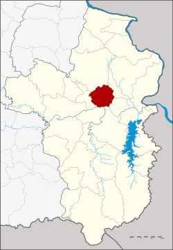 District location in Ubon Ratchathani Province | |
| Coordinates: 15°18′56″N 105°9′18″E | |
| Country | Thailand |
| Province | Ubon Ratchathani |
| Seat | Tan Sum |
| Area | |
| • Total | 502.2 km2 (193.9 sq mi) |
| Population (2005) | |
| • Total | 31,164 |
| • Density | 62.1/km2 (161/sq mi) |
| Time zone | UTC+7 (ICT) |
| Postal code | 34330 |
| Geocode | 3420 |
History
The minor district (king amphoe) Tan Sum was created on 18 September 1978, when the three tambons Tan Sum, Samrong, and Chik Thoeng were split off from Phibun Mangsahan District.[1] It was upgraded to a full district on 1 January 1988.[2]
Etymology
The old name of the area was Tan Chum (ตาลชุม), which means fertile land with plenty by Toddy palm trees (Borassus flabellifer). Later the name was changed to Tan Sum.
Geography
Neighboring districts are (from the east clockwise) Si Mueang Mai, Phibun Mangsahan, Sawang Wirawong, Don Mot Daeng, and Trakan Phuet Phon of Ubon Ratchathani Province.
The important water resource are the Mun and Se Bok Rivers.
Administration
The district is divided into six sub-districts (tambons), which are further subdivided into 59 villages (mubans). Tan Sum is a township (thesaban tambon) which covers parts of tambon Tan Sum. There are a further six tambon administrative organizations (TAO).
| No. | Name | Thai name | Villages | Pop. | |
|---|---|---|---|---|---|
| 1. | Tan Sum | ตาลสุม | 15 | 8,508 | |
| 2. | Samrong | สำโรง | 8 | 3,778 | |
| 3. | Chik Thoeng | จิกเทิง | 9 | 5,175 | |
| 4. | Nong Kung | หนองกุง | 8 | 3,974 | |
| 5. | Na Khai | นาคาย | 13 | 6,045 | |
| 6. | Kham Wa | คำหว้า | 6 | 3,684 |
References
- ประกาศกระทรวงมหาดไทย เรื่อง แบ่งท้องที่อำเภอพิบูลมังสาหาร จังหวัดอุบลราชธานี ตั้งเป็นกิ่งอำเภอตาลสุม (PDF). Royal Gazette (in Thai). 95 (108 ง): 3263. October 3, 1978.
- พระราชกฤษฎีกาตั้งอำเภอนามน อำเภอพระยืน อำเภอหนองบัวระเหว อำเภอบ้านเหลื่อม อำเภอจะแนะ อำเภอหนองหงส์ อำเภอนาโพธิ์ อำเภอเกาะยาว อำเภอแกดำ อำเภอสระโบสถ์ อำเภอโนนคูณ อำเภอควนโดน อำเภอไชยวาน อำเภอหนองแสง และอำเภอตาลสุม พ.ศ. ๒๕๓๐ (PDF). Royal Gazette (in Thai). 104 (278 ก special): 33–37. December 31, 1987.