Tamási District
Tamási (Hungarian: Tamási járás) is a district in north-western part of Tolna County. Tamási is also the name of the town where the district seat is found. The district is located in the Southern Transdanubia Statistical Region.
Tamási District Tamási járás | |
|---|---|
 Coat of arms | |
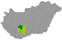 Tamási District within Hungary and Tolna County. | |
| Country | |
| County | Tolna |
| District seat | Tamási |
| Area | |
| • Total | 1,019.94 km2 (393.80 sq mi) |
| Area rank | 1st in Tolna |
| Population (2011 census) | |
| • Total | 38,705 |
| • Rank | 3rd in Tolna |
| • Density | 38/km2 (100/sq mi) |
Geography
Tamási District borders with Enying District and Sárbogárd District (Fejér County) to the north, Paks District and Szekszárd District to the east, Bonyhád District and Hegyhát District (Baranya County) to the south, Dombóvár District to the southwest, Tab District and Siófok District (Somogy County) to the west. The number of the inhabited places in Tamási District is 32.
Municipalities
The district has 3 towns, 2 large villages and 27 villages. (ordered by population, as of 1 January 2013)[1]
- Belecska (388)
- Diósberény (346)
- Dúzs (258)
- Értény (803)
- Felsőnyék (1,029)
- Fürged (726)
- Gyönk (2,091)
- Hőgyész (2,904)
- Iregszemcse (2,692)
- Kalaznó (145)
- Keszőhidegkút (207)
- Kisszékely (324)
- Koppányszántó (326)
- Magyarkeszi (1,278)
- Miszla (292)
- Mucsi (448)
- Nagykónyi (1,144)
- Nagyszékely (401)
- Nagyszokoly (910)
- Ozora (1,620)
- Pári (631)
- Pincehely (2,288)
- Regöly (1,175)
- Simontornya (4,128)
- Szakadát (227)
- Szakály (1,387)
- Szárazd (234)
- Tamási (8,345) – district seat
- Tolnanémedi (1,052)
- Udvari (357)
- Újireg (279)
- Varsád (360)
The bolded municipalities are cities, italics municipalities are large villages.
See also
- List of cities and towns in Hungary
References
- "A KSH 2013. évi helységnévkönyve". ksh.hu. Retrieved 2018-01-23.