Sullivans Tracks, Kansas
Sullivans Tracks is an unincorporated community in Grant County, Kansas, United States. It lies on the border of Sherman and Sullivan Townships[1] at the intersection of the Cimarron Valley Railroad with Roads E and 13, 6 miles (9 km) west-southwest of the county seat of Ulysses.[2]
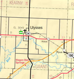
Map of Grant County from KDOT (map legend)
References
- Census Bureau map, combined with county map
- Official county map
Further reading
External links
- Grant County Maps: Current, Historic, KDOT
- U.S. Geological Survey Geographic Names Information System: Sullivans Track
Municipalities and communities of Grant County, Kansas, United States | ||
|---|---|---|
| City | 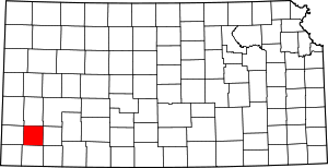 Map of Kansas highlighting Grant County | |
| Unincorporated communities | ||
| Townships | ||
This article is issued from Wikipedia. The text is licensed under Creative Commons - Attribution - Sharealike. Additional terms may apply for the media files.