Sugar Grove Township, Kane County, Illinois
Sugar Grove Township is one of sixteen townships in Kane County, Illinois, USA. As of the 2010 census, its population was 19,618 and it contained 6,963 housing units.[2] The Sugar Grove campus of Waubonsee Community College is within this township.
Sugar Grove Township | |
|---|---|
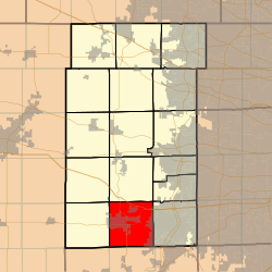 Location in Kane County | |
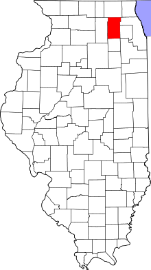 Kane County's location in Illinois | |
| Coordinates: 41°46′09″N 88°25′48″W | |
| Country | |
| State | |
| County | Kane |
| Established | November 6, 1849 |
| Area | |
| • Total | 35.41 sq mi (91.7 km2) |
| • Land | 35.23 sq mi (91.2 km2) |
| • Water | 0.18 sq mi (0.5 km2) 0.51% |
| Elevation | 699 ft (213 m) |
| Population (2010) | |
| • Estimate (2016)[1] | 20,620 |
| • Density | 556.9/sq mi (215.0/km2) |
| Time zone | UTC-6 (CST) |
| • Summer (DST) | UTC-5 (CDT) |
| ZIP codes | 60119, 60506, 60511, 60554 |
| FIPS code | 17-089-73404 |
Geography
According to the 2010 census, the township has a total area of 35.41 square miles (91.7 km2), of which 35.23 square miles (91.2 km2) (or 99.49%) is land and 0.18 square miles (0.47 km2) (or 0.51%) is water.[2] The township encompasses an area that extends to Orchard Road to the east, Baseline Road (Route 30) to the south, Dugan Road to the west and Seavey Road/Tanner Road to the north.
Government
The town hall is located at 70 West First Street Sugar Grove, IL. The township is led by an elected supervisor and four trustees. The other elected officials are the assessor, clerk and highway commissioner.
The Sugar Grove Library District now covers both Sugar Grove and Blackberry Townships.
Cities, towns, villages
- Aurora (partial)
- Big Rock (partial)
- Montgomery (partial)
- North Aurora (partial)
- Sugar Grove (partial)
Cemeteries
The township contains these two cemeteries: Jericho and Sugar Grove.
Airports and landing strips
- Aurora Municipal Airport
School districts
- Aurora West Unit School District 129
- Hinckley-Big Rock Community Unit School District 429
- Kaneland Community Unit School District 302
- Yorkville Community Unit School District 115
Political districts
- Illinois's 14th congressional district
- State House District 50
- State Senate District 25
References
- "Sugar Grove Township, Kane County, Illinois". Geographic Names Information System. United States Geological Survey. Retrieved 2010-06-26.
- United States Census Bureau 2009 TIGER/Line Shapefiles
- United States National Atlas
- "Population and Housing Unit Estimates". Retrieved June 9, 2017.
- "Population, Housing Units, Area, and Density: 2010 - County -- County Subdivision and Place -- 2010 Census Summary File 1". United States Census. Archived from the original on 2020-02-12. Retrieved 2013-05-28.
- "Census of Population and Housing". Census.gov. Retrieved June 4, 2016.
External links
- City-Data.com
- Illinois State Archives
- Township Officials of Illinois
- Township Website
- County Assessor Website
- Township Park District Website
- Township Library District Website
Places adjacent to Sugar Grove Township, Kane County, Illinois | |
|---|---|
Municipalities and communities of Kane County, Illinois, United States | ||
|---|---|---|
| Cities | Map of Illinois highlighting Kane County | |
| Villages | ||
| Townships | ||
| CDP | ||
| Other unincorporated communities | ||
| Footnotes | ‡This populated place also has portions in an adjacent county or counties | |