Stupava, Malacky District
Stupava (German: Stampfen; Hungarian: Stomfa) is a town in western Slovakia. It is situated in the Malacky District, Bratislava Region.
Stupava | |
|---|---|
Town | |
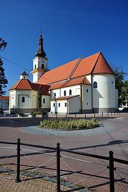 Church of Saint Stephen | |
 Coat of arms | |
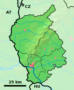 Stupava Location of Stupava in the Bratislava Region 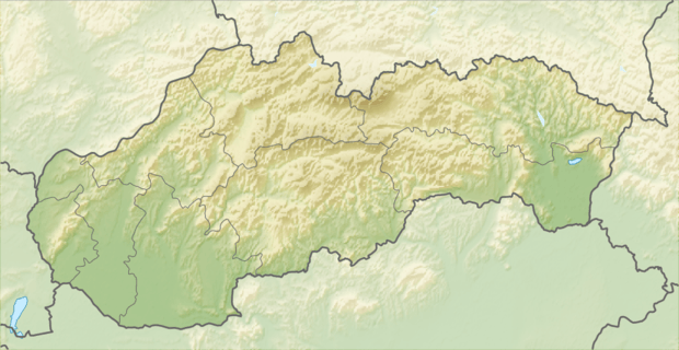 Stupava Stupava (Slovakia) | |
| Coordinates: 48°16′16″N 17°01′54″E | |
| Country | Slovakia |
| Region | Bratislava |
| District | Malacky |
| First mentioned | 1269 |
| Government | |
| • Mayor | Roman Maroš |
| Area | |
| • Total | 67.178 km2 (25.938 sq mi) |
| Elevation | 182 m (597 ft) |
| Population (2018-12-31[1]) | |
| • Total | 11,887 |
| • Density | 180/km2 (460/sq mi) |
| Time zone | UTC+1 (CET) |
| • Summer (DST) | UTC+2 (CEST) |
| Postal code | 900 31 |
| Area code(s) | +421-2 |
| Car plate | MA |
| Website | www.stupava.sk |
Etymology
The name is derived from Proto-Slavic stǫpa (Slovak: stupa) - a wooden bowl carved from a tree trunk, but also the name of various crushing and pressing tools.[2]
Geography
The town is located in the Záhorie lowland, under the Little Carpathians, around 15 km (9 mi) north of Bratislava at an altitude of 182 metres. It has 13, 499 inhabitants as of 2015 and has a land area of 67.17 km2 (26 sq mi). Apart from the core part of the city, Mást (German: Maaßt, Hungarian: Mászt), located just south of the core part of the city, is another part of Stupava. It has been initially a separate village with ethnic Croatian majority, which was formally annexed by Stupava in 1953.[3]
History
However, traces of habitation go back to the Bronze Age, and the first known inhabitants were the Celts. The Romans built a military station as a part of the near Limes Romanus on the Danube. The first written mention about the town was in 1269 in a document of the King Béla IV under name Ztumpa. In the second half of the 13th century the now-ruined Pajštún Castle in the Little Carpathians was built. It was developing mainly as an agricultural and trading settlement. The name of the town comes from the pressing mills called stupa on the Stupavský potok brook, which were used for extracting oil from flax and hemp.
Landmarks
- Stupava Castle, originally built as a water castle, rebuilt in the 17th century to the Renaissance château, now serving as a retirement home
- Roman Catholic church in Baroque style from the first half of the 17th century
- Baroque-style Calvary chapel from the beginning of the 18th century
Demographics
According to the 2001 census, the town had 8,063 inhabitants. 96.7% of inhabitants were Slovaks, 1% Czechs and 0.5% Hungarians.[4] The religious makeup was 70.4% Roman Catholics, 19.5% people with no religious affiliation and 2% Lutherans.[4]
Twin towns — sister cities
Stupava is twinned with:[5]


References
- "Population and migration". Statistical Office of the Slovak Republic. Retrieved 2019-04-16.
- Závodný, Andrej (2010). "Vodné názvy slovenskej časti Pomoravia". VARIA XVII (PDF) (in Slovak). Ružomberok: Katolícka univerzita v Ružomberku – Filozofická fakulta, Slovenská jazykovedná spoločnosť pri SAV. p. 778. ISBN 978-80-8084-550-6.
- "Trocha z histórie Mástu". Mástsky potravinový spolok v Stupave. Retrieved 2019-06-25.
- "Municipal Statistics". Statistical Office of the Slovak republic. Archived from the original on 2007-10-27. Retrieved 2007-11-06.
- "Úvodná strana". stupava.sk (in Slovak). Stupava. Retrieved 2019-09-04.
External links
![]()
Municipalities of Malacky District | ||
|---|---|---|
| Authority control |
|
|---|