Auchinloch
Auchinloch (Gaelic: Achadh an Locha) is a village in North Lanarkshire, near Lenzie in Scotland.[2] In previous years it was in the Parish of Cadder and, until 1996, Strathkelvin District. The village's name - "Field of the Loch" - derives from its proximity to a small loch called the Gadloch. The area was sometimes known as the Loch Lands.[3]
Auchinloch
| |
|---|---|
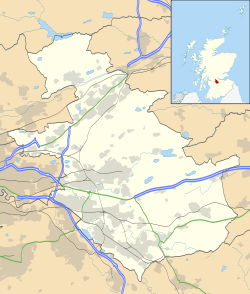
.jpg) Auchinloch from the air | |
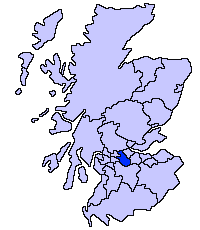
 Auchinloch Location within North Lanarkshire | |
| Population | 750 [1] Mid-2012 estimate |
| OS grid reference | NS661708 |
| Council area | |
| Lieutenancy area | |
| Country | Scotland |
| Sovereign state | United Kingdom |
| Post town | GLASGOW |
| Postcode district | G66 |
| Dialling code | 0141 |
| Police | Scotland |
| Fire | Scottish |
| Ambulance | Scottish |
History
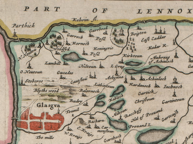
The etymology of the name is ‘Field of the loch’ (achadh an locha).[4] Several old documents show Auchinloch with various spellings including maps by Timothy Pont,[5] Charles Ross,[6] and William Roy.[7] There is some evidence that the religious revivals of the 18th century touched the village.[8][9] The housing used to consist mainly of two parallel rows of single-storied weavers' cottages. One gazetteer, Samuel Lewis, describes coal being hardly worth digging with some limestone quarrying with a works established at Garnkirk. He quotes 138 inhabitants.[10] Around the year 1860 there were 126 inhabitants.[11] There was also a convalescent home at Auchinloch.[12] In 1864 it had 64 places for residents.[13] Industrialization came in the 1880s, with the opening of the Lumloch Colliery, and then in the 1920s Wester Auchengeich Colliery. The latter closed in 1968.[14]
Outside modern Auchinloch, near Auchinleck, is the Wallace Well.[15] This used to be called Auchinloch Well, was common to all farmers, and is mentioned in the New Statistical Account.[16]
The Village
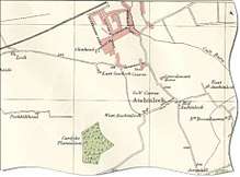
.jpg)
.jpg)
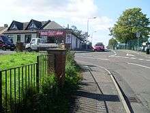
Auchinloch is home to the school, Auchinloch Primary.[18] The present school building dates to the 1930s whilst the original 19th century school building still remains to the east of the village and now serves as the village hall/community centre.[19] Auchinloch Community Centre lies at the top of the village, near the local pub, the Golden Pheasant which is located on Stepps Road. The pub has been bought over by a new owner and following extensive refurbishment is now a thriving hub for food and drinks. A grocery shop is located in the village where in December 1999 the local shopkeeper was murdered. There is also a Bowling Green in the village and also Cardyke Farm Shelter, a branch of Cats Protection outside. The village is in the catchment area for Lenzie Academy.[20]
Notable residents
- Patrick Baird, merchant. Built the school and preached a sermon each Christmas Day.[21]
References
- "Estimated population of localities by broad age groups, mid-2012" (PDF). Retrieved 3 January 2018.
- "OS 25 inch 1892-1949". National Library of Scotland. Ordnance Survey. Retrieved 26 October 2017.
- Brotchie, T.C.F. (1921). Some Sylvan Scenes near Glasgow. Glasgow: Aird & Coghill. p. 110. Retrieved 3 December 2017.
- Drummond, Peter, John (2014). An analysis of toponyms and toponymic patterns in eight parishes of the upper Kelvin basin (PDF). Glasgow: Glasgow University. p. 145. Retrieved 3 July 2017.
- "Auchinloch on Pont's Map". NLS. Pont. Retrieved 24 February 2018.
- "Old County Maps". NLS. Retrieved 27 January 2018.
- "Roy's map of the Lowlands". NLS. Retrieved 27 January 2018.
- Tyerman, Luke (1877). The life of George Whitefield. London: Hodder. p. 3. Retrieved 24 February 2018.
- Gillies, John (1754). Historical collections relating to remarkable periods of the success of the Gospel, and eminent instruments employed in promoting it (Vol 2 ed.). Glasgow: Printed by Robert and Andrew Foulis. p. 357. Retrieved 24 February 2018.
- Lewis, Samuel (1846). A topographical dictionary of Scotland ... London: S. Lewis and Co. p. 76. Retrieved 24 February 2018.
- M'Donald, Hugh (1856). Rambles Round Glasgow (2nd ed.). Glasgow: Thomas Murray and Son. pp. 429–430. Retrieved 30 November 2017.
- Watson, Thomas (1894). Kirkintilloch, town and parish. Glasgow: J. Smith. p. 131. Retrieved 13 October 2017.
- Groome, Francis Hindes (1882). Ordnance gazetteer of Scotland : a survey of Scottish topography, statistical, biographical, and historical (Vol 1 ed.). Edinburgh: T.C. Jack. Retrieved 24 February 2018.
- "Kirkintilloch Today: News, Sport, Jobs, Property, Cars, Entertainments & More". web.archive.org. 6 February 2006. Archived from the original on 6 February 2006. Retrieved 22 January 2012.
- "Glasgow, Robroyston Mains, Wallace's Well". CANMORE. Royal Commission on the Ancient and Historical Monuments of Scotland. Retrieved 24 February 2018.
- Society for the Benefit of the Sons and Daughters of the Clergy (1845). The new statistical account of Scotland. Edinburgh and London: W. Blackwood and Sons. p. 800. Retrieved 31 December 2017.
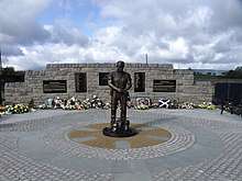
- "Welcome home - iconic miner returned to rightful place at Auchengeich". Monklands Memories. Archived from the original on 25 February 2018. Retrieved 24 February 2018.
- Louden, Dick (26 September 2000). "Small beginnings". The Herald. Retrieved 28 February 2018.
- "Our School". auchinloch.n-lanark.sch.uk. 31 August 2011. Retrieved 4 November 2011.
- Gallacher, Liz (15 September 2016). "Desperate house hunters camp out to secure home in Lenzie school area". Kirkintilloch Herald. Retrieved 24 February 2018.
- M'Donald, Hugh (1856). Rambles Round Glasgow (2nd ed.). Glasgow: Thomas Murray and Son. pp. 429–430. Retrieved 30 November 2017.
External links
| Wikimedia Commons has media related to Auchinloch. |