Stafford, Oregon
Stafford is an unincorporated community, classified as a hamlet, in Clackamas County, Oregon, United States. It is a census-designated place (CDP), with a population of 1,577 as of the 2010 census.[1] The community covers approximately 15.7 km2 (3,900 acres)[1] located in a rough triangle south of Lake Oswego, east of Tualatin, and west of West Linn. Students in the area attend the schools of the West Linn-Wilsonville School District.
Stafford, Oregon | |
|---|---|
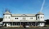
 Baptist church in Stafford | |
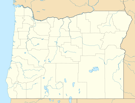 Stafford Location within the state of Oregon  Stafford Stafford (the United States) | |
| Coordinates: 45°21′27″N 122°43′17″W | |
| Country | United States |
| State | Oregon |
| County | Clackamas |
| Area | |
| • Total | 6.1 sq mi (15.7 km2) |
| • Land | 6.0 sq mi (15.6 km2) |
| • Water | 0.04 sq mi (0.1 km2) |
| Population (2010) | |
| • Total | 1,577 |
| • Density | 262/sq mi (101.1/km2) |
| Time zone | UTC-8 (Pacific (PST)) |
| • Summer (DST) | UTC-7 (PDT) |
| ZIP code | 97062, 97068 |
| Area code(s) | 503 and 971 |
| FIPS code | 41-69800 |
| GNIS feature ID | 1127510 |
History
Stafford was named by George A. Steel, a prominent Portland pioneer, after his hometown of Stafford, Ohio, in the 1860s.[2] The Stafford School opened in the community in 1892, and the following year the Eastside Electric Railway owned by Steel reached the area.[2] In 1895, the Wanker family moved to the area and bought land where they built a store and tavern, an area later to become Wankers Corner at the intersection of Stafford Road and Borland Road.[2] It has frequently been noted on lists of unusual place names.[3] The two buildings currently located at Wanker's Corner are the Wanker's Country Store and the Wanker's Corner Saloon and Cafe. It is not a recognized community, it has never had a post office, nor does it consistently appear on maps of Oregon (although the AAA map of Oregon shows it in an inset). The United States Geological Survey classifies Wankers Corner as a "locale": "a place at which there is or was human activity".[4][5]
Status
Parts of the Stafford area were proposed to be added to the Portland area's urban growth boundary in 1995.[2] Eventually 830 acres (3.4 km2) were added, but later removed after a court fight that ended in 2001 at the Oregon Court of Appeals.[2] In November 2006, the residents of Stafford voted 344-30 to form a hamlet, the second Oregon community to do so (after Beavercreek).[6]
References
- "Geographic Identifiers: 2010 Demographic Profile Data (G001): Stafford CDP, Oregon". U.S. Census Bureau, American Factfinder. Archived from the original on March 10, 2015. Retrieved March 9, 2015.
- Tims, Dana (August 24, 2006). "Graphics: Stafford timeline". The Oregonian. p. 13.
- Parker, Quentin (2010). Welcome to Horneytown, North Carolina, Population: 15: An insider's guide to 201 of the world's weirdest and wildest places. Adams Media. pp. xii.
- "Feature Query Results". United States Board on Geographic Names, United States Geological Survey. Retrieved 2010-09-21.
- "Feature Class Definitions". United States Board on Geographic Names, United States Geological Survey. Retrieved 2010-09-21.
- Tims, Dana (2006-11-22). "Once divided, Stafford unites as a hamlet". The Oregonian. Retrieved 2006-12-11.
- Jones, Philip N.; Henderson, Jean (1992). Bicycling the Backroads of Northwest Oregon. The Mountaineers Books. pp. 72–73. ISBN 0-89886-340-6.
External links

- Stafford official page at Clackamas County website
- Stafford community website
Municipalities and communities of Clackamas County, Oregon, United States | ||
|---|---|---|
| Cities | 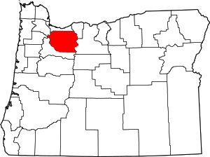 Clackamas County map | |
| Hamlets | ||
| CDPs | ||
| Other unincorporated communities |
| |
| Indian reservation | ||
| Footnotes | ‡This populated place also has portions in an adjacent county or counties | |