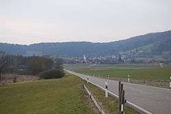
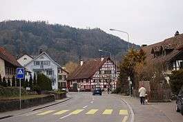
Stadel bei Niederglatt
Stadel is a municipality in the district of Dielsdorf in the canton of Zürich in Switzerland.
Stadel bei Niederglatt | |
|---|---|
 | |
 Coat of arms | |
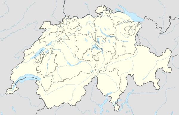
Location of Stadel bei Niederglatt 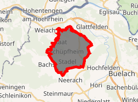
| |
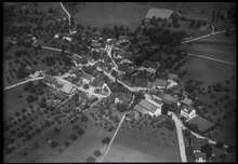
 Stadel bei Niederglatt Stadel bei Niederglatt | |
| Coordinates: 47°32′N 8°28′E | |
| Country | Switzerland |
| Canton | Zurich |
| District | Dielsdorf |
| Government | |
| • Mayor | Peter Bernhard |
| Area | |
| • Total | 12.89 km2 (4.98 sq mi) |
| Elevation | 436 m (1,430 ft) |
| Population (2018-12-31)[2] | |
| • Total | 2,289 |
| • Density | 180/km2 (460/sq mi) |
| Postal code | 8174 |
| SFOS number | 0100 |
| Localities | Stadel, Windlach, Raat, Schüpfheim |
| Surrounded by | Glattfelden, Hochfelden, Neerach, Bachs, Weiach |
| Website | www SFSO statistics |
Geography
Stadel has an area of 12.9 km2 (5.0 sq mi). Of this area, 58.8% is used for agricultural purposes, while 30.4% is forested. Of the rest of the land, 10.2% is settled (buildings or roads) and the remainder (0.5%) is non-productive (rivers, glaciers or mountains).[3]
To distinguish between several places having the same name, this one is suffixed by the addition of bei Niederglatt (German: near Niederglatt). Besides the village of Stadel the municipality comprises the three hamlets Windlach, Raat, and Schüpfheim.
Demographics
Stadel has a population (as of 31 December 2018) of 2,289.[4] As of 2007, 10.5% of the population was made up of foreign nationals. Over the last 10 years the population has grown at a rate of 21.8%. Most of the population (as of 2000) speaks German (93.7%), with English being second most common ( 1.2%) and French being third ( 0.6%).
In the 2007 election the most popular party was the SVP which received 54.2% of the vote. The next three most popular parties were the CSP (9.2%), the SPS (8.6%) and the FDP (8.4%).
The age distribution of the population (as of 2000) is children and teenagers (0–19 years old) make up 23.1% of the population, while adults (20–64 years old) make up 63% and seniors (over 64 years old) make up 14%. In Stadel about 80.3% of the population (between age 25-64) have completed either non-mandatory upper secondary education or additional higher education (either university or a Fachhochschule).
Stadel has an unemployment rate of 1.52%. As of 2005, there were 132 people employed in the primary economic sector and about 44 businesses involved in this sector. 80 people are employed in the secondary sector and there are 25 businesses in this sector. 253 people are employed in the tertiary sector, with 43 businesses in this sector.[3]
References
- "Arealstatistik Standard - Gemeinden nach 4 Hauptbereichen". Federal Statistical Office. Retrieved 13 January 2019.
- "Ständige Wohnbevölkerung nach Staatsangehörigkeitskategorie Geschlecht und Gemeinde; Provisorische Jahresergebnisse; 2018". Federal Statistical Office. 9 April 2019. Retrieved 11 April 2019.
- Swiss Federal Statistical Office accessed 04-Aug-2009
- Swiss Federal Statistical Office - STAT-TAB, online database – Ständige und nichtständige Wohnbevölkerung nach institutionellen Gliederungen, Geburtsort und Staatsangehörigkeit (in German) accessed 23 September 2019
External links
- Official communal web-site of Stadel (in German)
| Wikimedia Commons has media related to Stadel bei Niederglatt. |
Municipalities in Dielsdorf District, Switzerland | ||
|---|---|---|