Springbrook, North Dakota
Springbrook is a city in Williams County, North Dakota, United States. The population was 27 at the 2010 census.[5] It is also spelled Spring Brook.[6][7]
Springbrook, North Dakota | |
|---|---|
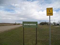 Sign in Springbrook | |
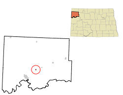 Location of Springbrook, North Dakota | |
| Coordinates: 48°15′10″N 103°27′45″W | |
| Country | United States |
| State | North Dakota |
| County | Williams |
| Area | |
| • Total | 0.37 sq mi (0.96 km2) |
| • Land | 0.37 sq mi (0.96 km2) |
| • Water | 0 sq mi (0 km2) |
| Elevation | 2,070 ft (631 m) |
| Population | |
| • Total | 27 |
| • Estimate (2018)[3] | 36 |
| • Density | 73/sq mi (28/km2) |
| Time zone | UTC-6 (Central (CST)) |
| • Summer (DST) | UTC-5 (CDT) |
| ZIP code | 58843 |
| Area code(s) | 701 |
| FIPS code | 38-74780 |
| GNIS feature ID | 1032222[4] |
Geography
Springbrook is located at 48°15′10″N 103°27′45″W (48.252816, -103.462533).[8]
According to the United States Census Bureau, the city has a total area of 0.37 square miles (0.96 km2), all of it land.[1]
Demographics
| Historical population | |||
|---|---|---|---|
| Census | Pop. | %± | |
| 1920 | 93 | — | |
| 1930 | 105 | 12.9% | |
| 1940 | 77 | −26.7% | |
| 1950 | 51 | −33.8% | |
| 1960 | 35 | −31.4% | |
| 1970 | 27 | −22.9% | |
| 1980 | 52 | 92.6% | |
| 1990 | 29 | −44.2% | |
| 2000 | 26 | −10.3% | |
| 2010 | 27 | 3.8% | |
| Est. 2018 | 36 | [3] | 33.3% |
| U.S. Decennial Census[9] 2018 Estimate[10] | |||
2010 census
As of the census[2] of 2010, there were 27 people, 11 households, and 6 families residing in the city. The population density was 73.0 inhabitants per square mile (28.2/km2). There were 14 housing units at an average density of 37.8 per square mile (14.6/km2). The racial makeup of the city was 100.0% White.
There were 11 households of which 45.5% had children under the age of 18 living with them, 36.4% were married couples living together, 9.1% had a female householder with no husband present, 9.1% had a male householder with no wife present, and 45.5% were non-families. 18.2% of all households were made up of individuals and 9.1% had someone living alone who was 65 years of age or older. The average household size was 2.45 and the average family size was 3.17.
The median age in the city was 41.3 years. 29.6% of residents were under the age of 18; 3.7% were between the ages of 18 and 24; 22.2% were from 25 to 44; 40.7% were from 45 to 64; and 3.7% were 65 years of age or older. The gender makeup of the city was 37.0% male and 63.0% female.
2000 census
As of the census of 2000, there were 26 people, 14 households, and 7 families residing in the city. The population density was 70.4 people per square mile (27.1/km²). There were 20 housing units at an average density of 54.2 per square mile (20.9/km²). The racial makeup of the city was 100.00% White. Hispanic or Latino of any race were 15.38% of the population.
There were 14 households out of which 14.3% had children under the age of 18 living with them, 50.0% were married couples living together, and 50.0% were non-families. 50.0% of all households were made up of individuals and 21.4% had someone living alone who was 65 years of age or older. The average household size was 1.86 and the average family size was 2.71.
In the city, the population was spread out with 15.4% under the age of 18, 15.4% from 18 to 24, 15.4% from 25 to 44, 26.9% from 45 to 64, and 26.9% who were 65 years of age or older. The median age was 46 years. For every 100 females, there were 116.7 males. For every 100 females age 18 and over, there were 120.0 males.
The median income for a household in the city was $35,938, and the median income for a family was $53,125. Males had a median income of $31,250 versus $23,750 for females. The per capita income for the city was $17,142. There were 22.2% of families and 38.5% of the population living below the poverty line, including 100.0% of under eighteens and none of those over 64.
Climate
According to the Köppen Climate Classification system, Springbrook has a semi-arid climate, abbreviated "BSk" on climate maps.[11]
References
- "US Gazetteer files 2010". United States Census Bureau. Archived from the original on January 25, 2012. Retrieved June 14, 2012.
- "U.S. Census website". United States Census Bureau. Retrieved June 14, 2012.
- "Population and Housing Unit Estimates". Retrieved September 6, 2019.
- "US Board on Geographic Names". United States Geological Survey. October 25, 2007. Retrieved January 31, 2008.
- "2010 Census Redistricting Data (Public Law 94-171) Summary File". American FactFinder. United States Census Bureau. Retrieved May 2, 2011.
- USGS, Geographic Names Information System primary spelling, with Springbrook only a variant.
- North Dakota Official Highway Map, 2003–2004
- "US Gazetteer files: 2010, 2000, and 1990". United States Census Bureau. February 12, 2011. Retrieved April 23, 2011.
- "U.S. Decennial Census". Census.gov. Retrieved May 25, 2014.
- "Population Estimates". United States Census Bureau. Retrieved September 6, 2019.
- Climate Summary for Springbrook, North Dakota
Municipalities and communities of Williams County, North Dakota, United States | ||
|---|---|---|
| Cities | 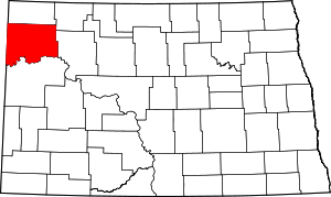 Map of North Dakota highlighting Williams County | |
| Townships |
| |
| Unorganized territories |
| |
| Unincorporated communities | ||
| Indian reservation | ||
| Footnotes | ‡This populated place also has portions in an adjacent county or counties | |