Spanish Lake, Missouri
Spanish Lake is a census-designated place (CDP) in St. Louis County, Missouri, United States. The population was 19,650 at the 2010 census.[3]
Spanish Lake, Missouri | |
|---|---|
 Location of Spanish Lake, Missouri | |
| Coordinates: 38°47′9″N 90°12′46″W | |
| Country | United States |
| State | Missouri |
| County | St. Louis |
| Area | |
| • Total | 7.5 sq mi (19.5 km2) |
| • Land | 7.4 sq mi (19.1 km2) |
| • Water | 0.2 sq mi (0.4 km2) |
| Elevation | 541 ft (165 m) |
| Population (2010) | |
| • Total | 19,650 |
| • Density | 2,600/sq mi (1,000/km2) |
| Time zone | UTC-6 (Central (CST)) |
| • Summer (DST) | UTC-5 (CDT) |
| FIPS code | 29-69266[1] |
| GNIS feature ID | 0756747[2] |
Geography
Spanish Lake is located at 38°47′9″N 90°12′46″W (38.785849, -90.212879).[4]
The Spanish Lake community is located in the northeastern portion of St. Louis County. The community is bounded by the Mississippi River to the east, the Missouri River to the north, Highway 367 to the west, and Interstate 270 to the south.[5]
According to the United States Census Bureau, the CDP has a total area of 7.5 square miles (19 km2), of which 7.4 square miles (19 km2) is land and 0.2 square miles (0.52 km2), or 2.13%, is water.
History
Spanish Lake, originally called Spanish Pond until the late nineteenth century, was named after the Spanish troops who stayed there while building a fortified post for Spain in 1768. Much of the area was once the property of James De St. Vrain, a brother of the last Spanish lieutenant governor of Upper Louisiana. It was in this district, near Spanish Pond, that an old log cabin, said to have been used as a government building by Lieutenant Governor De Lassus De St. Vrain, the last Spanish executive to rule this section, was erected.[5]
Spanish Lake prospered in the nineteenth century, as a crossroads farming village came into being. The Bellefontaine Road area was settled largely after General Bissell relocated Fort Bellefontaine. Fort Bellefontaine was established in 1806 by Gen. James Wilkerson, governor of the territory of Louisiana. The fort served as one of the most important military posts west of the Mississippi River until the troops were removed to the Jefferson Barracks reservation in 1827. Traffic between St. Louis and the fort was busy; many officials had homes in both places, and visiting dignitaries usually went to both sites. The liveliest traffic was effected by the farmers riding back and forth to the city.[5]
Spanish Lake became a well-developed neighborhood with the arrival of German immigrants. Farmland was intensely cultivated, and small businesses and industries sprang up around the intersection of Bellefontaine, Parker, and Spanish Pond roads, forming the village’s center. The Catholic parish of St. Aloysius in Spanish Lake was founded by, and for many years served as, a mission of Baden, located in the northern portion of St. Louis. The Bank of Baden played a large role in farm financing in Spanish Lake, and many county farmers also had business interests in Baden. The German dominance of the region was almost complete by the 1870s, and most of the surviving farm houses and outbuildings are associated with that era.[5]
Spanish Lake was a rural farming community for many years, until the 1950s when neighborhoods of tract housing were built. The area became a rural refuge from St. Louis city and received an exclusively white population. The 1970s saw the proliferation of dense apartment housing to Spanish Lake. African-Americans fleeing the failed Pruitt-Igoe public housing high rises in the city moved into the apartments via the Section 8 voucher system which immediately struck racial tensions in the area, particularly in local schools. The 1990s saw a mass exodus of the white population, spurred on by blockbusting, a practice some U.S. real estate agents use to encourage white property owners to sell their houses quickly at a loss, implying the African-Americans moving into their neighborhood will depress their property values. This era of the city's history is chronicled in the documentary Spanish Lake, although its depiction comes with some disagreement from community stakeholders.[6]
Demographics
| Historical population | |||
|---|---|---|---|
| Census | Pop. | %± | |
| 1970 | 15,647 | — | |
| 1980 | 20,632 | 31.9% | |
| 1990 | 20,322 | −1.5% | |
| 2000 | 21,337 | 5.0% | |
| 2010 | 19,650 | −7.9% | |
At the 2000 census there were 21,337 people in 8,381 households, including 5,673 families, in the CDP. The population density was 2,900.4 people per square mile (1,119.3/km²). There were 8,852 housing units at an average density of 1,203.3/sq mi (464.4/km²). The racial makeup of the CDP was 42.25% White, 54.79% African American, 0.20% Native American, 0.66% Asian, 0.03% Pacific Islander, 0.46% from other races, and 1.61% from two or more races. Hispanic or Latino of any race were 1.03%.[1]
Of the 8,381 households 38.3% had children under the age of 18 living with them, 39.4% were married couples living together, 23.6% had a female householder with no husband present, and 32.3% were non-families. 27.6% of households were one person and 8.9% were one person aged 65 or older. The average household size was 2.54 and the average family size was 3.09.
The age distribution was 30.4% under the age of 18, 9.9% from 18 to 24, 31.3% from 25 to 44, 17.3% from 45 to 64, and 11.0% 65 or older. The median age was 31 years. For every 100 females, there were 86.0 males. For every 100 females age 18 and over, there were 79.0 males.
The median household income was $37,410 and the median family income was $44,139. Males had a median income of $32,340 versus $26,644 for females. The per capita income for the CDP was $18,976. About 10.2% of families and 11.7% of the population were below the poverty line, including 18.4% of those under age 18 and 8.0% of those age 65 or over.
References
- "U.S. Census website". United States Census Bureau. Retrieved 2008-01-31.
- "US Board on Geographic Names". United States Geological Survey. 2007-10-25. Retrieved 2008-01-31.
- "Race, Hispanic or Latino, Age, and Housing Occupancy: 2010 Census Redistricting Data (Public Law 94-171) Summary File (QT-PL), Spanish Lake CDP, Missouri". United States Census Bureau. Retrieved October 26, 2011.
- "US Gazetteer files: 2010, 2000, and 1990". United States Census Bureau. 2011-02-12. Retrieved 2011-04-23.
- http://www.stlouisco.com/plan/Comp-Plans/Span-Lake/pages4to10.pdf St. Louis County, Missouri website
- Spanish Lake Community Association
External links

| Topics | 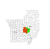 | |
|---|---|---|
| Central city | ||
| Largest cities (over 50,000 in 2010) | ||
| Medium-sized cities (over 20,000 in 2010) | ||
| Largest towns and villages (over 10,000 in 2010) |
| |
| Missouri Counties | ||
| Illinois Counties | ||
| Subregions | ||