Southern Province, Rwanda
Southern Province (Kinyarwanda: Intara y'Amajyepfo; French: Province du Sud; Dutch: Zuidelijke Provincie) is one of Rwanda's five provinces. It was created in early January 2006 as part of a government decentralization program that re-organized the country's local government structures.
Southern Province | |
|---|---|
 Landscape near the Burundi border | |
 | |
| Country | Rwanda |
| Capital | Nyanza |
| Districts | |
| Government | |
| • Governor | Fidèle Ndayisaba |
| Area | |
| • Total | 5,963 km2 (2,302 sq mi) |
| Population (2012 census) | |
| • Total | 2,589,975 |
| • Density | 430/km2 (1,100/sq mi) |
| Other settlements | Butare, Gikongoro, Ruhango |
| HDI (2018) | 0.522[2] low · 4th of 5 |
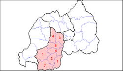
Southern Province comprises the former provinces of Gikongoro, Gitarama, and Butare, and is divided into the districts of Huye, Ruhango, Nyamagabe, Gisagara, Muhanga, Kamonyi, Nyanza, and Nyaruguru.
The capital city of Southern Province is Nyanza.
Notes and references
- Area Calculation (see below)
- "Sub-national HDI - Area Database - Global Data Lab". hdi.globaldatalab.org. Retrieved 2018-09-13.
Area calculation
- Pixel sizes for provinces taken from traced maps: Northern = 28,547; Eastern = 81,548; Southern = 50,844; Western = 51,798; Kigali = 6,129
- Total Pixel size for Rwanda = 28,547 + 81,548 + 50,844 + 51,798 + 6,129 = 218,866
- => Southern Province % of total area: 50,844 / 218,866 = 23.23%
- Total area of Rwanda = 26,338 km2 (10,169 sq mi)
- "Rwanda". The World Factbook. United States Central Intelligence Agency. 4 March 2010. Accessed 11 March 2010.
- => Area of Southern Province = 26,338 km2 (10,169 sq mi) x 23.23% = 6,118 km2 (2,362 sq mi)
External links
This article is issued from Wikipedia. The text is licensed under Creative Commons - Attribution - Sharealike. Additional terms may apply for the media files.