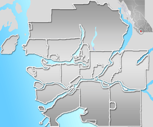
South Slope, Burnaby
South Slope, sometimes referred to as Southern Burnaby, is a mainly single-family neighborhood in Burnaby in British Columbia, Canada, just southeast of Metrotown. It borders Suncrest, an all single-family home neighbourhood to the west, and goes as far east as Edmonds. Although the northern boundary of South Slope is Rumble Street, many residents north of the street consider themselves living in South Slope, including South Slope Elementary, and Burnaby South Secondary School. The neighbourhood gets its name from the steep slope it is located on. The neighbourhood is one of the oldest parts of the city, which can be seen be seen in Nelson Elementary, which is over a hundred years old, and dozens of Heritage Homes.
South Slope | |
|---|---|
Neighbourhood | |
 South Slope Location in Metro Vancouver | |
| Coordinates: 49.215°N 123.002°W | |
| Country | |
| Province | British Columbia |
| City | Burnaby |
History
South Slope was originally called, "Alta Vista", meaning "High View", and offered early residents in the very early 20th century great views of the, "Fraser Valley", (Richmond and Big Bend), and was served by Royal Oak, and Highland Park stations, on the historic British Columbia Electric Railway. It is one of the oldest neighborhoods in Burnaby, and that can be seen in the large amounts of historical buildings in the neighborhoods. During the period of 1910-1912 the number of houses was about a dozen buildings in 1910 flew to 400 in 1912.
The borough's development blew up in the post-war years, as houses we're mass developed, most commonly the, "Mid Century Vernacular", and Vancouver Special later on.
Commodities
Although the neighborhoods is almost all residential, there are small family-owned businesses located on the intersection of Rumble St. and Royal Oak Avenue. There are also townhouses sprouting close to the Skytrain tracks, but are all north of the neighborhoods border (Rumble Street).
Parks
The parks in South Slope mainly consist of creeks that run from the Fraser River watershed. The creeks are maintained by the City of Burnaby who culvert, and repair these creeks. In fact some of the creeks have a healthy wildlife population. These creeks include Sussex Creek, Boundary Creek, Kaymar Creek (coho population), Glen-Lyon Creek, Gray Creek (beaver population), Froggers Creek (cutthroat trout population), John Matthews Creek (rainbow trout population), and Byrne Creek.
Parks include Alta Vista Reservoir Park, Riverway West School Park, Macpherson Park, David Gray Park, Suncrest Park, Ledingham Park, McKay Park, and Ron McLean Park.
There was a planned Ice Rink on MacPherson Park, but the located was moved to Eastern Burnaby.
Main roads
Rumble Street, MacPherson Avenue, Marine Drive, Gilley Avenue, Royal Oak Avenue, Nelson Avenue, Sussex Avenue, and Patterson Avenue.
Schools
- Nelson Elementary (oldest school in Burnaby) (K–7)
- Clinton Elementary (K–7)
- Riverway West School (continuing education)
- Glenwood Elementary (K–7)
- South Slope Elementary (K–7)
- Burnaby South Secondary School (8–12)