Somers Historic District
The Somers Historic District encompasses the historic civic and social center of the town of Somers, Connecticut. It stretches along Main Street, with extensions along Springfield Road and Battle Street, and includes a significant number of vernacular Federal and Greek Revival houses. It includes the town's early churches, as well as important civic buildings, including the town hall and library. The district was listed on the National Register of Historic Places in 1982.[1]
Somers Historic District | |
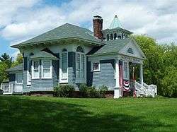 The former Free Public Library building | |
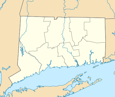  | |
| Location | Main and Battle Sts., Bugbee Lane, and Springfield Rd., Somers, Connecticut |
|---|---|
| Coordinates | 41°59′7″N 72°26′48″W |
| Area | 100 acres (40 ha) |
| Architect | Multiple |
| Architectural style | Greek Revival, Colonial, Federal |
| NRHP reference No. | 82004389[1] |
| Added to NRHP | September 23, 1982 |
Description and history
The area that is now Somers was settled in the 17th century as part of Agawam Plantation (now Springfield, Massachusetts). It was separately incorporated out of Enfield in 1734, with jurisdiction transferred to the Connecticut Colony in 1749. The town has been primarily agricultural for much of its history, although there was a mill village at Somersville. The town flourished first with fruit production and then with tobacco and dairy production in the 19th century. The town center, located at the junction Main Street (Connecticut Route 190) with Springfield and South Streets (Connecticut Route 83), has been its civic and social center throughout. Important buildings, including early churches and schools, were located here, and the placement of similar buildings later has reinforced its importance in this role.[2]
The historic district is 100 acres (40 ha) in size, and stretches along Main Street, with extensions along Springfield Road and Battle Street. Most of the buildings are early 19th-century residences, with Federal or Greek Revival style, although there are a selection of later 19th century styles represented as well. The older properties are largely clustered in three places: on Springfield Road near Main, the eastern end of Main Street, and the area just west of where the modern (1950) town hall stands.[2]
See also
- Somersville Historic District, also NRHP-listed in Somers
- National Register of Historic Places listings in Tolland County, Connecticut
References
| Wikimedia Commons has media related to Somers Historic District. |
- "National Register Information System". National Register of Historic Places. National Park Service. March 13, 2009.
- Bruce Clouette and John Herzan (May 25, 1979). "NRHP Inventory-Nomination: Somers Historic District". National Park Service. and Accompanying 22 photos, exterior and interior, from 1979
| Lists by county | 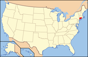 | |
|---|---|---|
| Lists by city or town | ||
| Other lists | ||