National Register of Historic Places listings in Middlesex County, Connecticut
This is a list of the National Register of Historic Places listings in Middlesex County, Connecticut.
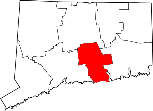
Location of Middlesex County in Connecticut
There are 121 properties and districts listed on the National Register of Historic Places in Middlesex County, Connecticut, United States. Tabulated here are 88 places; see National Register of Historic Places listings in Middletown, Connecticut for 33 more; the oyster sloop Christeen was located in Middlesex County when listed in 1991, but relocated to Oyster Bay, New York in 1992. Including those in Middletown, there are three National Historic Landmarks among the listings.
The locations of National Register properties and districts for which the latitude and longitude coordinates are included below, may be seen in an online map.[1]
- This National Park Service list is complete through NPS recent listings posted June 19, 2020.[2]
Current listings (excluding Middletown)
| [3] | Name on the Register[4] | Image | Date listed[5] | Location | City or town | Description |
|---|---|---|---|---|---|---|
| 1 | Belltown Historic District |  Belltown Historic District |
October 28, 1985 (#85003543) |
Roughly Main St. between W. High St. and CT 16, and portions of cross streets W. High, Barton Hill-Summit, and Skinner St. 41°34′23″N 72°30′17″W |
East Hampton | |
| 2 | Black Horse Tavern |  Black Horse Tavern |
December 1, 1978 (#78002851) |
Southeast of Old Saybrook at 175 N. Cove Rd. 41°17′20″N 72°21′20″W |
Old Saybrook | |
| 3 | BOC Site | October 15, 1987 (#87001218) |
Address Restricted |
Haddam | Archaeological site documented as part of the Lower Connecticut River Valley Woodland Period Archaeological TR. 0.1 acre. | |
| 4 | Bridge No. 1132 |  Bridge No. 1132 |
September 29, 2004 (#04001091) |
CT 80 at the Hammonasset River 41°21′26″N 72°36′45″W |
Killingworth | Open-spandrel concrete arch bridge built in 1934; extends into Madison in New Haven County |
| 5 | Bridge No. 1603 | 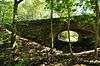 Bridge No. 1603 |
July 29, 1993 (#93000641) |
Devil's Hopyard Rd. (Rt. 434) over an unnamed brook in Devil's Hopyard State Park 41°29′02″N 72°20′33″W |
East Haddam | Near Chapman Falls. |
| 6 | Bridge No. 1604 |  Bridge No. 1604 |
July 29, 1993 (#93000642) |
Devil's Hopyard Rd. (Rt. 434) over unnamed brook in Devil's Hopyard State Park 41°28′39″N 72°20′31″W |
East Haddam | |
| 7 | Bridge No. 1605 |  Bridge No. 1605 |
July 29, 1993 (#93000643) |
Devil's Hopyard Rd. (Rt. 434) over Muddy Brook in Devil's Hopyard State Park 41°28′32″N 72°20′31″W |
East Haddam | |
| 8 | Benjamin Bushnell Farm | 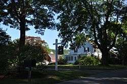 Benjamin Bushnell Farm |
May 10, 1990 (#90000761) |
52 Ingham Hill Rd. 41°19′49″N 72°25′14″W |
Essex | |
| 9 | Elisha Bushnell House | 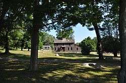 Elisha Bushnell House |
November 29, 1978 (#78002850) |
1445 Boston Post Rd. 41°17′14″N 72°24′31″W |
Old Saybrook | |
| 10 | Bushnell-Dickinson House | 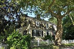 Bushnell-Dickinson House |
August 28, 2013 (#13000289) |
170 Old Post Rd. 41°17′12″N 72°24′11″W |
Old Saybrook | |
| 11 | Camp Bethel | 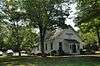 Camp Bethel |
December 11, 2007 (#07001246) |
124 Camp Bethel Rd. 41°27′11″N 72°28′24″W |
Haddam | |
| 12 | Hubbell Carter House | 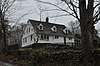 Hubbell Carter House |
November 29, 2018 (#100003147) |
2 Carter Hill Rd. 41°18′52″N 72°30′59″W |
Clinton | |
| 13 | Centerbrook Congregational Church | 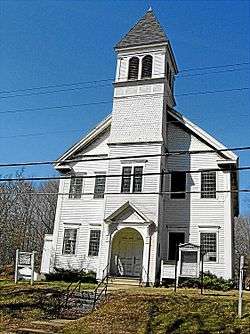 Centerbrook Congregational Church |
February 12, 1987 (#87000113) |
Main St. 41°21′06″N 72°24′53″W |
Essex | |
| 14 | Clinton Village Historic District | 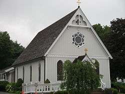 Clinton Village Historic District |
July 29, 1994 (#94000788) |
Along Cemetery Rd., Church, E. Main and Liberty Sts., Old Post Rd., and Waterside Ln. 41°16′36″N 72°31′07″W |
Clinton | |
| 15 | Comstock's Bridge | 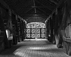 Comstock's Bridge |
January 1, 1976 (#76001978) |
Southeast of East Hampton off CT 16 41°33′11″N 72°26′57″W |
East Hampton | |
| 16 | Comstock-Cheney Hall | 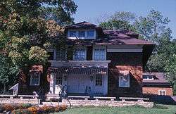 Comstock-Cheney Hall |
April 15, 1982 (#82003769) |
Main and Summit Sts. 41°20′55″N 72°26′32″W |
Essex | Better known as Ivoryton Theatre, the first summer theatre in the U.S.? |
| 17 | Connecticut Valley Railroad Roundhouse and Turntable Site |  Connecticut Valley Railroad Roundhouse and Turntable Site |
April 28, 1994 (#94000395) |
Off Main St. in Fort Saybrook Monument Park in Saybrook Point 41°17′02″N 72°21′05″W |
Old Saybrook | |
| 18 | Cypress Cemetery |  Cypress Cemetery |
October 2, 2018 (#100003006) |
100 College St. 41°17′02″N 72°21′19″W |
Old Saybrook | |
| 19 | Charles Daniels House | 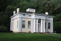 Charles Daniels House |
February 19, 1988 (#88000094) |
43 Liberty St. 41°24′27″N 72°27′33″W |
Chester | |
| 20 | Amasa Day House | 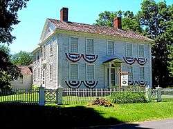 Amasa Day House |
September 22, 1972 (#72001315) |
Plains Rd. 41°30′07″N 72°27′09″W |
East Haddam | |
| 21 | Deep River Freight Station | 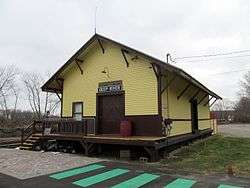 Deep River Freight Station |
December 21, 1994 (#94001445) |
152 River St. 41°23′38″N 72°25′37″W |
Deep River | |
| 22 | Deep River Town Hall |  Deep River Town Hall |
January 1, 1976 (#76001977) |
CT 80 and CT 9A 41°23′06″N 72°26′11″W |
Deep River | |
| 23 | Doane's Sawmill/Deep River Manufacturing Company |  Doane's Sawmill/Deep River Manufacturing Company |
February 21, 1985 (#85000313) |
Horse Hill and Winthrop Rds. 41°20′17″N 72°29′02″W |
Westbrook and Deep River | |
| 24 | Doris (Sailing yacht) | 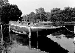 Doris (Sailing yacht) |
May 31, 1984 (#84001108) |
Connecticut River off River Rd. 41°23′00″N 72°23′34″W |
Deep River | |
| 25 | Jedidiah Dudley House |  Jedidiah Dudley House |
April 12, 1982 (#82004339) |
Springbrook Rd. 41°18′54″N 72°21′51″W |
Old Saybrook | |
| 26 | East Haddam Historic District |  East Haddam Historic District |
April 29, 1983 (#83001273) |
CT 149, Broom, Norwich, Creamery, Lumberyard, and Landing Hill Rds. 41°27′23″N 72°27′45″W |
East Haddam | |
| 27 | Samuel Eliot House |  Samuel Eliot House |
November 9, 1972 (#72001316) |
500 Main St. 41°17′02″N 72°22′08″W |
Old Saybrook | |
| 28 | Emmanuel Church | 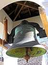 Emmanuel Church |
August 5, 1999 (#99000924) |
50 Emmanuel Church Rd. 41°23′34″N 72°36′33″W |
Killingworth | |
| 29 | Essex Freight Station | 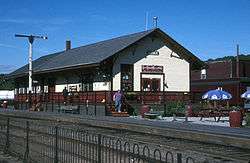 Essex Freight Station |
April 19, 1994 (#94000337) |
1 Railroad Ave. 41°21′00″N 72°24′18″W |
Essex | |
| 30 | Fenwick Historic District | 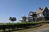 Fenwick Historic District |
April 13, 1995 (#95000437) |
Roughly, along Agawam, Neponset and Pettipaug Aves. 41°16′14″N 72°21′23″W |
Old Saybrook | |
| 31 | Goodspeed Opera House |  Goodspeed Opera House |
July 30, 1971 (#71000901) |
Norwich Rd. 41°27′07″N 72°27′47″W |
East Haddam | |
| 32 | Haddam Center Historic District | 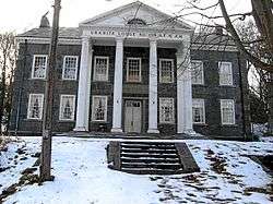 Haddam Center Historic District |
February 9, 1989 (#89000012) |
Roughly 2.5 miles (4.0 km) along Walkley Rd. and CT 154/Saybrook Rd. 41°28′46″N 72°30′55″W |
Haddam | |
| 33 | Hadlyme North Historic District | 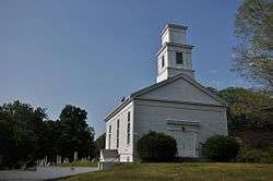 Hadlyme North Historic District |
December 8, 1988 (#88002686) |
Roughly bounded by CT 82, Town St., Banning Rd., and Old Town St. 41°25′45″N 72°24′25″W |
East Haddam | |
| 34 | Hammonasset Paper Mill Site |  Hammonasset Paper Mill Site |
February 23, 1996 (#96000128) |
Green Hill Road at the Hammonasset River[6] 41°19′27″N 72°35′36″W |
Killingworth | Extends into Madison. |
| 35 | Gen. William Hart House | 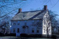 Gen. William Hart House |
November 9, 1972 (#72001318) |
350 Main St. 41°17′14″N 72°22′31″W |
Old Saybrook | |
| 36 | James Hazelton House | 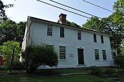 James Hazelton House |
November 16, 1988 (#88001468) |
23 Hayden Hill Rd. 41°28′46″N 72°31′06″W |
Haddam | |
| 37 | Higganum Landing Historic District |  Higganum Landing Historic District |
December 10, 2018 (#100003206) |
40-68 Landing Rd., 2-14 Landing Rd. S 41°27′00″N 72°32′55″W |
Haddam | |
| 38 | Hill's Academy | 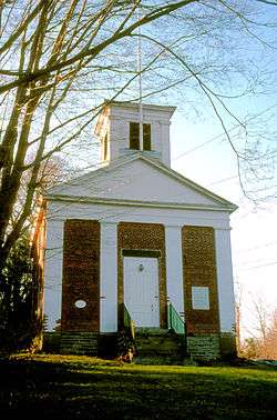 Hill's Academy |
August 23, 1985 (#85001831) |
22 Prospect St. 41°21′14″N 72°23′34″W |
Essex | |
| 39 | Indian Hill Avenue Historic District | 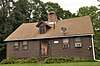 Indian Hill Avenue Historic District |
May 26, 1983 (#83001274) |
Main St. and Indian Hill Ave. to the river 41°35′54″N 72°37′23″W |
Portland | |
| 40 | Ivoryton Historic District | 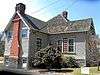 Ivoryton Historic District |
April 15, 2014 (#13000895) |
Roughly bounded by Main, N. Main, Oak, Blake & Summit Sts., Park Rd. & Comstock Ave. 41°20′54″N 72°26′27″W |
Essex | Ivoryton, Connecticut |
| 41 | James Pharmacy | 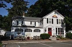 James Pharmacy |
August 5, 1994 (#94000845) |
2 Pennywise Ln. 41°17′09″N 72°22′35″W |
Old Saybrook | |
| 42 | Lay-Pritchett House | 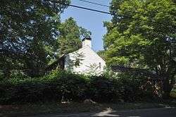 Lay-Pritchett House |
October 11, 1978 (#78002854) |
North of Westbrook on CT 145 41°19′55″N 72°29′35″W |
Westbrook | |
| 43 | Daniel and Mary Lee House | 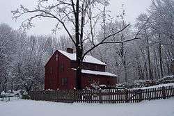 Daniel and Mary Lee House |
April 3, 1991 (#91000365) |
Pepperidge Rd. E of Jobs Pond Rd. 41°34′47″N 72°34′59″W |
Portland | |
| 44 | Little Haddam Historic District | .jpg) Little Haddam Historic District |
August 1, 1996 (#96000783) |
Roughly bounded by E. Haddam Rd., Orchard Rd., and Town St. 41°28′44″N 72°26′48″W |
East Haddam | |
| 45 | David Lyman II House |  David Lyman II House |
February 6, 1986 (#86000149) |
5 Lyman Rd. 41°29′47″N 72°42′43″W |
Middlefield | |
| 46 | Thomas Lyman House | 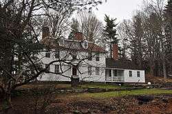 Thomas Lyman House |
November 20, 1975 (#75001921) |
105 Middlefield Rd. 41°29′18″N 72°41′16″W |
Durham | |
| 47 | Lynde Point Lighthouse | 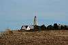 Lynde Point Lighthouse |
May 29, 1990 (#89001469) |
Southeastern terminus of Sequassen Ave. 41°16′16″N 72°20′38″W |
Old Saybrook | |
| 48 | Main Street Historic District |  Main Street Historic District |
October 24, 1985 (#85003389) |
Roughly bounded by Nooks Hill Rd., Prospect Hill Rd., Wall and West Sts. and New Ln., and Stevens Ln. and Main St. 41°36′07″N 72°38′56″W |
Cromwell | |
| 49 | Main Street Historic District |  Main Street Historic District |
September 4, 1986 (#86002837) |
Roughly Maple Ave. and Main St. between Talcott Ln. and Higganum Rd. 41°28′26″N 72°40′51″W |
Durham | |
| 50 | Marlborough Street Historic District |  Marlborough Street Historic District |
March 20, 2012 (#12000130) |
58, 64, 69, 70, 78, 88, & 92 Marlborough St. 41°34′15″N 72°38′05″W |
Portland | |
| 51 | Middle Haddam Historic District |  Middle Haddam Historic District |
February 3, 1984 (#84001112) |
Moodus and Long Hill Rds. 41°33′11″N 72°33′06″W |
East Hampton | |
| 52 | Middle Haddam School | 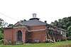 Middle Haddam School |
October 18, 2019 (#100004545) |
12 Schoolhouse Ln. 41°33′09″N 72°32′52″W |
East Hampton | |
| 53 | Middletown Upper Houses Historic District |  Middletown Upper Houses Historic District |
July 27, 1979 (#79002620) |
CT 99 41°35′19″N 72°38′28″W |
Cromwell | Historic district of area that was in Middletown, until it was split to Cromwell in 1851 |
| 54 | Millington Green Historic District | 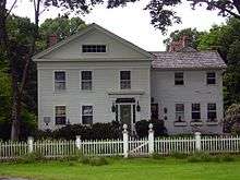 Millington Green Historic District |
July 25, 1996 (#96000782) |
Roughly bounded by Millington, Tater Hill, Haywardville, and Old Hopyard Rds. 41°29′06″N 72°21′28″W |
East Haddam | |
| 55 | North Cove Historic District | 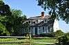 North Cove Historic District |
July 22, 1994 (#94000766) |
Roughly N. Cove Rd. from Church St. to the Connecticut River and adjacent properties on Cromwell Pl. 41°17′13″N 72°21′32″W |
Old Saybrook | |
| 56 | Oak Lodge |  Oak Lodge |
September 4, 1986 (#86001734) |
Western side of Schreeder Pond, Chatfield Hollow State Park 41°22′11″N 72°35′27″W |
Killingworth | |
| 57 | Old Saybrook South Green | 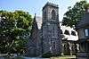 Old Saybrook South Green |
September 3, 1976 (#76001984) |
Old Boston Post Rd., Pennywise Lane, Main St. 41°17′17″N 72°22′36″W |
Old Saybrook | |
| 58 | Old Saybrook Town Hall and Theater | 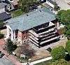 Old Saybrook Town Hall and Theater |
June 21, 2007 (#07000558) |
300 Main St. 41°17′26″N 72°23′11″W |
Old Saybrook | Now known as the Katharine Hepburn Cultural Arts Center |
| 59 | Old Town Hall | 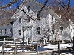 Old Town Hall |
February 23, 1972 (#72001310) |
On the green between Liberty St. and Goose Hill Rd. 41°24′25″N 72°27′09″W |
Chester | |
| 60 | Oriole Rockshelter | October 15, 1987 (#87001222) |
Address Restricted |
East Haddam | ||
| 61 | Parker House | 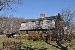 Parker House |
November 29, 1978 (#78002853) |
680 Middlesex Turnpike 41°19′25″N 72°22′30″W |
Old Saybrook | |
| 62 | Parmelee House | 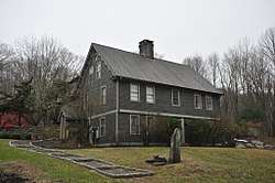 Parmelee House |
May 15, 2007 (#07000417) |
4 Beckwith Rd. 41°23′03″N 72°35′13″W |
Killingworth | |
| 63 | Portland Brownstone Quarries | 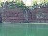 Portland Brownstone Quarries |
May 16, 2000 (#00000703) |
Brownstone Ave. and Silver St. 41°34′30″N 72°38′36″W |
Portland | Quarried since 1690, source of vast quantities of brownstone for New York City, Philadelphia, Boston, other urban areas' buildings. |
| 64 | Pratt House | 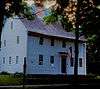 Pratt House |
August 23, 1985 (#85001824) |
19 West Ave. 41°21′13″N 72°23′40″W |
Essex | |
| 65 | Dr. Ambrose Pratt House | 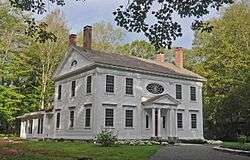 Dr. Ambrose Pratt House |
November 9, 1972 (#72001311) |
Pratt St. 41°24′01″N 72°26′43″W |
Chester | |
| 66 | Humphrey Pratt Tavern | 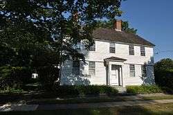 Humphrey Pratt Tavern |
November 7, 1972 (#72001320) |
287 Main St. 41°17′18″N 72°22′35″W |
Old Saybrook | |
| 67 | Pratt, Read and Company Factory Complex | 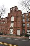 Pratt, Read and Company Factory Complex |
August 30, 1984 (#84001117) |
Main St. between Bridge and Spring Sts. and 5 Bridge St. 41°23′25″N 72°26′22″W |
Deep River | |
| 68 | Rapallo Viaduct | 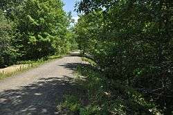 Rapallo Viaduct |
August 21, 1986 (#86002728) |
Flat Brook and former Air Line railroad right-of-way 41°34′19″N 72°28′19″W |
East Hampton | |
| 69 | Roaring Brook I Site | July 31, 1987 (#87001220) |
Address Restricted |
East Haddam | Archaeological site documented as part of the Lower Connecticut River Valley Woodland Period Archaeological TR. Less than 1 acre. | |
| 70 | Roaring Brook II Site | July 31, 1987 (#87001221) |
Address Restricted |
East Haddam | Archaeological site documented as part of the Lower Connecticut River Valley Woodland Period Archaeological TR. Less than 1 acre. | |
| 71 | Sage-Kirby House | 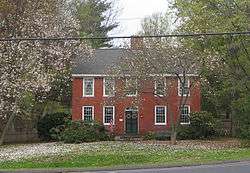 Sage-Kirby House |
April 29, 1982 (#82003767) |
93 Shunpike Rd. 41°36′41″N 72°40′36″W |
Cromwell | |
| 72 | Saybrook Breakwater Lighthouse | 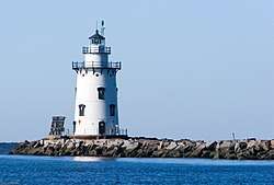 Saybrook Breakwater Lighthouse |
May 29, 1990 (#89001474) |
Southern terminus of Saybrook Jetty at the mouth of the Connecticut River 41°15′47″N 72°20′35″W |
Old Saybrook | |
| 73 | Seventh Sister | 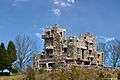 Seventh Sister |
July 31, 1986 (#86002103) |
67 River Rd. 41°25′25″N 72°25′53″W |
East Haddam and Lyme | Now Gillette Castle State Park. |
| 74 | Shore Line Electric Railway Power House | 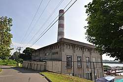 Shore Line Electric Railway Power House |
June 20, 2019 (#100004086) |
220 Ferry Road 41°18′51″N 72°21′39″W |
Old Saybrook | |
| 75 | Steamboat Dock Site | 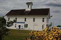 Steamboat Dock Site |
April 1, 1982 (#82003768) |
Main St. 41°21′04″N 72°23′06″W |
Essex | Now the Connecticut River Museum |
| 76 | William Stevens House |  William Stevens House |
May 30, 1985 (#85001163) |
131 Cow Hill Rd. 41°18′17″N 72°32′45″W |
Clinton | |
| 77 | William Tully House |  William Tully House |
March 15, 1982 (#82004340) |
135 N. Cove Rd. 41°17′21″N 72°21′26″W |
Old Saybrook | |
| 78 | Villa Bella Vista |  Villa Bella Vista |
December 28, 2000 (#00001560) |
7 Old Depot Rd. 41°24′12″N 72°26′28″W |
Chester | |
| 79 | William Ward Jr. House |  William Ward Jr. House |
February 19, 1988 (#88000109) |
137 Powder Hill Rd. 41°30′14″N 72°43′47″W |
Middlefield | |
| 80 | Warner House |  Warner House |
February 19, 1987 (#87000174) |
307 Town St. 41°27′12″N 72°26′27″W |
East Haddam | |
| 81 | Jonathan Warner House | 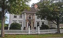 Jonathan Warner House |
December 19, 1978 (#78002855) |
47 Kings Highway 41°25′00″N 72°26′27″W |
Chester | |
| 82 | Westbrook Town Center Historic District |  Westbrook Town Center Historic District |
October 16, 2017 (#100001732) |
Old Clinton at Hammock Rds., Boston Post Rd. at Bellstone Ave., Trolley Rd., Boston Post Rd. at Goodspeed Dr. 41°17′04″N 72°26′44″W |
Westbrook | |
| 83 | White-Overton-Callander House | 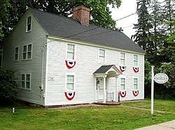 White-Overton-Callander House |
May 21, 2014 (#13000896) |
492 Main Street 41°35′15″N 72°37′43″W |
Portland | House museum of the Portland Historical Society |
| 84 | Ambrose Whittlesey House | 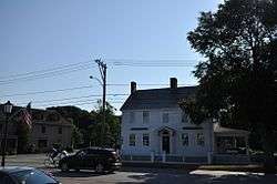 Ambrose Whittlesey House |
August 23, 1985 (#85001830) |
14 Main St. 41°17′51″N 72°22′37″W |
Old Saybrook | |
| 85 | John Whittlesey Jr. House | 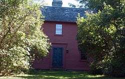 John Whittlesey Jr. House |
October 26, 1984 (#84002644) |
40 Ferry Rd. 41°18′49″N 72°21′33″W |
Old Saybrook | |
| 86 | Wickham Road Historic District | 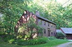 Wickham Road Historic District |
July 25, 1996 (#96000781) |
Roughly the junction of Wickham and Geoffrey Rds. 41°30′16″N 72°22′46″W |
East Haddam | |
| 87 | Williams and Stancliff Octagon Houses |  Williams and Stancliff Octagon Houses |
April 22, 1976 (#76001985) |
26 and 28 Marlborough St. 41°34′21″N 72°38′20″W |
Portland | |
| 88 | Working Girls' Vacation Society Historic District | 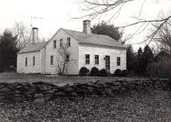 Working Girls' Vacation Society Historic District |
June 3, 1994 (#94000557) |
60, 64, and 66 Mill Rd. 41°26′31″N 72°23′43″W |
East Haddam |
Formerly listed, and other status
| [3] | Name on the Register[4] | Image | Date listed[5] | Location | City or town | Description |
|---|---|---|---|---|---|---|
| 1 | Christeen (oyster sloop) | 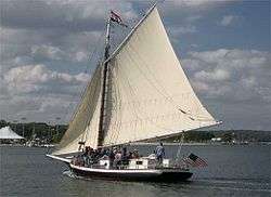 Christeen (oyster sloop) |
December 4, 1991 (#91002060) |
Essex Harbor 41°21′03″N 72°23′04″W |
Essex | Sloop that was stationed in Essex Harbor when NRHP-listed, later moved to Oyster Bay, New York. |
See also
| Wikimedia Commons has media related to National Register of Historic Places in Middlesex County, Connecticut. |
References
- The latitude and longitude information provided in this table was derived originally from the National Register Information System, which has been found to be fairly accurate for about 99% of listings. Some locations in this table may have been corrected to current GPS standards.
- "National Register of Historic Places: Weekly List Actions". National Park Service, United States Department of the Interior. Retrieved on June 19, 2020.
- Numbers represent an ordering by significant words. Various colorings, defined here, differentiate National Historic Landmarks and historic districts from other NRHP buildings, structures, sites or objects.
- "National Register Information System". National Register of Historic Places. National Park Service. March 13, 2009.
- The eight-digit number below each date is the number assigned to each location in the National Register Information System database, which can be viewed by clicking the number.
- "Madison Historic Sites". Madison Historical Society. Archived from the original on 2015-03-20. Retrieved 2014-11-21.
| Lists by county | 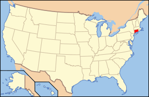 | |
|---|---|---|
| Lists by city or town | ||
| Other lists | ||
This article is issued from Wikipedia. The text is licensed under Creative Commons - Attribution - Sharealike. Additional terms may apply for the media files.