Sherrodsville, Ohio
Sherrodsville (/ˈʃɛrɒdzvɪl/ SHERR-odz-vil) is a village in Carroll County, Ohio, United States. The population was 304 at the 2010 census. It is part of the Canton–Massillon Metropolitan Statistical Area.
Sherrodsville, Ohio | |
|---|---|
.JPG) Sherrodsville Community Park in Spring | |
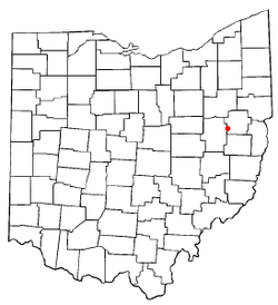 Location of Sherrodsville, Ohio | |
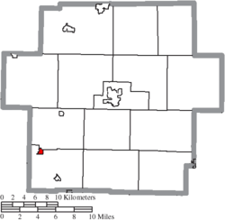 Location of Sherrodsville in Carroll County | |
| Coordinates: 40°29′41″N 81°14′40″W | |
| Country | United States |
| State | Ohio |
| County | Carroll |
| Area | |
| • Total | 0.32 sq mi (0.83 km2) |
| • Land | 0.32 sq mi (0.83 km2) |
| • Water | 0 sq mi (0 km2) |
| Elevation | 909 ft (277 m) |
| Population | |
| • Total | 304 |
| • Estimate (2019[4]) | 280 |
| • Density | 950.0/sq mi (366.8/km2) |
| Time zone | UTC-5 (Eastern (EST)) |
| • Summer (DST) | UTC-4 (EDT) |
| ZIP code | 44675 |
| Area code(s) | 740 |
| FIPS code | 39-72242[5] |
| GNIS feature ID | 1049175[2] |
History
Sherrodsville was laid out in 1882, and named after Charles Sherrod, the original owner of the town site.[6]
Geography
Sherrodsville is located on Conotton Creek at 40°29′41″N 81°14′40″W (40.494728, -81.244479).[7]
According to the United States Census Bureau, the village has a total area of 0.32 square miles (0.83 km2), all land.[1]
Sherrodsville is at the intersection of State Routes 39 and 212.
The Wheeling and Lake Erie Railway previously the New York, Chicago and St. Louis Railroad passes through Sherrodsville.
Demographics
2010 census
As of the census[3] of 2010, there were 304 people, 113 households, and 84 families living in the village. The population density was 950.0 inhabitants per square mile (366.8/km2). There were 122 housing units at an average density of 381.3 per square mile (147.2/km2). The racial makeup of the village was 98.4% White, 1.0% Native American, 0.3% from other races, and 0.3% from two or more races. Hispanic or Latino of any race were 0.3% of the population.
There were 113 households of which 35.4% had children under the age of 18 living with them, 51.3% were married couples living together, 11.5% had a female householder with no husband present, 11.5% had a male householder with no wife present, and 25.7% were non-families. 23.0% of all households were made up of individuals and 8.9% had someone living alone who was 65 years of age or older. The average household size was 2.69 and the average family size was 3.05.
The median age in the village was 36.5 years. 26.6% of residents were under the age of 18; 8.3% were between the ages of 18 and 24; 23.8% were from 25 to 44; 30.5% were from 45 to 64; and 10.9% were 65 years of age or older. The gender makeup of the village was 52.0% male and 48.0% female.
2000 census
As of the census[5] of 2000, there were 316 people, 122 households, and 90 families living in the village. The population density was 999.7 people per square mile (381.3/km²). There were 129 housing units at an average density of 408.1 per square mile (155.6/km²). The racial makeup of the village was 97.15% White, 0.32% African American, 0.32% Asian, 0.32% from other races, and 1.90% from two or more races. 0.32% of the population were Hispanic or Latino of any race.
There were 122 households out of which 28.7% had children under the age of 18 living with them, 54.9% were married couples living together, 14.8% had a female householder with no husband present, and 26.2% were non-families. 23.8% of all households were made up of individuals and 10.7% had someone living alone who was 65 years of age or older. The average household size was 2.59 and the average family size was 3.03.
In the village, the population was spread out with 26.3% under the age of 18, 9.8% from 18 to 24, 28.2% from 25 to 44, 21.2% from 45 to 64, and 14.6% who were 65 years of age or older. The median age was 39 years. For every 100 females there were 89.2 males. For every 100 females age 18 and over, there were 84.9 males.
The median income for a household in the village was $28,036, and the median income for a family was $31,786. Males had a median income of $27,014 versus $17,813 for females. The per capita income for the village was $12,896. 19.1% of the population and 15.1% of families were below the poverty line. Out of the total population, 33.3% of those under the age of 18 and 15.0% of those 65 and older were living below the poverty line.
Education
| Historical population | |||
|---|---|---|---|
| Census | Pop. | %± | |
| 1890 | 893 | — | |
| 1900 | 926 | 3.7% | |
| 1910 | 721 | −22.1% | |
| 1920 | 377 | −47.7% | |
| 1930 | 361 | −4.2% | |
| 1940 | 333 | −7.8% | |
| 1950 | 426 | 27.9% | |
| 1960 | 480 | 12.7% | |
| 1970 | 400 | −16.7% | |
| 1980 | 396 | −1.0% | |
| 1990 | 284 | −28.3% | |
| 2000 | 316 | 11.3% | |
| 2010 | 304 | −3.8% | |
| Est. 2019 | 280 | [4] | −7.9% |
| [8] | |||
Public education in the village of Sherrodsville is provided by the Conotton Valley Union Local School District. Campuses serving the village include Sherrodsville Elementary School (Grades K-6) and Conotton Valley High School (Grades 7-12).
Notable people
Edmund Rowe, United States Representative from 1943 to 1945.
References
- "US Gazetteer files 2010". United States Census Bureau. Archived from the original on 2012-01-25. Retrieved 2013-01-06.
- "US Board on Geographic Names". United States Geological Survey. 2007-10-25. Retrieved 2008-01-31.
- "U.S. Census website". United States Census Bureau. Retrieved 2013-01-06.
- "Population and Housing Unit Estimates". Retrieved May 21, 2020.
- "U.S. Census website". United States Census Bureau. Retrieved 2008-01-31.
- Overman, William Daniel (1958). Ohio Town Names. Akron, OH: Atlantic Press. p. 126.
- "US Gazetteer files: 2010, 2000, and 1990". United States Census Bureau. 2011-02-12. Retrieved 2011-04-23.
- census data: 1890,1900 : Hunt, William C. (1901). Population of the United States by states and territories, counties, and minor Civil Divisions, as returned at the Twelfth Census: 1900. United States Census Printing Office. p. 306., 1910, 1920, 1930 : 1930 page 40, 1940 : 1940 page 117, 1950 : 1950 page 14, 1960 : 1960 page 16, 1970 : 1970 page=124, 1990: 1990 , 2000 : 2000 , 2010 : 2010
Municipalities and communities of Carroll County, Ohio, United States | ||
|---|---|---|
| Villages | 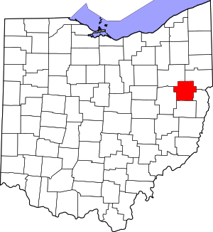 Map of Ohio highlighting Carroll County | |
| Townships | ||
| CDP | ||
| Unincorporated communities | ||
| Footnotes | ‡This populated place also has portions in an adjacent county or counties | |