Sexton, Arkansas
Sexton (also Salem Springs) is a former community in Dutch Mills Township, Washington County, Arkansas, United States.[1] The community was located on a tributary of the Baron Fork (a tributary of the Illinois River) approximately one-half mile east of the Arkansas - Oklahoma state line.[2]
Sexton, Arkansas | |
|---|---|
Ghost town | |
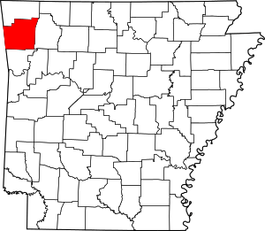
 Sexton, Arkansas Sexton's position in Arkansas. | |
| Coordinates: 35°54′55″N 94°30′25″W | |
| Country | United States |
| State | Arkansas |
| County | Washington |
| Township | Dutch Mills |
| Elevation | 1,014 ft (309 m) |
| Time zone | UTC-6 (Central (CST)) |
| • Summer (DST) | UTC-5 (CDT) |
| Area code(s) | 479 |
| GNIS feature ID | 81941 |
| U.S. Geological Survey Geographic Names Information System: Sexton, Arkansas | |
A post office called Sexton was established in 1882, and remained in operation until 1906.[3] The community has the name of William H. Sexton, an early postmaster.[4]
References
- "Feature Detail Report for: Sexton, Arkansas (historical)." USGS. U.S. Geological Survey Geographic Names Information System: Sexton, Arkansas Retrieved January 11, 2011.
- Tahlequah, OK, 1:25000 Scale Topographic Map, USGS, 1898
- "Post Offices". Jim Forte Postal History. Retrieved 4 February 2018.
- History of Benton, Washington, Carroll, Madison, Crawford, Franklin, and Sebastian Counties, Arkansas. Higginson Book Company. 1889. p. 321.
This article is issued from Wikipedia. The text is licensed under Creative Commons - Attribution - Sharealike. Additional terms may apply for the media files.