Johnson, Arkansas
Johnson is a city in Washington County, Arkansas, United States. The community is located on the Springfield Plateau deep in the Ozark Mountains and is surrounded by valleys and natural springs. Early settlers took advantage of these natural features and formed an economy based on mining lime, the Johnson Mill and trout. Although a post office was opened in the community in 1887,[3] Johnson did not incorporate until it required the development of a city government to provide utility services in 1961. Located between Fayetteville and Springdale in the heart of the rapidly growing Northwest Arkansas metropolitan statistical area, Johnson has been experiencing a population and building boom in recent years, as indicated by a 46% growth in population between the 2000 and 2010 censuses.[4]
Johnson, Arkansas | |
|---|---|
 The historic Johnson Mill | |
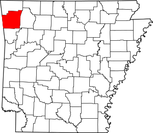
 Location of Johnson in Washington County, Arkansas. | |
| Coordinates: 36°8′2″N 94°9′57″W | |
| Country | United States |
| State | Arkansas |
| County | Washington |
| Area | |
| • City | 3.65 sq mi (9.44 km2) |
| • Land | 3.61 sq mi (9.36 km2) |
| • Water | 0.03 sq mi (0.08 km2) |
| Elevation | 1,198 ft (365 m) |
| Population (2010) | |
| • City | 3,353 |
| • Estimate (2018)[2] | 3,736 |
| • Density | 1,016.88/sq mi (392.67/km2) |
| • Metro | 463,204 |
| Time zone | UTC-6 (Central (CST)) |
| • Summer (DST) | UTC-5 (CDT) |
| ZIP code | 72741 |
| Area code(s) | 479 |
| FIPS code | 05-35500 |
| GNIS feature ID | 0077381 |
| Website | cityofjohnson |
Geography
Johnson is located at 36°8′2″N 94°9′57″W (36.133867, -94.165937)[5] between Fayetteville and Springdale. The town is located off Exit 69 on I-49 in Northwest Arkansas.
According to the United States Census Bureau, the city has a total area of 3.1 square miles (8.0 km2), all land.
Demographics
| Historical population | |||
|---|---|---|---|
| Census | Pop. | %± | |
| 1970 | 274 | — | |
| 1980 | 519 | 89.4% | |
| 1990 | 599 | 15.4% | |
| 2000 | 2,319 | 287.1% | |
| 2010 | 3,353 | 44.6% | |
| Est. 2018 | 3,736 | [2] | 11.4% |
| [4] | |||
As of the census[6] of 2000, there were 2,319 people, 928 households, and 638 families residing in the city. The population density was 751.2 people per square mile (289.8/km2). There were 990 housing units at an average density of 320.7/sq mi (123.7/km2). The racial makeup of the city was 91.55% White, 1.42% Black or African American, 0.69% Native American, 2.11% Asian, 0.09% Pacific Islander, 1.68% from other races, and 2.46% from two or more races. 3.19% of the population were Hispanic or Latino of any race.
There were 928 households, out of which 37.6% had children under the age of 18 living with them, 55.5% were married couples living together, 10.1% had a female householder with no husband present, and 31.3% were non-families. 22.7% of all households were made up of individuals, and 4.1% had someone living alone who was 65 years of age or older. The average household size was 2.49 and the average family size was 2.98.
In the city, the population was spread out, with 27.8% under the age of 18, 10.3% from 18 to 24, 42.8% from 25 to 44, 13.6% from 45 to 64, and 5.5% who were 65 years of age or older. The median age was 29 years. For every 100 females, there were 91.3 males. For every 100 females age 18 and over, there were 87.6 males.
The median income for a household in the city was $44,556, and the median income for a family was $51,618. Males had a median income of $35,189 versus $25,625 for females. The per capita income for the city was $21,502. About 5.4% of families and 7.6% of the population were below the poverty line, including 10.2% of those under age 18 and 9.6% of those age 65 or over.
Government
The City of Johnson is operated under a mayor/council governmental system. The City Council meets on the second Tuesday of every month.
Governmental officers
- Mayor Chris Keeney
- Recorder/treasurer Jennifer Allen
- District Judge Jeff Harper
- City Attorney Harrington Miller
- Police Chief Wayne Woods
- Fire Chief Matt Mills
- Building Official Clay Wilson
- Councilmember Bill Burnett
- Councilmember Dan Cross
- Councilmember Bob Fant
- Councilmember Katherine Hudson
- Councilmember Angela Perea
- Councilmember John Wright
Infrastructure
Trails
Clear Creek Trail: The nearly three-mile Clear Creek Trail connects Scull Creek Trail to Lake Fayetteville Park and is part of the Northwest Arkansas Razorback Regional Greenway, a 36-mile trail that connects south Fayetteville to north Bentonville, and is funded by a grant from the Walton Family Foundation to the Northwest Arkansas Regional Planning Commission.
Water
Water service in Johnson is provided by Springdale Water Utilities by an inter-municipal agreement. Springdale purchases treated water from Beaver Water District. Wastewater is treated and conveyed into the Springdale system, except the southern reaches which gravity flow into the Fayetteville system.
References
- "2017 U.S. Gazetteer Files". United States Census Bureau. Retrieved Aug 22, 2018.
- "Population and Housing Unit Estimates". Retrieved November 16, 2019.
- History of Benton, Washington, Carroll, Madison, Crawford, Franklin, and Sebastian Counties, Arkansas. Higginson Book Company. 1889. p. 321.
- Hamblen, Mark (March 1, 2012). "Johnson (Washington County)". Encyclopedia of Arkansas History and Culture. Butler Center for Arkansas Studies at the Central Arkansas Library System. Retrieved April 27, 2013.
- "US Gazetteer files: 2010, 2000, and 1990". United States Census Bureau. 2011-02-12. Retrieved 2011-04-23.
- "U.S. Census website". United States Census Bureau. Retrieved 2008-01-31.