Sergokalinsky District
Sergokalinsky District (Russian: Сергокали́нский райо́н; Dargwa: Сергокъала район) is an administrative[1] and municipal[6] district (raion), one of the forty-one in the Republic of Dagestan, Russia. It is located in the east of the republic. The area of the district is 528.4 square kilometers (204.0 sq mi).[2] Its administrative center is the rural locality (a selo) of Sergokala.[1] As of the 2010 Census, the total population of the district was 27,133, with the population of Sergokala accounting for 30.0% of that number.[3]
Sergokalinsky District Сергокалинский район | |
|---|---|
| Other transcription(s) | |
| • Dargwa | Сергокъала район |
 Landscape of Sergokalinsky District | |
 Coat of arms | |
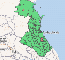
Location of Sergokalinsky District in the Republic of Dagestan | |
| Coordinates: 42°27′N 47°40′E | |
| Country | Russia |
| Federal subject | Republic of Dagestan[1] |
| Established | 1929 |
| Administrative center | Sergokala[1] |
| Area | |
| • Total | 528.4 km2 (204.0 sq mi) |
| Population | |
| • Total | 27,133 |
| • Estimate (2018)[4] | 27,662 (+1.9%) |
| • Density | 51/km2 (130/sq mi) |
| • Urban | 0% |
| • Rural | 100% |
| Administrative structure | |
| • Administrative divisions | 10 Selsoviets |
| • Inhabited localities[5] | 35 Rural localities |
| Municipal structure | |
| • Municipally incorporated as | Sergokalinsky Municipal District[6] |
| • Municipal divisions[6] | 0 Urban settlements, 15 Rural settlements |
| Time zone | UTC+3 (MSK |
| OKTMO ID | 82644000 |
| Website | http://www.sergokala.ru |
| 2010 Census | 27,133[3] |
|---|---|
| 2002 Census | 29,665[8] |
| 1989 Census | 18,700[9] |
| 1979 Census | 19,691[10] |
Administrative and municipal status
Within the framework of administrative divisions, Sergokalinsky District is one of the forty-one in the Republic of Dagestan.[1] The district is divided into ten selsoviets which comprise thirty-five rural localities.[5] As a municipal division, the district is incorporated as Sergokalinsky Municipal District.[6] Its ten selsoviets are incorporated as fifteen rural settlements within the municipal district.[6] The selo of Sergokala serves as the administrative center of both the administrative[1] and municipal[11] district.
References
Notes
- Law #16
- "General Information" (in Russian). Sergokalinsky District. Retrieved January 20, 2017.
- Russian Federal State Statistics Service (2011). "Всероссийская перепись населения 2010 года. Том 1" [2010 All-Russian Population Census, vol. 1]. Всероссийская перепись населения 2010 года [2010 All-Russia Population Census] (in Russian). Federal State Statistics Service.
- "26. Численность постоянного населения Российской Федерации по муниципальным образованиям на 1 января 2018 года". Federal State Statistics Service. Retrieved January 23, 2019.
- Государственный комитет Российской Федерации по статистике. Комитет Российской Федерации по стандартизации, метрологии и сертификации. №ОК 019-95 1 января 1997 г. «Общероссийский классификатор объектов административно-территориального деления. Код 82 244», в ред. изменения №278/2015 от 1 января 2016 г.. (State Statistics Committee of the Russian Federation. Committee of the Russian Federation on Standardization, Metrology, and Certification. #OK 019-95 January 1, 1997 Russian Classification of Objects of Administrative Division (OKATO). Code 82 244, as amended by the Amendment #278/2015 of January 1, 2016. ).
- Law #6
- "Об исчислении времени". Официальный интернет-портал правовой информации (in Russian). June 3, 2011. Retrieved January 19, 2019.
- Russian Federal State Statistics Service (May 21, 2004). "Численность населения России, субъектов Российской Федерации в составе федеральных округов, районов, городских поселений, сельских населённых пунктов – районных центров и сельских населённых пунктов с населением 3 тысячи и более человек" [Population of Russia, Its Federal Districts, Federal Subjects, Districts, Urban Localities, Rural Localities—Administrative Centers, and Rural Localities with Population of Over 3,000] (XLS). Всероссийская перепись населения 2002 года [All-Russia Population Census of 2002] (in Russian).
- "Всесоюзная перепись населения 1989 г. Численность наличного населения союзных и автономных республик, автономных областей и округов, краёв, областей, районов, городских поселений и сёл-райцентров" [All Union Population Census of 1989: Present Population of Union and Autonomous Republics, Autonomous Oblasts and Okrugs, Krais, Oblasts, Districts, Urban Settlements, and Villages Serving as District Administrative Centers]. Всесоюзная перепись населения 1989 года [All-Union Population Census of 1989] (in Russian). Институт демографии Национального исследовательского университета: Высшая школа экономики [Institute of Demography at the National Research University: Higher School of Economics]. 1989 – via Demoscope Weekly.
- "Всесоюзная перепись населения 1979 г. Национальный состав населения по регионам России" [All Union Population Census of 1979. Ethnic composition of the population by regions of Russia] (XLS). Всесоюзная перепись населения 1979 года [All-Union Population Census of 1979] (in Russian). 1979 – via Demoscope Weekly (website of the Institute of Demographics of the State University—Higher School of Economics.
- Федеральная служба государственной статистики. Федеральное агентство по технологическому регулированию и метрологии. №ОК 033-2013 1 января 2014 г. «Общероссийский классификатор территорий муниципальных образований. Код 82 644». (Federal State Statistics Service. Federal Agency on Technological Regulation and Metrology. #OK 033-2013 January 1, 2014 Russian Classification of Territories of Municipal Formations. Code 82 644. ).
Sources
- Народное Собрание Республики Дагестан. Закон №16 от 10 апреля 2002 г. «Об административно-территориальном устройстве Республики Дагестан», в ред. Закона №106 от 30 декабря 2013 г. «О внесении изменений в некоторые законодательные акты Республики Дагестан». Вступил в силу со дня официального опубликования. Опубликован: "Дагестанская правда", №81, 12 апреля 2002 г. (People's Assembly of the Republic of Dagestan. Law #16 of April 10, 2002 On the Administrative-Territorial Structure of the Republic of Dagestan, as amended by the Law #106 of December 30, 2013 On Amending Various Legislative Acts of the Republic of Dagestan. Effective as of the day of the official publication.).
- Народное Собрание Республики Дагестан. Закон №6 от 13 января 2005 г. «О статусе и границах муниципальных образований Республики Дагестан», в ред. Закона №43 от 30 апреля 2015 г. «О статусе городского округа с внутригородским делением "Город Махачкала", статусе и границах внутригородских районов в составе городского округа с внутригородским делением "Город Махачкала" и о внесении изменений в отдельные законодательные акты Республики Дагестан». Вступил в силу со дня официального опубликования. Опубликован: "Дагестанская правда", №8, 15 февраля 2005 г. (People's Assembly of the Republic of Dagestan. Law #6 of January 13, 2005 On the Status and Borders of the Municipal Formations of the Republic of Dagestan, as amended by the Law #43 of April 30, 2015 On the Status of the "City of Makhachkala" Urban Okrug with Intra-Urban Divisions, the Status and the Borders of the Intra-City Districts Comprising the "City of Makhachkala" Urban Okrug with Intra-Urban Divisions, and on Amending Various Legislative Acts of the Republic of Dagestan. Effective as of the day of the official publication.).
Administrative divisions of the Republic of Dagestan | |||
|---|---|---|---|
| Districts |
| ||
| Cities and towns | |||
| Urban-type settlements | |||
__NOTOC_