Seriqbuya
Seriqbuya (Uyghur: سېرىقبۇيا, USY: Сериқбуя, ULY: Sëriqbuya; Chinese: 色力布亚镇; pinyin: Sèlìbùyǎ Zhèn) is a town in Maralbexi (Bachu) County, Kashgar Prefecture, Xinjiang, China. It is located on Provincial Road 215, on the left (northwestern) bank of the Yarkand River and about 180 kilometers to the east of the city of Kashgar.
Seriqbuya Sëriqbuya, سېرىقبۇيا Serikbuya, Selibuya | |
|---|---|
Town | |
| سېرىقبۇيا, 色力布亚 (Sèlìbùyà) | |
 Seriqbuya Location in Xinjiang | |
| Coordinates: 39°18′10″N 77°49′17″E | |
| Country | People's Republic of China |
| Autonomous Region | Xinjiang |
| Prefecture | Kashgar |
| County | Maralbexi / Bachu |
| Time zone | GMT+6 |
| Postal code | 844000 |
| Area code(s) | 0998 |
| Alternative Chinese name | |||||||
|---|---|---|---|---|---|---|---|
| Traditional Chinese | 色力布亞鎮 | ||||||
| Simplified Chinese | 色力布亚镇 | ||||||
| |||||||
In 2013, Seriqbuya was the site of violence between ethnic Uyghurs on one side and Chinese government officials and police on the other.[1][2][3]
Historical maps
Historical English-language maps including Seriqbuya:
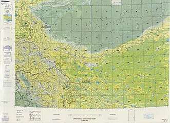 From the Operational Navigation Chart; map including Seriqbuya (labeled as Serikbuya (Se-li-pu-ya)) (DMA, 1980)[lower-alpha 1]
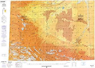 Map including Seriqbuya (labeled as Seribuya (Se-li-pu-ya)) (DMA, 1984)[lower-alpha 2]
Notes
- From map: "The representation of international boundaries is not necessarily authoritative."
- From map: "The representation of international boundaries is not necessarily authoritative"
References
- D. Grammaticas, Doubts over China government claims on Xinjiang attack, BBC, 26 April 2013
- Luisetta Mudie, Parameswaran Ponnudurai. (24 April 2013). "Xinjiang Violence Leaves 21 Dead". Radio Free Asia. Retrieved 25 February 2020.CS1 maint: uses authors parameter (link)
- "Overview of the Maralbeshi Incident on 23 April 2013" (PDF). World Uyghur Congress. May 2013. Archived from the original (PDF) on 23 August 2016.
This article is issued from Wikipedia. The text is licensed under Creative Commons - Attribution - Sharealike. Additional terms may apply for the media files.