Seeley, California
Seeley is a census-designated place (CDP) in Imperial County, California. Seeley is located 7.5 miles (12 km) west of El Centro.[3] The population was 1,823 at the 2010 census, up from 1,624 in 2000. It is part of the El Centro Metropolitan Area.
Seeley | |
|---|---|
 Seeley's welcome sign | |
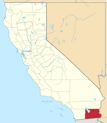
 Location in Imperial County and the state of California | |
 Seeley Location in the United States | |
| Coordinates: 32°47′35″N 115°41′28″W[1] | |
| Country | |
| State | |
| County | Imperial |
| Area | |
| • Total | 1.242 sq mi (3.218 km2) |
| • Land | 1.219 sq mi (3.157 km2) |
| • Water | 0.023 sq mi (0.061 km2) 1.9% |
| Elevation | -36 ft (-11 m) |
| Population (2010) | |
| • Total | 1,739 |
| • Density | 1,353.3/sq mi (507.5/km2) |
| Time zone | UTC-8 (Pacific (PST)) |
| • Summer (DST) | UTC-7 (PDT) |
| ZIP code | 92273 |
| Area codes | 442/760 |
| FIPS code | 06-70798 |
| GNIS feature IDs | 1661418, 2409303 |
History
The first post office at Seeley was opened in 1909.[3] The name honors Henry Seeley, an early developer of Imperial County.[3]
Seeley is one of the oldest established communities in Imperial County, tracing its history back to the early years of the 20th century. Originally established as a stage stop on the shores of the now dead "Blue Lake", Seeley was known originally as Silsbee.
NAF El Centro, the winter home of the Blue Angels, was built adjacent to Seeley in 1946. In 1964, Interstate 8 was run a mile south of Seeley, marking the lowest elevation on the Interstate Highway System at -52 feet.
Geography
Bordered on the west by the New River, Seeley sits astride the Imperial Fault and above what was once the basin of the "Blue Lake". Like much of the Imperial Valley, Seeley lies entirely below sea level.
According to the United States Census Bureau, the CDP has a total area of 1.2 square miles (3.1 km2), of which 1.2 square miles (3.1 km2) is land and 0.02 square miles (0.052 km2) (1.9%) is water.
Climate
This area has a large amount of sunshine year round due to its stable descending air and high pressure. According to the Köppen Climate Classification system, Seeley has a desert climate, abbreviated "Bwh" on climate maps.[4]
Demographics
2010
At the 2010 census Seeley had a population of 1,823. The population density was 1,399.9 people per square mile (540.5/km²). The racial makeup of Seeley was 746 (42.9%) White, 19 (1.1%) African American, 7 (0.4%) Native American, 21 (1.2%) Asian, 2 (0.1%) Pacific Islander, 793 (45.6%) from other races, and 151 (8.7%) from two or more races. Hispanic or Latino of any race were 1,489 persons (85.6%).[5]
The whole population lived in households, no one lived in non-institutionalized group quarters and no one was institutionalized.
There were 493 households, 276 (56.0%) had children under the age of 18 living in them, 268 (54.4%) were opposite-sex married couples living together, 114 (23.1%) had a female householder with no husband present, 28 (5.7%) had a male householder with no wife present. There were 40 (8.1%) unmarried opposite-sex partnerships, and 2 (0.4%) same-sex married couples or partnerships. 66 households (13.4%) were one person and 27 (5.5%) had someone living alone who was 65 or older. The average household size was 3.53. There were 410 families (83.2% of households); the average family size was 3.83.
The age distribution was 577 people (33.2%) under the age of 18, 195 people (11.2%) aged 18 to 24, 421 people (24.2%) aged 25 to 44, 373 people (21.4%) aged 45 to 64, and 173 people (9.9%) who were 65 or older. The median age was 28.5 years. For every 100 females, there were 95.4 males. For every 100 females age 18 and over, there were 85.3 males.
There were 556 housing units at an average density of 447.6 per square mile (172.8/km²), of which 49e were occupied, of which 246 (49.9%) were owner-occupied, and 247 (50.1%) were occupied by renters. The homeowner vacancy rate was 5.3%; the rental vacancy rate was 10.5%. 892 people (51.3% of the population) lived in owner-occupied housing units and 847 people (48.7%) lived in rental housing units.
2000
At the 2000 census there were 1,624 people, 438 households, and 382 families in the CDP. The population density was 1,346.3 people per square mile (518.2/km²). There were 460 housing units at an average density of 381.3 per square mile (146.8/km²). The racial makeup of the CDP was 54.7% White, 0.7% Black or African American, 1.0% Native American, 2.3% Asian, 0.1% Pacific Islander, 35.9% from other races, and 5.2% from two or more races. 81.5% of the population were Hispanic or Latino of any race.[6] Of the 438 households 54.8% had children under the age of 18 living with them, 66.4% were married couples living together, 16.4% had a female householder with no husband present, and 12.6% were non-families. 9.8% of households were one person and 4.8% were one person aged 65 or older. The average household size was 3.7 and the average family size was 4.0.
The age distribution was 38.2% under the age of 18, 8.7% from 18 to 24, 28.8% from 25 to 44, 17.1% from 45 to 64, and 7.1% 65 or older. The median age was 27 years. For every 100 females, there were 96.6 males. For every 100 females age 18 and over, there were 88.2 males.
The median household income was $31,058 and the median family income was $31,667. Males had a median income of $28,654 versus $20,625 for females. The per capita income for the CDP was $9,539. About 22.2% of families and 26.3% of the population were below the poverty line, including 36.0% of those under age 18 and 18.0% of those age 65 or over.
Politics
In the state legislature, Seeley is in the 40th Senate District, represented by Democrat Ben Hueso,[7] and the 56th Assembly District, represented by Democrat Eduardo Garcia.[8]
Federally, Seeley is in California's 51st congressional district, represented by Democrat Juan Vargas.[9]
See also
- San Diego–Imperial, mppù California
- El Centro Metropolitan Area
References
- "Seeley". Geographic Names Information System. United States Geological Survey.
- "2010 Census U.S. Gazetteer Files – Places – California". United States Census Bureau.
- Durham, David L. (1998). California's Geographic Names: A Gazetteer of Historic and Modern Names of the State. Clovis, Calif.: Word Dancer Press. p. 1466. ISBN 1-884995-14-4.
- Climate Summary for Seeley, California
- "2010 Census Interactive Population Search: CA - Seeley CDP". U.S. Census Bureau. Archived from the original on July 15, 2014. Retrieved July 12, 2014.
- "U.S. Census website". United States Census Bureau. Retrieved 2008-01-31.
- "Senators". State of California. Retrieved April 11, 2013.
- "Members Assembly". State of California. Retrieved April 11, 2013.
- "California's 51st Congressional District - Representatives & District Map". Civic Impulse, LLC. Retrieved April 11, 2013.